The case to kill the Needham Line (and replace it with Rapid Transit)

Everything is interconnected.

That should be the lesson of any transportation infrastructure project. Everything moves together. One part is always related to another. A change to one piece of infrastructure may have effects—positive or negative—across modes, across time, and across a region. In some cases, a project in one area can have a major impact on a seemingly disparate project somewhere else. We can’t think of transportation projects in a silo; instead, we must think of everything is interrelated.

South Station Expansion: Supply vs Demand

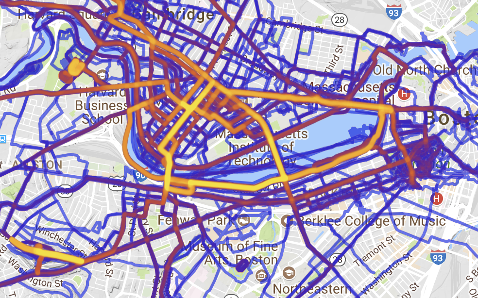
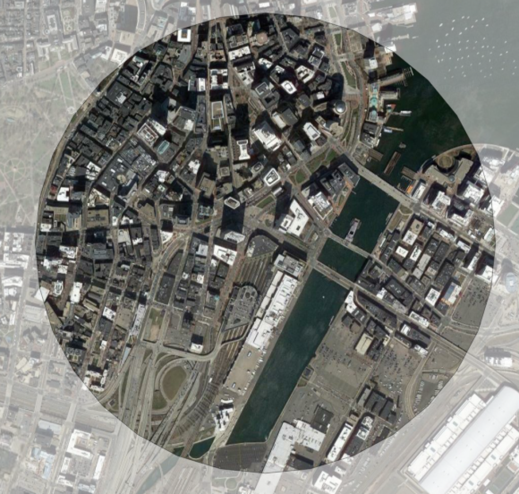
Which brings me to the South Station Expansion (SSX) project. This behemoth is a decade-long (or more) project of dubious value. Of most value is rebuilding the Tower 1 interlocking, which, when it fails, has huge service impacts for the entirety of the south side Commuter Rail network, impacting tens of thousands of commuters. Of more cost, and less apparent benefit, are plans to buy the post office building and build more tracks at South Station. SSX poses the current capacity issues at South Station as a supply problem, and therefore sees the solution to build more supply. But what if, instead, we addressed the demand?

There are two ways to think of the demand at South Station, and how to mitigate it. One is to look at the time which it takes each train to platform, let passengers off the train, have the crew change from one end of the train to another and perform a brake test, and board passengers for the destination (the passenger movements and crew end change can happen simultaneously). Right now, at rush hour, there is a maximum of 20 Commuter Rail trains per hour at South Station, spread across 11 tracks used for Commuter Rail (the other two are used for Amtrak). This means that the average occupancy time of a track at South Station is 33 minutes. 

This is not exactly good. At outlying terminals, trains frequently turn in as little as fifteen minutes; most Worcester Line trains, for example, spend 20 minutes or less from the time they arrive at an outlying terminal to the time they leave. Even taking into account higher passenger loads at the terminal station and the need to empty the train before refilling it (given the width of the platforms), as well as extra time to traverse Tower 1, something less than 33 minutes should be possible. Let’s assume that an average turn time of 25 minutes were feasible at South Station. This would allow 26 trains per hour to use the terminal’s 11 Commuter Rail tracks, a 30% increase over the current “capacity” without building a single new track.

There’s another way to look at SSX as a demand issue rather than a supply one: run fewer trains into the station. In most cases, this is a non-starter: the trains which run into the station are near or at capacity, so running fewer would cause more crowding and provide less service; even if longer trains were run where possible, they would be even more infrequent than the service provided today. There is an exception: the Needham Line could be replaced with rapid transit service and removed from South Station entirely, freeing up 10% of the capacity there without lifting a finger, at least on the Commuter Rail side. Reducing demand to preclude building more supply could save billions of dollars, and while converting the Needham Line to rapid transit wouldn’t be cheap, it might be significantly less expensive than South Station Expansion.

Needham Line Replacement

Other than the Fairmount Line, the Needham Line is Commuter Rail’s shortest. It runs less than 14 miles, splitting off of the Northeast Corridor at Forest Hills, running through Roslindale and West Roxbury to Needham Junction, and then curving back northeast to Needham Heights. (The track beyond there originally connected to what is now the Riverside Line.) The end of the line at Needham Heights is less than 10 miles, as the crow flies, from Downtown, closer, in fact, than the Green Line terminus at Riverside. Yet a train to South Station takes 46 minutes to complete the journey, making frequent stops between Needham and Forest Hills. Service is infrequent—about every 40 minutes—yet the line is still so crowded that it sometimes leaves passengers behind. This is probably because a typical rush hour commute time is even longer: the trip from Needham to Boston by car can take well over an hour.

This page recently detailed how a mile-long extension of the Orange Line to Melrose could, for a small investment, dramatically improve the service. Replacing the Needham Line would be a similar endeavor, albeit one at a larger scale. It would involve two line extensions, extending the Green Line south from Newton Highlands to Needham, and the Orange Line west from Forest Hills to West Roxbury. Most Needham Line riders would see slightly longer trip times to downtown Boston, but this would be made up for by dramatically-increase capacity, significantly shorter waiting times and much more frequent off-peak and weekend service (the Needham Line doesn’t operate on Sundays). It would also have cascading benefits throughout the regional transportation network.

Orange Line Extension to West Roxbury

Extending the Orange Line to West Roxbury would be a relatively simple project, as far as rail extensions go. Southwest of Forest Hills, the Orange Line terminates in a small, four-track yard, where trains can be stored temporarily at the end of the line. This yard happens to be adjacent to the Needham Line tracks, which extend to Roslindale and beyond. While it was originally a two-track right-of-way, the current Needham Line operates with a combination of single track and dual track, with most stations on the single track portion. Any conversion to rapid transit would require double-tracking of the line, which is generally easy in the existing right-of-way, except for two bridges in Robert and LaGrange streets, which have wide bridge abutments, but only a single trackway. 

A trip to Back Bay station would take two or three minutes longer on the Orange Line than it does today on Commuter Rail, but rather than a train once every 40 minutes at rush hour and every two hours midday and Saturdays (and no service on Sundays), trains would come every few minutes, all day long. Given the current fare structure and the infrequency of service, many passengers would shift from taking a bus to Forest Hills and changing to the train there to a direct train trip, freeing up buses to be used on other routes in the region. 

The largest cost in converting the line to rapid transit would be from the development of stations, which would generally have to be rebuilt with new platforms and vertical circulation, as few are ADA-compliant and some rely on pedestrian grade crossings, which are not feasible with third-rail power systems. The four new stations would replace the existing Commuter Rail stations, although it may be possible to consolidate the West Roxbury, Highland and Bellevue stations, which are less than half a mile from each other. The line may benefit from having a new station to the west near the VFW parkway. This would provide access to new housing developments there, the potential for a park-and-ride facility, and a station within walking distance of the VA medical center there, which is currently difficult to reach by transit and surrounded by a sea of parking. There are also several parcels of low-density strip malls which could be redeveloped as transit-oriented development (like this one), increasing ridership at the station as well as providing much-needed housing for the region. (There’s also a major electrical substation there, which would provide power to the line.)

West of there, there may be need for a small storage yard along the current right-of-way, especially if additional vehicles were needed to provide service (the Orange Line fleet as constructed today can barely keep up with current demand, but the new expanded fleet will allow more frequent service). The right-of-way across the river could be converted into a multi-use path, extending west across the Charles, through Cutler Park to Needham Junction, the Green Line extension, and the path southwest to Dover and beyond.

Why not extend the Orange Line further west? One is technology and the line’s profile: it would only be able to run as far as Needham Junction, north of which there are grade crossings incompatible with third rail electrification. It would require rebuilding three long bridges across the Charles, a drainage in Cutler Park and 128, which are currently single-tracked, and dealing with the current grade crossing in the golf course west of Hersey. But mostly, it’s because the population profile. The stations in Needham serve a much less dense population than those in Boston, and extending the Orange Line two miles across a park to serve Hersey and Needham Junction would be far more expensive than using the Green Line, which is needed in Needham because of the grade crossings there.

Green Line Extension to Needham

The outer portion of the Needham Line, from Needham Junction to Newton, looks very little like the line in West Roxbury. Today’s Needham Line is made up of three different railroads, a branch of the Boston and Providence to Dedham built in the 1840s, the Charles River Railroad built in the 1850s, and the portion between West Roxbury and Needham Junction, built in the early 1900s. While the B&P was grade-separated, the Charles River Railroad was not, and there are eight grade crossings between Needham Junction and Newton Highlands. This lends itself far more to a light-rail operation, with overhead power and smaller stations. Luckily, the Charles River Railroad split off the Boston and Albany’s Highland Branch at Newton Highlands, and the Highland Branch is today’s D Line.

Extending the D Line the first mile to Oak Street would be simple. The right-of-way is 85 feet wide, plenty wide enough for two Green Line tracks and the parallel Upper Falls Greenway (a 2017 document suggests there might be some areas which would require additional retaining walls, although the width of the corridor can easily accommodate two tracks). There are no grade crossings, existing mixed-use areas, and significant opportunities for further development in the corridor. The costliest item may be building a junction between the lines past Newton Highlands.

West of Oak Street is trickier, as bridges over both the Charles River and Route 128 would have to be widened and replaced. The bridge over the Charles is a single track, while the bridge over 128 was removed during the wildly expensive “add-a-lane” project (originally, the scope included rebuilding the bridge, but it was deleted out as a cost-saving move; although MassDOT would be responsible for restoring the bridge if the MBTA requested it, theoretically using highway funding; abutments are built to accommodate two tracks). From there, the right-of-way extends in to Needham, where it eventually joins up with the existing Commuter Rail line. Grade crossings would have to be added and power run (there is an existing substation adjacent to the line at the junction with the current D Line, as well as high voltage power at Needham Junction) and stations built, although grade-level, Green Line stations would be far less costly than those on the Orange Line, since they would consist of little more than concrete platforms and shelters. If retaining service to Hersey was desired, it could be served by a single-track extension from a terminal at Needham Junction (and theoretically, a single track Green Line would make more sense for a line from Needham to West Roxbury than Orange Line service, if service were desired along this leg).

The trip from Needham to Downtown Boston would be five to ten minutes longer than the Commuter Rail trip (more of an impact from Needham Junction and a minimal change from Needham Highlands), although improved Green Line fare payment and boarding may help speed trips on the line. There would be a major advantage for trips to the Longwood Medical Area, however, since the Longwood Green Line station would be just 25 to 30 minutes from Needham, and it is located significantly closer to the major employment center there than the Ruggles stop on the Commuter Rail is today. And, of course, trains would run every eight or ten minutes, as compared to the less-frequent Commuter Rail service today.

Since everything is interrelated, the biggest obstacle to this project may actually be the core capacity of the Green Line subway in Back Bay. From Copley to Park, there is a train every 90 seconds, which is close to the capacity of the line. While the MBTA has proposed adding longer vehicles to the line to increase capacity, adding a branch to Needham might overload the central subway system, even if service to each of the sub-branches (Needham and Riverside) were cut to every 8 to 10 minutes at rush hour, it would put more pressure on the line. There is, however, an escape valve. The design of the Kenmore station would allow some trains to terminate there, loop over the main trunk of the subway, and turn back outbound, without impact the Copley-Park segment. While this would incur a transfer for some passengers, they could board any other train in the station and continue their trip (and any passenger going to a destination west of Kenmore, like the LMA, would have no impact). This would allow service on the Riverside and Needham branches to maintain high frequencies without adding congestion downtown. (There are other solutions as well, but may be significantly more capital intensive than this, which would be free.)

Green Line Storage Capacity

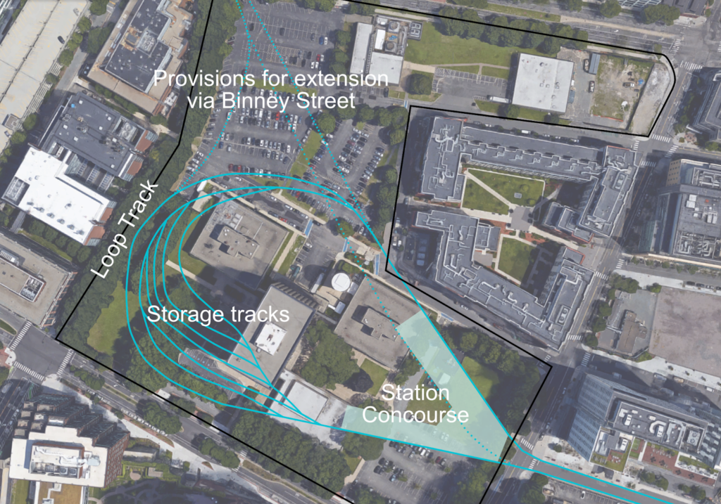
A major benefit, however, would be the ability of the Needham extension to provide additional rail car storage for the Green Line. Once the Somverille Green Line extension opens, the line will need additional cars, and if the fleet is upgraded from 75-foot cars to 100-foot cars, as is proposed, the current storage facilities will be unable to cope with the number of cars on the line. (Of course, if service were run 24 hours each day, enough cars would be operating on the line as to reduce the need for more storage.) Cars are currently stored at Riverside, Reservoir, Lake Street (at the end of the B Line) and at Lechmere. The Lechmere yard will be replaced with a new facility as part of the Green Line extension project, but there are otherwise few areas to expand train storage, and the Needham Branch would require more cars, and more storage. 

Needham Junction, however, provides that room. The current Riverside yard provides storage for 6000 linear feet of railcars, which accounts for about half of the space in the yard (the rest is the T’s heavy maintenance facility for the Green Line). Needham Junction could easily accommodate that size of facility (see a comparison here) and, if expanded to fill out the wye there and the adjacent power line right of way could store triple the amount, enough to store the entire current fleet (including the forthcoming Type 9s), so certainly enough to provide additional capacity for future fleet needs. Part of the site could also be used as a park-and-ride lot or for transit-oriented development (the portion not already owned by the T is owned by a landscaping company).

Overall Benefits

Extending the Green and Orange lines to Needham and West Roxbury would be a major undertaking: a multi-year project which would cost hundreds of millions of dollars. And yet, its effects would be felt far outside of Needham and West Roxbury. It would provide:

  • Much more frequent service for Needham, West Roxbury and Roslindale commuters 
  • More capacity at an unexpanded South Station, to add service to other Commuter Rail lines, and the ability to push back the huge expenditure required to add capacity to South Station
  • Additional “slots” on the Northeast Corridor, to allow more service on this particularly-constrained portion of the Commuter Rail.
  • Additional storage for Green Line trains
  • More bus service in the entire region, since many of the bus routes currently serving Forest Hills could be reduced in frequency (given the Orange Line in West Roxbury) and cut back from Forest Hills to Roslindale or other Orange Line stations. The buses saved could be reallocated to other parts of the system. In addition, the 59 bus in Newton and Needham could be truncated and replaced with the Green Line.
  • The reallocation of the three Needham Line Commuter Rail train sets, which would add capacity to the rest of the system and/or allow some of the most antiquated trains to be retired.
  • A new greenway path connecting the ends of the Orange and Green line extensions to Cutler and Millennium Parks, across the Charles River, and south and west to Needham Town Forest and parks and conservation areas beyond.

Thus, extending the Green and Orange lines will not just benefit those along the Green and Orange extension routes, but also people riding buses, people riding the rest of the Green Line, and people riding Commuter Rail, as well as allowing the state to push back the need to build out the South Station expansion, and potentially explore opportunities to further address the demand side (by reducing turn times further or building a North South Rail Link) instead.

Extend Red-Blue to … Kendall?

At some point on the Internet, I’ve scoffed at the idea of extending the Blue Line across the Longfellow Bridge (somehow) and then run along Main Street to some superstation at Kendall (which there’s not room for) and then making a turn on the Grand Junction right-of-way (or something). I still do. You couldn’t reliably run the Blue Line and Red Line together on the Longfellow and they have separate loading gauges so would need different tracks at Kendall. To facilitate a Red-Blue Connector, it makes sense to stub-end the Blue Line at Charles Station and provide an easy answer to Kendall Square.

Or does it?

This would be a short and pointless blog post if the first paragraph was 100% true. Plus, I’ve written that blog post before. Twice.

One of the trickiest things about the Red-Blue Connector is shoehorning a good, useful terminal in to the space under Charles Circle. It’s not easy. You’d have to dig a wide tunnel, or long tail tracks, or dig out pocket tracks or tail tracks under a busy roadway and the supports for the Red Line. It would be somewhat difficult to build any sort of functional terminal: there’s just not the space. You could put something under Storrow Drive (technically Embankment Road) and Ebersol fields, which would result in a decent terminal, but you’d have to dig up and rebuild the fields, and you’d be digging adjacent to the river. It would provide for good operations; you could stack in several tracks for layover, storage and recovery, rather than using crossovers and/or the Bowdoin Loop.

So Ebersol would work for operations, but you’re still pushing more people in to the Red Line and the already-overburdened Kendall and Charles stations, and forcing every Kendall-bound Blue Line passenger to transfer (albeit an easier transfer than exists today). There’s another potential terminal. It’s bigger than Ebersol, would allow increased capacity across the Charles, the potential for further expansion and, oh, yeah, it’s already somewhere where a huge hole is going to be built in the near term.

I’m speaking of the Volpe site recently bought by MIT. Since they’re going to be digging a big hole, it would make sense to put something useful in it, not just more parking. It is an extra 3000 feet to tunnel from Charles Circle to Volpe, but it’s mostly in a shallow river and free from utility considerations (as far a I can tell). In theory, this should be relatively cheap tunneling: it could be done in a similar manner to the Ted Williams Tunnel: building tubes off-site, digging a trench, and sinking the tubes in to place, except downscaled by a significant factor: the width of two Blue Line trains is narrower than two highway lanes. The river is 12 to 15 feet deep just downstream of the Longfellow, so it would need to be excavated down about that much to accommodate current depths. The TWT required digging through muck and in to bedrock at times to accommodate a shipping lane clearance at low tide, but the Charles has no such river traffic. The disposal and mitigation of the sludge on the river bottom may be the trickiest part, although it would be beneficial to start cleaning up the muck on the bottom of the Charles River.

Then there’s the Broad Canal. This should be easy. It’s 15 feet deep, doesn’t need clearance for anything more than kayaks (although the waste heat from the power plant would have to be accounted for), and could be easily coffer-dammed, dug out, cleaned up, and filled in with several feet of water sheet above. To make up for any displaced water volume (hello, Waters of the United States), the canal above could be extended, Lechmere-style, to a water feature figuring in prominently in the new Volpe development.

What does this get you? A lot, actually. First of all, designing a subway loop terminal in Volpe’s basement would add minimal marginal cost to the development and would make it extremely transit-oriented, and add value to the project: there’d be no need to trek through the Marriott to Kendall Square to the Red Line for trips downtown. (Do you need a loop? Probably not, but if you can get MIT to dig the hole, you might as well put a good terminal down there, although if you wanted to run trains through to Binney and beyond in the future, you could build a simpler island platform with tail and storage tracks beyond.) This north/east side of Kendall is booming. In the past 10 years, several blocks have been rebuilt from gravel lots to job sites and residential developments: below is the same corner in 2011 and 2017, for instance. It would also bring transit a bit closer to the no-man’s-land in the mile between Kendall and Lechmere. With Volpe as the linchpin of several thousand more jobs and residents, expanding transit should be a priority in Kendall.

2011
2017

This plan would also give the Kendall area a direct connection to more of Downtown Boston, East Boston, the HYM Suffolk Downs site Boston is proposing for Amazon (but will be developed no matter where Amazon goes), and, most importantly, the airport (this could—maybe—provide the impetus to build a better connection to the airport from the Blue Line). It would provide more capacity across the Charles—although the north-of-Boston portion Red Line is most full from Central to Kendall—and more importantly would take some traffic out of the Kendall Station, which was never really designed for the number of people using it today.

Further down the road? The Volpe site hemmed in by Biogen to the west, but a right-of-way could be preserved over to Binney Street where a further extension could easily reach the Grand Junction. From there, much is possible. A line to Sullivan Square and Assembly via the Grand Junction. A line in the other direction linking Kendall to Allston, and then further west. Once GLX is complete, the Blue Line will be the only transit line which terminates in Downtown Boston, which is operationally inefficient. This would give it a terminal at both ends to improve operations.

I’m not sure how much this costs; I haven’t been able to find a good breakdown of the order-of-magnitude for the costs for the TWT. (I did speak to Fred Salvucci about it, and he said it was the cheapest and easiest part of the Big Dig to build, although that’s a pretty low bar.) I also can’t find information about the specific cost of the “Haymarket North Extension” tunnel costs, but that project seemed not to have broken the bank (as far as I can tell, the below-ground portion of that line did not use boring machines). Searching the Globe archives, the entire Haymarket North project cost $180 million at the time, equivalent to $750 million today. That number includes: the five miles of the line to Oak Grove, some tricky engineering building between buildings from Haymarket to the river, and the B&M holding up the state for $18 million ($95 million today) to build the line through Charlestown (This is more than half, considering 1970s inflation, of what the state would pay a couple years later to buy the entirety of the Boston and Maine lines in Massachusetts east of Fitchburg: $39.5 million, $170 million today). For this proposal, the state would only have to negotiate over a small portion of Broad Canal Way, and its owner—an REIT—would stand to benefit from better transit to the airport so might be willing to make the price right.

In any case, if Charles Station was built as a through station and not a terminal, it would reduce construction costs there (where they’re expensive) and improve operations. The station could even be built with side platforms to keep the width of the subway narrower. The Volpe terminal could be built basically for free if it was integrated in to the overall Volpe development. The question comes down to the cost of the underwater tunnel. If it’s reasonable—and it seems that it would be—this would make a lot of sense. What about transfers from further north on the Red Line? This would preserve the full functionality of the Red-Blue connector, except it would work even better. And if the North South Rail Link ever obviated the need for the Grand Junction to function as a freight corridor, the Blue Line could easily be extended west or north.

Optimizing traffic on Storrow Drive

Personal Strava heat map via here.

While it may not be news to many regular readers, in addition to riding bikes and transit advocacy, I dabble in running. Living in Cambridge, one of my regular routes is along the Charles River. According to Strava, I’ve run the section between the BU footbridge and the Harvard Bridge 132 times although this is certainly an under-count due to both GPS issues as well as times when I didn’t run Strava (contrary to public belief, if it isn’t on Strava it is still possible that it did happen). Long story, short: I run along Storrow Drive a lot.

And I’ve noticed something as I navigate the narrow section of path above the buried Muddy River: the lane allocation westbound in the area of the Bowker Overpass is not optimal. As a narrative, proceeding west from Mass Ave:

  • 3 lanes passing under the Harvard Bridge
  • These split in to two 2-lane “barrels”, one feeds Kenmore/Fenway, immediately splitting in to two lanes on to the Bowker Overpass and one to Beacon St, the other feeds two lanes west along Storrow Drive.
  • This second barrel is then met by the flyover from the Bowker Overpass, which is, in turn, fed by two lanes from the Bowker and one lane from Beacon St.
  • This ramp merges down to one lane, and then merges in to the Storrow Drive mainline, with a very short merge area (the signs, in fact, say “no merge area”) with poor sight lines as the merge is on the concave inside of a curve.
No Merge Area = No good.

It is this last section which is worst. If you attempt to enter Storrow Drive from Beacon Street, you have to merge in to:

  1. the two-lane Bowker ramp
  2. then merge from two lanes to one on the Bowker Ramp and 
  3. then merge on to Storrow Drive

all within a span of 900 feet. The final merge is on to Storrow Drive with poor sight lines, high traffic speed, and no merge area. None of this is good. If these ramps were rationalized, however, these three merges could be replaced by a single merge, including the worst bottleneck at the entrance from Charlesgate to Storrow Drive, going from a dangerous merge to a continuous stream of travel. The state did this circa 2009 (you can see it on HistoricAerials here) but apparently didn’t change enough of the signage, which caused confusion further back, and some people complained, and rather than trying to make it work, they gave up. Old habits die hard. But we should make an effort to change them, rather than revert back to dangerous, inefficient roadways. The road was restriped to its current condition in 2011. There’s no word from the Universal Hubbian masses that it got appreciably better then: people probably got used to it, but it was too late.

This time, let’s not give up. Let’s get some data. Mine is anecdotal and circumstantial: anecdotal because when I observe the area there always seem to be more drivers exiting Storrow Drive to Charlesgate than continuing west and circumstantial because proceeding west on Storrow, the next exit point is at River Street, so there is relatively little reason to get on Storrow rather than to take the Turnpike (except, perhaps, to avoid a toll). So rather than splitting in to four, the three lanes under the Harvard Bridge could feed in to three separate lanes going to Fenway via Charlesgate, Beacon St and west on Storrow. The ramp from Charlesgate would then maintain a single lane on to the overpass, which would eliminate a further merge. So we need these data.

Now, here’s some real data. In the morning peak hour, 3400 vehicles per hour approach the ramp to Charlesgate. 2100 take the ramp, 1300 stay on Storrow, and 800 enter Storrow from Charlesgate. In the evening, 2000 take the ramp, and 2250 stay on Storrow, then joined by 1300 from Charlesgate. So the pinchpoint may be whether a single lane is able to handle 2250 vehicles; a quick spot count on a Thursday night in December showed about 2000 vehicles per hour during this peak time. This may well be a tight fit. But there are certainly single-lane ramps that handle more traffic (the ramp from 95 north to 128 north, for example). By observing the traffic flow, it is apparent that when Charlesgate backs up (not infrequent on normal days, to say nothing of evenings with Red Sox games), the left two lanes become de facto off-ramp lanes, with only the right lane open for through traffic. Codifying this would make the system safer and more efficient.

Here is the layout of the current ramps at Charlesgate, with orange areas showing the current merges, and yellow areas showing “sorting” areas where drivers have to choose the required lane. The proposal would simplify this, since each lane would lead to a specific destination, and signage could be improved. (This sign not only doesn’t accurately represent reality—the two right lanes both lead to Newton and Arlington—but it’s far too late for an errant driver to safely correct course. The next sign back has the same images, but slightly different, if somewhat more correct, information. Let’s ignore for a moment the tiny, white-on-blue destination sign no one could reasonably expect to read at 40 mph. If changed, the signs on the Harvard Bridge could read

 Fenway    Kenmore Sq    Newton/Arlington 

above each lane.)

Here is the proposal:

Note that three of the four major merges in Storrow-Charlesgate complex disappear. Just by repainting lines on the road (and likely some physical chicanes to keep Boston Drivers from creating two lanes where they shouldn’t) we can decrease the number of merges by 75%. The one merge left occurs on the longest, straightest portion of the entire complex, and on low-speed ramps, with about 500 feet to merge: three times longer than the merge area when the ramp enters Storrow Drive. And other than signage and paint, there would be no infrastructure costs associated with this sort of project.

Why would a transit-bike advocate like me care about cars? Two reasons. First of all, system efficiency. This is a clear example of where some minor changes could be implemented to create a safer system with less friction, less idling, and less pollution. But the second is that this could be used to improve conditions for bicyclists and pedestrians. Why? Because maintaining the two lanes of Storrow Drive require a pinch point on the Paul Dudley White Path where it narrows from a width of 10 to 12 feet down to 8. If this portion of Storrow were narrowed to a single lane, it would provide plenty of room to widen the bike path and provide a better experience here for cyclists and pedestrians.

Should this be the end state of these ramps? Certainly not. Once the Longfellow is completed, the accident-waiting-to-happen ramp from Storrow to Mass Ave will be rendered redundant and should be closed to eliminate the crossing of the busy sidewalk and bike lane there. In the medium term, Peter Furth makes a strong case that surface roadways could probably handle the traffic, which would be cheaper to build and maintain (the current bridge structures date to the 1960s and are functionally obsolete). In the long run, Storrow Drive and the Charlesgate complex act as mainly as a last-mile distributor from the suburbs to urban job centers. The roads are “necessary” because we don’t have a functional transit system to allow easy travel between the north and south sides of the city (especially between the northern portion of Boston and the Longwood Medical Area complex). With a regional rail connection coupled with congestion-based road pricing (other than political obstinacy, there’s little to keep the DCR from erecting EZ-Pass gantries and tolling the roadway, and the DCR could certainly use the money) we could return the riverbanks to something closer to James and Helen Storrow’s vision. It’s not much, but improving these lanes, at least, would be a start.

North Station doesn’t belong on the North-South Rail Link

The North South Rail Link has been bubbling up in the news recently (only partially because of me); perhaps as Boston realizes that it won’t meet the needs of the next century by expanding on the mistakes of the past. Now comes word that a Harvard-led team examined the cost of the project and found that while it would be costly, it wouldn’t be the $15 billion Big-Dig-esque boondoggle the Romney administration feared when it sidelined the project in 2006. (Remember that when the T doesn’t want to build something, they just make up numbers.) Given the immense savings from the project and the potential to free up huge parcels of prime real estate (that’s the topic of another post entirely), the $4 to $6 billion proposal is right in the ballpark of where a realistic cost-benefit analysis would show long-term benefits, despite the initial cost.

But I’m not going to touch on that (today, at least). I am going to touch on a mistake that everyone makes when they talk about the NSRL: the inclusion of North Station. That’s right. I don’t think North Station belongs in the North-South Rail Link, because North Station is not now—nor has it ever been—in the right location. Since we’re talking about building an entirely new station 80 feet underground, there’s no rule which says that we have to have the exact same stations. South Station belongs. North doesn’t.

Let’s look at the current downtown stations in Boston. Here’s South Station and Back Bay, showing everything within a half mile:


South Station is surrounded by some highway ramps and water, but otherwise well-located in between the Financial District and the Seaport, and it also has a Red Line connection. Now, here’s North Station:

See the problem here? Note how nearly everything to the north of North Station has no real use: it’s highway ramps, river, and parking lots. No housing. No jobs. So that when people get off the train at North Station, they almost invariably walk south, towards South Station. You could move North Station half a mile south and pretty much everyone would still be within half a mile of the train station. North Station has never been in the right location, but is there as an accident of history: it was as close in as they could build a station nearly 200 years ago (well, a series of stations for several railroads) without bulldozing half the city. It’s the right place for a surface station, but if you have the chance to build underground, it’s not.

Most NSRL plans try to mitigate this with a third, Central station, somewhere near Aquarium Station, but this has the same issue as North Station: half of the catchment area is in the Harbor:

This would give you three stations doing the job of two. Each train would have to stop three times, but the two northern stops could easily be replaced by a single stop somewhere in between. I nominate City Hall plaza. It would connect to the Orange, Green and Blue lines (at Government Center and Haymarket) and, if you draw a circle around it, it wouldn’t wind up with half of the circle containing fish.

North Station would still be served by the Orange and Green lines, and it would allow the North-South Rail Link to serve the efficiently and effectively serve the greatest number of passengers. A pair of stations in Sullivan Square and near Lechmere could allow regional access to the areas north of the river, which would sit on prime real estate if the tracks were no longer needed (they’d be underground). Since stations are much more expensive to build than tunnels (you can bore a tunnel more easily than a station), it might wind up cheaper, too.

Putting it all together, here’s a map showing the areas accessible under both the two-station and three-station schemes. Shown without any shading are areas within half a mile of the stations in both plans. Red areas are areas which are within a half mile of the three-station plan but not the two station plan, blue areas are within half a mile of stations in the two-station plan but not the three-station.

This shows that if you are willing to put a station in the vicinity of Government Center, you can get the same coverage in downtown Boston with just two stations. You lose the areas shaded in red, but these are mostly water and highway ramps. Instead, you gain most of Beacon Hill and the State House. It seems like a fair trade. (Yes, you lose direct access for Commuter Rail from North Station during major events at the Garden, but a Government Center/Haymarket station would only be a six minute walk away, or a two minute ride on two subway lines.)

In Commonwealth Magazine, I said that we shouldn’t double-down on the mistakes of the past by building larger, inefficient stub-end terminals. The same goes for North Station. The station itself is in the wrong place. If we build a North-South Rail Link, there’s no need to replicate it just because it’s always been there. Downtown Boston is compact enough it only needs two stations (plus the third at Back Bay). North Station isn’t one of them.

MBTA buses need help, but Houston is not the answer

The MBTA’s Control Board recently produced a document talking about spending several million dollars on a Houston-style network redesign. While the MBTA certainly needs help running their buses, what happened in Houston, for lack of a better phrase, should probably stay in Houston. The transit systems (and the cities themselves) are quite different, and the issues the MBTA has with its buses are far different than those in Houston.

Houston transit ridership, 1999-2014. Data from NTD.
Normalized to 100% in 1999.

Houston did not redesign its network not necessarily because it is forward thinking, but—and this often goes unreported—Houston’s existing network was failing. (Looking at the top ten pages on Google about the network redesign, only one mentions the loss of ridership.) In 1999, Houston’s transit agency carried about 100 million passengers per year. In 2004, despite a new light rail line opening, overall ridership had dropped to 95 million, with fewer than 90 million on buses. Ridership stayed flat around 100 million until 2008, when it cratered.

By 2010, total transit ridership was at 81 million, with bus ridership at 66 million. In other words: Houston, we have a problem. It’s since recovered slightly, but transit ridership is still down 15% from 2000, with bus ridership down by 30%. If the MBTA lost 30% of its ridership, it would be in full-on crisis mode. And this took place over a time when Houston’s population grew by 25%, so transit rides per person per year declined from 21.2 to 14.4. (No wonder Houston’s big new roads do little to relieve congestion.) By comparison, Boston’s metropolitan area has 86.5 transit trips per year (on the MBTA alone, likely slightly higher if you include RTAs within the area).

Bus ridership didn’t decline simply because Houston ran fewer buses, as is the case in many cities. Service hours did climb slightly between 1999 and 2003, and were subsequently cut slightly when the light rail line opened. Still, Houston ran more bus service (as measured by revenue hours) in 2014 than it did in 1999, yet the system carried 30% fewer passengers. In 1999, the system carried 35 trips per revenue hour. By 2014, that number was down to 24. (In Boston, buses carry 50 trips per revenue hour. For comparison, single train cars carry more than 100.)

It was clear to Houston’s planners that they had a major service issue with their bus system: vehicles were being used inefficiently and were not providing service where it was needed. Instead of doubling down on a failing system, they made a cogent decision to completely rebuild the network, reallocate resources to focus more on frequent service, and use a geographic resource—the straight and often wide street grid—to provide a system which would be more useful to the current population and destinations. The goal is to increase ridership using the same number of vehicles, and given the recent decline in ridership, there should be plenty of spare capacity.

This made sense—a lot of sense—for Houston. It would make very little sense for Boston.

Unlike Houston, Boston does not have spare resources to reallocate. At rush hour, most buses in Boston are at—and frequently over—capacity. This is not the case in Houston. Most frequent bus lines there run every 10 or 15 minutes at rush hour. This is frequent enough to provide “walk-up” service, but shows that there is not a major capacity crunch; if there were, buses would be run more often. One bus line (the 82) and one rail line in Houston run more frequently than every 10 minutes at rush hour. Even with the new route network, there is still a lot of spare capacity on Houston’s buses. (Despite carrying 2/3 as many passengers—the networks carried similar numbers of passengers in 2000, but have since diverged—Houston runs 20% more service hours than Boston does.)

Houston and Boston transit ridership from NTD.
Normalized to 100% in 2009.
Note: Likely data error showed a spike for Boston bus ridership in 2004.
This has been removed for chart simplicity.

This is far from the experience in Boston. In addition to nine rail lines operating more frequently than every 10 minutes, there are 21 bus routes which do the same. There are many others which are well over capacity, yet there are not enough buses to go around to provide enough service on these routes. The 47, 64 and 70 are all at crush capacity—often leaving riders behind—even though they only run every 10 to 20 minutes at rush hour (and that’s just a non-random sample of routes which run within a stone’s throw of my house in Cambridgeport). This is an entirely different problem from Houston—nowhere in the Space City is there a bus line like the 7, 73 or 111 where a full bus runs ever four or five minutes—and it requires an entirely different solution.

Unlike Houston, transit ridership in Boston has been growing, outpacing many other cities and the local rate of population growth, without any new infrastructure having been built in decades. Overall transit ridership is up 15% since 1999, and bus ridership up nearly 10%. Can Boston’s ridership be attributed to increase service hours? No, bus service hours have been basically flat since 1999 (and not “basically flat” by the FMCB’s definition, but actually flat, up less than 3% since 1999, despite the addition of the Silver Line during that time). So buses have been getting more crowded, not less.

This leaves out three other major factors which would preclude a Houston-style program in Boston. First, Boston’s geography is not grid-based, but relies on a few corridors linking more central nodes. Most of these routes already have buses, usually traveling in relatively straight, logical lines (with some exceptions). Second, Boston does not have the level of sprawl that Houston does, and attempts to serve low-density job centers will be inherently less efficient than the current urban core-based transit system (in Houston, the old core-based system was not seeing enough use, which is certainly not the case in Boston). Finally, rail ridership makes up two thirds of Boston’s overall transit ridership (only Boston, New York Washington, D.C. and Atlanta carry more passengers by rail than by bus) and the bus network logically feeds in to the rail network, which can’t be easily changed.

According to Jarrett Walker on Here and Now, two thirds of the routes in Houston were new, with smaller changes to the rest. In Boston, a reimagined system would likely result in most routes being largely unchanged—I’d venture to guess that it would be 80% of routes, and 90% of routes weighted by ridership, since higher-ridership routes would be less likely the be changed—and only a few areas would see dramatic reorganization. This is not to say there aren’t changes that should be made: routes should be straightened (the 34 and others which make mid-route loops to serve malls), made more logical (the 70), have anachronistic quirks ironed out (the 66 jog to Union Square) or, in some cases, be blown apart altogether to provide better connections (break up the 47!).

None of this reaches the level of what was done in Houston, where there is a lot of slack to provide rides for more passengers with the existing bus fleet; they could increase ridership by 50% and still be shy of bus ridership in 1999, and far from the crowding the T sees on a daily basis. There is no spare capacity in Boston for that kind of growth without a dramatic increase in the size of the fleet. If we are really going to improve buses in Boston, we need more money to run more buses.

If that money—and the facilities to house an enlarged fleet—is unavailable in the short term, what can be done is a wholesale program to make the buses we have work better. The problem is not that the routes we have don’t work for people (for instance, the 77 does, and should, run down Mass Ave), it’s that the way the buses run on these routes doesn’t work (it shouldn’t have to sit at a traffic light while two or three cars cross in front of it). Buses with 50 passengers on board sit in the same queues as cars with one, and other than a couple miles of Silver Line lanes, there are no transit priority features in Boston. There has been some nascent movement towards solving this in recent months, but it needs to go much further. If we are going to spend several million dollars on improving buses—as the FMCB proposes—let’s make sure we do it in a way that works for Boston, not Houston.

Boston Transportation Data

Sometimes, people ask for transportation data that they assume doesn’t exist but, au contraire, it does. There are some other data I have which I can provide on request, but aren’t posted publicly (and some of those are based on calculations I’ve made which might not be entirely perfect). Here are some of the resources I know of. Most are large PDFs, because that’s where data exists, right?

  • Massachusetts traffic volume counts. This has most vehicular traffic counts in the Commonwealth.
  • MBTA Blue Book has a lot of detailed information on MBTA operations. It does not have everything, but a lot: bus and transit ridership, some historic data (older versions of the Blue Book have data going back further; at some point I would like to compile these older data in to one document beyond Commuter Rail, which I have).
  • Commuter Rail counts by train. These data are outdated (2012) but give a good idea of how many people rider specific trains, at least on the day the count was completed.
  • Commuter Rail system survey. These data are even more outdated (2008) but even richer, including access and transfer data. It’s pretty dense.
  • Changes to MBTA service since 1964. A very comprehensive look at every bus line in the system, and every change to service in the past 50 years. 
  • Summary of Commuter Rail operations, including the number of train sets required.
  • MBTA salaries, in a very not-useful PDF document. I have an Excel somewhere. 
  • Keolis bid document, with salary information for various positions and job descriptions.
  • NTD Database, with transit system comparisons. You can also download the whole database as a database or in excel.
  • Monthly data by mode, 2007-2014
  • Archive of Commuter Rail schedules (Dave Weebly).
I will update this post frequently as needed. 

Go to a Public Meeting … Tonight!

In the past, this page has implored people to go to public meetings. There’s one tonight that you should definitely put on your calendar:

The City of Boston and MassDOT is rebuilding the North Washington Street / Charlestown Bridge between Boston and Charlestown. It is designed with top-notch cycling and pedestrian facilities, but the designers seem to have forgotten about transit. Five bus lines cross the bridge carrying 20,000 passengers per day, including the 111 to Chelsea—a lifeline for that community—yet these riders are subject to the same delays as traffic.

There is plenty of room as the bridge is design for transit priority as it is designed, and it is most important to have a lane on the inbound side. At rush hours, 30 MBTA buses (as well as many private, last-mile shuttles) carry 1200 passengers across the bridge per hour. At the same time, the two lanes of traffic are used by about 2000 vehicles, or 1000 per lane per hour. So a lane of buses is more efficient at moving people than a lane of car traffic, even if there’s only a bus every 2 minutes.

What’s more, this will dramatically improve operations and reliability. Approximately 5000 people cross the bridge inbound by transit during peak hours inbound, at times when there are often five to ten minute delays. If a bus lane saves an average of five minutes of travel time on weekdays, this will amount to an annual savings of 100,000 hours for passengers on the buses serving this route. For bus operations, a five minute savings amounts to 10% of the route, which would allow 10% more riders to be carried on the same number of buses, increasing the efficiency of the route.

It’s also low-hanging fruit. The entire bridge is being redesigned, so it’s easy to add in a few feet necessary for a bus facility. There are no parking spaces, so there are neither impacts to the neighborhood losing parking nor issues with designing roads to accommodate bus lanes and parking spaces, one of many of the problems the Silver Line has. It should be a slam dunk. If we can’t get transit priority here, how ever are we going to get it elsewhere?

The details:

6:30 PM 

The West End Museum 

150 Staniford Street 

Boston, MA 02114

We need as many people to come and speak out for transit priority as possible! See you there!

Can’t make the meeting? Send public comments by Dec 25 to:

dot.feedback.highway@state.ma.us attn Project File No. 604173

or

Patricia Leavenworth, P.E., Chief Engineer, MassDOT, 10 Park Plaza, Boston, MA 02116, ATTN: Bridge Project Management, Project File No. 604173.

Fixing the 70 Bus (at least part of it)

I posted about a year ago about the 70 bus, with its bizarre schedule and uneven headways between Waltham and Boston. I have a friend who has taken the 70 daily for a decade, outbound in the morning and inbound in the evening. And she’s not alone. After another discussion about the uneven headways, poor schedule adherence and endemic bunching, I decided to ask her (and some of her friends) to keep track of scheduling and crowding. That spreadsheet is growing. If you take the 70, I’m happy to have you help out.

I’m particularly interested in crowding, because it seems the MBTA, in the afternoon, has taken the initiative to have even outbound headways (a laudable goal; morning inbound could use some help, too), but pay no attention to inbound traffic. They may assume that because it runs from Cambridge towards Waltham, everyone takes it in that direction. And plenty do. But plenty also use it for the “reverse” commute; my friend regularly shares the bus with 50 or 60 of her closest friends. The corridor is growing; she reports the bus is getting busier. It needs to be scheduled to provide service to this area, lest potential customers vote with their feet and drive instead.

If you look at the afternoon inbound schedule (part of it is shown to the right), it is scheduled to have bus bunching. There are 16 buses departing Watertown Square between 4 pm and 7 pm, on average, one every 11 minutes. However, twelve of these buses are scheduled to come in pairs, three minutes apart or less. So in reality there is only service 10 times during those three hours, or once every 18 minutes. That’s a big difference. To put it in a math-ier way, the current schedule has an 11 minute headway with a standard deviation of 9:25. That’s not good. (The goal, with even headways, should be zero.)

With some complex routing schemes, buses come in to a route from one line and leave the other end on to another. But the 70 extends out to the edge of the system, and a bus at the end of a line had little choice other than to turn around and run back to Cambridge. It’s particularly complex with three separate termini—Cedarwood, the North Waltham figure-8 (the 70A) and several short turns in Waltham Square—but it’s pretty easy to reverse-engineer the schedule and figure out which outbound bus runs inbound, and how much schedule recovery each bus has. By doing this, we can see whether it might be possible to make some small changes to the schedule in order to have buses scheduled at more regular intervals and provide better service overall. Right now, with the T out of space for new buses, we can’t really add service. But we can certainly make the service we have run better.

Scheduled times in Watertown Square.

So here’s my proposal: by slightly changing two early departures out of Cambridge (in the 3:00 range) and changing layover times by no more than five minutes (and leaving at least 7 minutes for schedule recovery at the Waltham end of the route) we can go from 11 minutes with a standard deviation of 9:25 to the same 11 minute average headway, but with a standard deviation of 2:45. The longest current headway is 23 minutes, with five headways over 20 minutes, and the current shortest headway is 0 minutes (two buses scheduled at the same time). The proposed schedule has all headways between 7 and 17 minutes. They’re not perfectly even, but they’re a whole lot better.

Take a look at the conditional formatting to the right. Muted, middle colors are less variable. Right now, the schedule seems optimized for even layover times at the expense of even headways. So a bus is somewhat more likely to leave on time, but then scheduled to be part of a bunch. The proposed schedule varies the layover times somewhat more (stdev of 2:19 vs 3:02), but it is far less variable for headways. Note how all the dark blue and bright red colors disappear from the chart on the right, and while there is some variability, there is far less than the current schedule. This means that buses aren’t scheduled to run in groups of two, and there are no longer scheduled 20-25 minute service gaps (which, with traffic fluctuations, can easily turn in to waits of half an hour or more, on a route which, nominally, has a bus every 10 to 12 minutes).

The T needs to analyze the patronage of the route, and make sure that they aren’t robbing Peter to pay Paul. Service reliability for normal peak ridership is very important, but it should not come at such a great expense to reverse peak riders. They constitute a large percentage of the passengers on the route—likely higher than many other comparable MBTA routes—and the T should balance the needs of all passengers, not just create a schedule which works for one direction at the expense of the other.

This afternoon, I watched the 70 on Nextbus as buses bunched—some as scheduled and some on their own. The schedule for the 70A in particular does not seem to have enough time for all buses on the route, and the figure-8 service pattern in North Waltham is pretty special. The 70 is a very complex route and in the long run the right answer is probably to cleave off the 70A and operate the route as a single route to alleviate bizarre headways and bunching. But in the short term, a few minor changes could be made for the next schedule rating, which would alleviate some of the problems experienced by riders today.

For the reference of current passengers, here’s an afternoon schedule which shows the originating point of various buses. Note that Waltham buses are likely more timely than Cedarwood buses, and both are more reliable than the 70A from North Waltham. Note that both this schedule and the one below are sorted by Watertown inbound, so the outbound trips are not in order. (If you’re going outbound, it’s basically a bus every 10 minutes at rush hour, inbound, it’s a bit more difficult to comprehend)

And here is the proposed schedule, with changes highlighted (and the number of minutes the layover is changed shown as well). It should be entirely feasible to implement this schedule, making very minor changes to the early part of the pre-evening rush outbound, and dramatically improving conditions for riders in the evening coming inbound.

How the North South Rail Link could work

North South Rail Link schematic showing current train volumes for Commuter Rail
lines, potential future RER-style connections and new and existing stations.

Discussion about the North South Rail Link has bubbled up again, with Mike Dukakis and Bill Weld writing in the Globe about how it should be a priority, Commonwealth magazine calling them out on where the money would come from, and Dukakis replying that if you wanted to find the money, you certainly could. A thread started on Universal Hub with a lot of people wondering how the rail link would function. Here are my thoughts/explanations.

Efficiency. The crux of the issue is that MassDOT wants/needs more space at South Station (and eventually North Station) and is limited by the number of tracks. Turning trains around is time-consuming: you have to unboard (deboard?) the train, board the train (even at rush hour, 50-100 or more reverse commuters may be waiting), have the crew change ends, and then thread out the same slow trackage you came in. Even with the best of practices, a terminal station track can only accommodate a train every 15 minutes or so. But if trains run through, boarding and alighting is faster and easier, there’s no need for the crew to change ends, and with more destinations,  fewer passengers get off at each stop. You could route 20 trains per hour per track, meaning that four tracks in the rail link could do the work of 20 at South Station (currently there are 13; the expansion would add about a half dozen more).

Electrification. You need to electrify the whole system (and maybe Amtrak to Portland). Maybe you could get away with dual mode engines, but that’s lipstick on a pig. Electrification of the Commuter Rail network would cost somewhere in the neighborhood of $1 to $2 billion dollars. Not cheap. But huge operational efficiencies: electric trains are cheaper to run, cheaper to maintain, and have faster acceleration meaning that trip times (and staff costs) are shorter, while ridership is higher (faster trains = higher ridership).

North/South imbalance and the Grand Junction. The idea behind the North South Rail Link is that trains coming in to South Station run through the tunnel and out one of the North Side lines. This is the Philadelphia model. This works well in theory (some passengers would get a one-seat ride; others would have to change), but in practice more trains run in to South Station than North Station (although this was not always the case; in 1972 there were twice as many passengers at North Station). Several pair off relatively well:

Needham-Haverhill
Providence/Stoughton-Lowell
Franklin-Fitchburg
Old Colony Lines-Eastern Route

But falls apart when you realize that all the North Side routes are taken and you haven’t accounted for the Worcester or Fairmount Lines. You could route them through to other terminals, say, to Anderson Woburn, but this seems wasteful; you don’t need a train every 8 minutes inbound from Woburn. This is where the Grand Junction comes in. If it were grade-separated in Cambridge (or maybe even if not; there are grade crossings in downtown Chicago with 20 trains per hour at peak times), Worcester Trains could split off at West Station (hopefully) and make a loop (much like lines in Melbourne, where a similar imbalance existed), serving Yawkey, Back Bay, Downtown and Kendall. As for the Fairmount Line …

Potential for RER(/S-bahn/Crosslink)-style service. Having the rail link in place with the Grand Junction connection would not only allow you to route trains through the city, but it would also allow you to implement RER-type service filling much of the urban ring and providing more frequent service than Commuter Rail (although Commuter Rail could run more frequently as well). If all the paired lines shared one set of tunnels, the Worcester Line could share the other with the following RER-type services:

Allston to Assembly via Cambridge (Kendall) and Sullivan
Readville to Allston via Downtown and Cambridge (Kendall)
Allston to Chelsea via Downtown and Sullivan

These would operate frequently all day, every 10 to 15 minutes, allowing transfers between subway and Commuter Rail. This leverages the capacity of the rail link to create a complementary urban rail network to provide new connections and take some pressure off the existing hub-and-spoke network.

Get rid of North Station. Most ideas about the Rail Link include three downtown stations. But you only need two. Where North Station is today is convenient to very little, and the half mile to its north is taken up by highway ramps and water. A better idea would be a station between Aquarium and Haymarket. It still allows for transfers to all subway lines, and there is very little that is less than a 10 minute walk from North Station but more than a 10 minute walk from Haymarket. It would save money, too. (Obviously, the existing Green/Orange line station would remain.)

Open new land to development. Much of the land near North and South Stations is taken up by trackage, and the Rail Link, obviating the need for these stations (a couple of tracks to use in emergencies and for trains like the Lake Shore Limited might make sense, at South Station especially, although these trains could operate to West Station and provide connections there instead), and this would be very valuable land. In addition, it would render Boston Engine Terminal obsolete as maintenance would be for electric vehicles, and if maintenance facilities were rebuilt on less valuable land (say, in Billerica or next to the Anderson/Woburn station). Based on what Northpoint just sold for, it would be worth maybe half a billion dollars in development rights. A lot of this money could be captured to help pay for the rail link itself.

Will the North South Rail Link happen any time soon? Probably not. But hopefully this will help people understand its potential (which is huge!) and what we’re talking about when we talk about the NSRL.

It’s time to radically rethink Mass Ave and Beacon St

There’s an intersection in Boston, at the end of the Harvard Bridge, that I bike through all the time.

So do a lot of other people.

Today, one of those people didn’t make it.

Legend:
White: Roadway
Yellow: Exclusive transit
Green: Bicycle
Gray: Pedestrian
Blue: Parking
“Wavy” = barrier or curb

The corner of Mass Ave and Beacon Street is dangerous. Like, really dangerous. It’s relatively narrow in both directions (i.e. not wide enough to easily separate uses), but still wide enough that cars can get up a decent amount of speed. It is heavily traveled by many modes, and has frequent buses and other large vehicles. Some of those things aren’t going away (no, we can’t kick the #1 bus out). We know it’s dangerous; we have for some time. Yet we’ve done nothing about it. Today, that has yielded tragic results.

But there are certainly things we could do. The intersection is dangerous for a variety of reasons:

  • The bike lane disappears so that there can be three (3) lanes on the Boston-bound side.
  • Buses pull in and out of the bike lane to make passenger stops.
  • Bicyclists have no leading signal, so they have to go at the same time as cars.
  • Cyclists accelerate down the grade off the bridge, quickly catching up on turning traffic.
  • Trucks swing out to make wide right turns from the left lane, oblivious to bicycle traffic three, and cyclists don’t see the trucks turning right; trucks then turn across these lanes.
  • There is frequently heavy traffic, so cyclists have to weave between stuck cars. When there’s less traffic, wide lanes allow cars to go fast.
  • Beacon Street has three lanes of traffic east of Mass Ave, making it feel much more like a highway than a city street, despite traffic counts that would barely require two. (It has fewer cars than parallel Comm Ave, which has—wait for it—two lanes of traffic.)
  • There are minimal bicycle facilities on Beacon Street, making cycling there especially dangerous.
As usual, most of the real estate on the street is given over to cars. It was seen as a real coup when Nicole got parking removed on one side of Mass Ave and bike lanes installed in 2012 and, at the time, it was. But we’ve come a long way since then. Comm Ave is getting protected bike lanes. And one of the first protected intersections in the country, which is downright Dutch! We’re fixing bicycling safety issues in other parts of the city: it’s high time we did so at this intersection as well.
There’s another element at play, too, which you can see if you look at the diagram that’s been staring you in the face since you started reading this post: this is a huge transit corridor. With the 1 and CT1 buses, it handles 15,000 bus riders per day, add in the M2 Shuttle and bus passengers account for 20,000 people on Mass Ave, despite lousy service and near-constant gridlock impacting schedules. Given that traffic counts for the bridge are only about 25,000, it means that if you’re crossing the bridge, there’s a better than even chance that you’re on a bike or a bus, as I’ve pointed out before. Yet even with the new lanes (thanks, MassDOT!), we still give 82% of the bridge space to cars, with no priority for transit.
So here’s what you could do:
  • Put a bus lane on the Harvard Bridge, extending south along Mass Ave to Boylston Street (and perhaps beyond). Build a new station at Boylston in the center of the roadway (you’d need left-door buses for this, but these exist), safety-zone type stops like shown here but both adjacent to the Hynes station, or exclusive bus lanes on the sides with signals to allow the buses to move to the center of the roadway. (This could be extended further south as well, but traffic is usually not as bad south of Boylston.) At Beacon Street, install offset bus stations on either side of the street (there’s not room for a single station) with signal priority. Modal equity is a good thing. And despite my feelings about the ITDP’s bus study (this would hardly qualify as gold standard by their rankings with offset stations and lanes demarcated by paint and not concrete, but there’s not room for that), I think this is a great place for bus lanes! And by putting them in the center, you reduce any instances of buses having to cross and block the lanes to make passengers stops.

    This will require removing only a couple of parking spaces on Mass Ave as the busway transitions in to the middle of the street to allow parking on one side. As far as I can tell, the businesses in the area have done fine without parking. Until Boylston, there are two ways of dealing with left turns. One would be to allow left turns from the bus lane, with a green light preceding any bus arrival to clear the lane. Even better would be to ban left turns all together, like San Francisco has on Market Street. This is safer for cyclists, pedestrians and vehicles, and addresses a major congestion issue (while allowing longer phases for straight movements). The few vehicles needing to go left could make a series of three rights (right on Comm/Newbury, right on Charlesgate, right on Marlborough/Comm) instead.

    (Why not at Beacon, too? A northbound driver past Marlborough would have to go all the way to Cambridge to get back. So the left turn lane there fits and allows that movement, although it could be reassessed if it received very little use.)

  • On Mass Ave, the southbound bike lane should be separated to the intersection. This is the most dangerous area, where cyclists are most likely to be right hooked as one was today. Bicyclists should have a separate phase to cross when there will be no other cross traffic allowed. At other times, cyclists could have a red signal for the straight or left (yes, left; more in a second) movement, but a green signal for a right turn on to Beacon Street. In addition, a curb or bollard south of the cycletrack on Beacon would require large trucks turning right to do so with much better visibility for cyclists, which could preclude the need to use specific bicycle signals to keep the users safe.
  • South of Beacon, Mass Ave would be a bike lane without separation to fit in the bus station, but would transition to a parking-protected separated facility.
  • Going northbound, the protected lane would similarly lose its protection at the stop. However, with no right turns possible, there would be no worry of a right hook. It would regain protection across the Harvard Bridge.
  • The Harvard Bridge is currently two five-foot bike lanes and four 11-foot travel lanes. By reducing the travel lanes by one foot each, a two-foot buffer is easily attainable.
  • Now, on to Beacon Street. Beacon Street is easy. It’s currently three 12-foot travel lanes and two six-foot parking lanes. There is no need for three lanes given traffic volumes on the street (just 7500 to 9500 per day!); two would suffice. If you pulled the width back to ten feet, you’d have 16 feet available to add two feet to each parking lane (8 feet instead of 6), a 2 foot buffer and a 10-foot-wide, two-way protected bike lane all the way to the Common. Which is why you’d need the aforementioned left turn from Mass Ave.
This is all doable. The big hurdle is convincing people that cars might have to wait in some more traffic so that transit riders, bicyclists and pedestrians—the majority of the users in the area—can have a faster and safer experience. We’ve seen what happens with the current layout: gridlock, congestion, pollution, with deadly results. It’s high time we made a change.

Update 8/9: In the original diagram, I had near-side bus stops, but it is noted that
far-side bus stops might work better from a transit signal priority point of view, and to allow for larger vehicles to make right turns. This turned out to be the case from a physical point of view as well inasmuch as it doesn’t require the busway to jog nearly as much if the parking moves from one side of Mass Ave to the other. The main issue is that cars would now be aiming right at the “safety zone” style bus stops and an errant car could drive in to a group of waiting passengers, but a protruding island could guide them towards the roadway. (By minimizing the amount of zigging and zagging, it would allow for more parking as well.) Another issue is that this would not accommodate the M2 Shuttle as well, as it turns right on to Beacon Street, but it could continue and go right on Mass Ave or have a separate stop further down Beacon Street. I’ve also added left turn boxes for cyclists. If you’re interested, the original design is shown to the left.

I also have a design shown to the right which has much less transit priority but puts a two-way bikeway in the center of Mass Ave (with enough room for a jersey-style crash barrier on either side). While it would provide a quite-safe bicyclist experience for those going straight, there are a number of significant downsides:

  • Bicyclists turning right would have to cross traffic at an intersection, and could not pull to the curb.
  • It would be very difficult to design a means for cyclists to enter and exit this cycling facility from the Paul Dudley White bike path along the river.
  • Turning movements for cyclists between Beacon and Mass Ave would also be difficult as there would be nowhere for cyclists to wait for a turning phase, which would be required for all turns.
  • Where, inevitably, bike lanes move from the middle to the side it would be an awkward transition (as is the case with the Comm Ave bike lanes at Charlesgate). 
  • The potential for transit improvements are minimal. The main benefit is that there would be no need to transition transit from the middle to the center as would be the case in other scenarios, but buses can more easily signal across mixed traffic. However, transit would only share a lane with right-turning vehicles, and the only way to really improve bus speeds would be to somehow assure that drivers didn’t use the right turn lane to bypass traffic and then attempt to merge back in. Good luck with that.
Update 8/20: Clarified a few things and slightly changed the diagram.