Suburban car sharing at Commuter Rail park-and-ride lots

Suburban park-and-ride lots are a fact of life. While rail stations near housing result in better land use and higher ridership (Windsor Gardens in Norwood, for example, has 600 riders per day with no parking. Of course, driving downtown from Windsor Gardens is a 1 to 2 hour endeavor at rush hour, on the train it’s 35 minutes.), there are some areas where sprawling populations are too dispersed for walkable stations and park-and-rides make some sense. (And, no, I’m not referring to somewhere like Ashland, Westborough or Kingston, where 1990s-era stations were built away from downtowns but next to big parking lots; despite this these stations have ridership no higher than Windsor Gardens.)

Take Littleton, for example. Its old train station is little more than a crossroads, not even the center of town, so the park-and-ride nearer routes 2 and 495 makes sense (the town itself is quite dispersed, a combination of sprawl and conservation land). The same could be said of South Acton, where the always-full parking lot combines with a small density node, although a walking-based station at West Acton would help to relieve some of the parking capacity issues at South Acton. Littleton’s parking is also at capacity, and will likely continue to increase when new schedules come in to effect this spring with 30-minute travel times to Porter Square, speeds unattainable by car without traffic, let alone on Route 2 at rush hour.

Littleton’s observed catchment extends to several nearby towns, and grassy areas adjacent to the lot are frequently used by motorists to park when the lot is full. Expansion is possible but not cheap: the MBTA-owned parcel is on a slope and construction costs would exceed the $5000 to $10000 per space typical of construction on level ground. But there is a need for more parking: the Fitchburg corridor serves a dispersed population with poor highway access to Downtown Boston, and providing parking allows many more people to use the train rather than drive downtown.

What makes Littleton somewhat different from other park-and-rides is the presence of several large nearby corporate campuses, most notably Cisco three miles to the south and IBM three miles to the north. Each campus houses more than 1000 employees, and each has abysmal non-driving access. (IBM is served by the end of the LRTA Route 15, which takes only 45 minutes to get to Lowell’s train station.) For all intents and purposes, access to either of these campuses requires a car.

Until the double track was completed to Littleton and the station there rebuilt, there were no reasonable reverse-peak transit options to get past South Acton, a longer drive from either of these campuses. But with the new schedules—and the recent promise of an even earlier train to Fitchburg—there are now hourly-or-better reverse-peak trains to Littleton, allowing city dwellers to get to Littleton’s train station without driving (even against peak traffic, getting to and from Littleton at rush hour is no picnic). Of course, this station is still miles from major employers, hence the proverbial last mile issue.

There are some possible solutions. Bicycles are allowed on reverse-commute trains, and the roads in Littleton and Boxborough are relatively bikeable (cyclists can use a closer back entrance to Cisco closed to vehicular traffic to keep cars from cutting through local neighborhoods). But cycling isn’t for everyone, especially given the narrow area roads and heavy rush hour traffic. Uber operates in the area, but the density of cars is relatively low (meaning potentially long wait times) and fares high: $7 to $10 from the train station to employer, as much as the train ticket from Boston. Corporate shuttles are another option: RedHat and Juniper run a shuttle from Alewife to their Westford campuses and the new CrossTown Connect TMA is exploring shuttle services from Littleton. But shuttles are expensive; a single route can cost $50,000 to $100,000 annually.

If only there was a parking lot full of cars sitting unused all day …

Imagine the following:

Jack lives in Boxborough and works in Boston. He leaves home at 7:30 to catch the 7:45 express train at Littleton. He arrives at the parking lot and parks in a reserved parking space at the Littleton station and takes the train to work. In the evening, he takes the 5:35 express from North Station which arrives at 6:25, gets in his car and drives home. 

In the meantime, Jill, who lives in Cambridge, gets on the train at Porter at 7:53 and arrives in Littleton at 8:38. She then gets in Jack’s car—parked in that reserved space nearest to the platform—and drives 10 minutes to IBM, where she works. In the evening, she returns the car to the same spot in the station and gets on the 5:15 train back to Boston, and the car is awaiting Jack’s return.

What incentive would Jack have for letting Jill borrow his car like this? Cars aren’t cheap, gas isn’t free, and most people won’t lend their car to a stranger. But Jack can be incentivized to lend Jill his car. Littleton’s parking availability is 2%, meaning that Jack isn’t guaranteed a space, especially taking this later express train. And the cost to park is $4 per day, or $70 per month, meaning that the annual cost for Jack to park is $840. In this scenario, we can offer Jack  free parking with a guaranteed space; money is nice, but the extra 10 minutes at home every morning may be worth a lot more to Jack than $840. This idea might work at park-and-rides which aren’t at capacity, but the guaranteed space is a kicker.

But with free parking, isn’t the T just subsidizing Jack and Jill’s arrangement? Not at all. If there wasn’t a vehicle available for Jill’s last-mile commute, she wouldn’t take the train, which costs her nearly $3700 per year. So the net increase in revenue for the T is nearly $3000 annually.

Jack is still letting a stranger borrow is car. But maybe Jill isn’t such a stranger after all. There is some precedent: car sharing company called RelayRides (now Turo) pioneered peer-to-peer car sharing in the past decade, although they have now relaunched based on longer rentals. FlightCar has a very similar model to the plan proposed here, except for longer periods of time at airports. Instead of paying $20 to $30 per day to park at the airport, your parking is free—and you get paid if someone rents your car. More to the point, Jill is an employee of a major corporation, not a random person getting off of a train. Jack would be assured that she wouldn’t go off joyriding during the day, but rather drive the car a few miles to the company parking lot (where, perhaps, Jill would have preferred parking). And because employee schedules are very set, it would be the same person driving Jack’s car every day, not whoever swiped their Zipcard.

Once money changes hands, car sharing does get more complicated, although this model could be used in the longer term to help further reimburse Jack for fuel and maintenance expenses beyond the parking savings. Insurance would also be an issue, and an umbrella policy would have to be set up, perhaps through a TMA or a larger organization overseeing this program if it were to grow. A safety net would need to be provided, but one already exists: both Jack and Jill could participate in an employer-based guaranteed ride home program in case Jack needed to come home early and there was no way for Jill to get to work otherwise, or if Jack called in sick and there was no car for Jill to drive to work, or if Jill stayed late at the office and Jack needed to fetch his car.

Technologically, the car could be set up in a number of ways. The easiest (and cheapest) would be to give Jill a spare key; this would work for a test project. A Zipcar-esque swipe-in system could be set up, but these cost hundreds of dollars to install, and might not be appropriate for a pilot. Installing GPS doesn’t come free, but Jack might have more peace of mind with tracking of Jill’s movements (when she’s driving his car) and even text alerts to let him know when she had returned the car to the station, so he would be assured of having a car waiting for him to get home at the end of the day.

There’s also the question of vacation schedules: if Jack goes on holiday, there is no car waiting for Jill. At those times, back-up cars could be used. Jill would have separate keys for back-up cars of other participants in the program. When Jack wasn’t working, she could use some of those cars, and those participants would also benefit from the guaranteed and free parking. (This would be even easier to set up with car sharing technology.) And since Jack and Jill would have each other’s emails, they would know vacation schedules ahead of time, so there wouldn’t be surprises. (It’s only an issue when Jack is on vacation anyway; when Jill is out of the office, Jack’s car just sits in Littleton all day.) If there were five outbound participants in this program, perhaps two back-up cars would be necessary.

In addition to cost, this program would be superior to shuttles because of the flexibility involved. Because Jack’s commute downtown from Littleton is nearly an hour each way and Jill’s commute from Littleton is only a few minutes, she has the ability to take an earlier or later train and still get in a full work day without affecting Jack’s commute. With a shuttle, it would require multiple trips at a higher cost. With shared cars, Jill could shift her schedule by an hour with no ill effect for Jack. Shuttles also lose efficiency when they have to make multiple stops at multiple employers, which are often not in a straight line (violating Jarrett Walker’s “be on the way” principle) while car sharing would allow commuters to more easily disperse to suburban job sites.

Assuming Jill switches from driving the whole way to driving and transit, and assuming 225 work days per year, she would save more than 10,000 vehicle miles traveled annually. Jack might save VMT as well; on days when the lot is full, he’d have a guaranteed parking space and wouldn’t have to drive in to work—or to a nearer park-and-ride like Alewife—when the lot was full. In addition, this sort of scheme, at a larger scale, may actually increase the utilization of the parking lot. It’s not too far-fetched to imagine one inbound commuter parking at 7:00 and a reverse-commuter leaving at 7:45 and a second inbound commuter parking at 8:30 and a second reverse-peak commuter using that car at 8:45, which doubles the efficiency of a single parking space.

With enough utilization, a shuttle would make sense: if 15 cars were being driven between Littleton and Cisco, for example, a 14-person van meeting each train would be feasible. But shuttles often suffer from a chicken-and-egg conundrum: without riders in place, there’s little incentive to invest $100,000 annually in a shuttle. Car sharing could provide a bridge to shuttle service for larger employers, and for smaller ones, provide a link for employees living in the city to work at suburban campuses.

Like park-and-rides, suburban office parks are a feature of the suburban and exurban landscape—like it or —although they are quickly losing allure (GE moving from suburban Connecticut to downtown-ish Boston is one such example). But they won’t disappear overnight. By leveraging the existing Commuter Rail network, park-and-ride infrastructure and the idle cars occupying the lots, we may be able to provide better options for commuters trying to get to these offices without trying to retrofit transit on to a landscape where it doesn’t work well. This wouldn’t be a panacea for the poor design of dispersed office parks. But it would provide transit accessibility for minimal cost.
Fairmount lessons from … Staten Island?

Set apart from the New York Subway system is the Staten Island Railway (SIR), which runs the length of Staten Island and connects to the Staten Island Ferry for the trip to Manhattan and beyond. While it operates somewhat-modified New York City subway equipment, it is part of the national railroad system, so the cars have meet FRA regulations and until 1997, fares were collected by on-board conductors. Since then, fare collection has been simplified and staffing reduced to a single operator.

Conductors make some sense on commuter rail systems: they have to raise and lower stair traps at stations with different platform levels and collect fares where trains pass through different zones. (Could zones be simplified on most US Commuter railroads? Yes, but that’s the topic of a different post.) But the SIR runs subway-style equipment at all-high-level platforms with one fare, so all the conductor was there for was to to collect the same fare from everyone. And unlike most subway lines in New York, nearly everyone on the train was traveling to one station: the Saint George terminal and the connection to Manhattan. So when the MTA came out with the Metrocard, the conductors disappeared, turnstiles and MetroCard machines appeared at Saint George, and passengers paid a fare upon entry and exit (similar to the MBTA’s exit fares when higher fares were charged for the Quincy extension). A few years later, after many passengers made the short walk to Tompkinsville, fare gates were added there, too.

But there was no need to put fare gates on the rest of the system. Most people use the line to access the ferry and get to Manhattan, and the cost of installing fare mechanisms at the other 20 stations on the line was far too high for the number of passengers using them, so travel between intermediate stops is free.

There aren’t many other systems that could use such a procedure: most either have multiple fare zones or multiple terminal stations (shared with other services, making faregates less feasible), or both, making it much harder to implement these sorts of efficiencies. But in Boston, the Fairmount Line meets both these criteria, and would be a good candidate for this sort of fare system.

Now, before we get too far in to the weeds, let’s posit that the Fairmount Line at some point gets more frequent service (the SIR runs every 15 minutes at rush hour and 30 minutes midday to match the ferry schedule, but the Fairmount Line should really run every 10 to 15 minutes), preferably from DMUs (or as this page has argued, EMUs). In the short term, four coaches and a diesel engine could be used for more frequent service, although doors might need to be automated. It wouldn’t have the look and feel of a subway, but it could be operated as much as possible as one (frequent service, all door boarding).

Most Commuter Rail trains operate with three crew members: an engineer and two conductors; at rush hours, there may be additional conductors. Their direct responsibilities don’t really extend beyond collecting fares and operating doors. These are important functions, especially for trains with 1000 passengers which run on lines which don’t have full-length high platforms and with multiple fare zones. But the Fairmount Line has neither. Tripling the current headways to 15 minutes at rush hours and 20 minutes at other times could be attained with the current level of staffing (you need more trains, but not more staff, and the marginal cost of running a train is half staffing costs; likely lower with EMUs). That doesn’t quite get you to subway levels of service, but it’s a lot better than the hourly service today. There may be FRA issues with removing personnel from the trains, but the FRA does grant waivers, and the SIR operates under FRA rules with one person train operation. Other than a low-level platform at Readville, union issues and entrenched bureaucracy, what would keep the T from doing the same with the Fairmount Line?

Most everyone would pay their fare. The easternmost platform at South Station—tracks 12 and 13—could be set aside for Fairmount passengers with Charlie Card gates at the end of the platform, and a couple of ticket machines on the inside for passengers arriving without fare. Charlie Cards could (probably) be set up to allow a free transfer to and from the Red Line. If South Station is expanded, a Fairmount Terminal could be built with a direct transfer to the Red Line within fare control through the station’s basement, although it’s unlikely that the never-used underground loop could be repurposed for rail service, it could serve as a pedestrian passageway.

Since the first station on the line at Newmarket is a relatively-unpleasant, two-mile walk from South Station, there would be no Tompkinsville issue. According to 2012 counts, more than 99.5% of trips on the Fairmount Line were to and from South Station. With more stations open since then and possible free rides, a few more people might use the train for inter-Dorchester travel. Even then, the cost of collecting fares would still far exceed the fares collected, and any such travelers would not be able to access the rest of the system without paying an additional fare.

Unfortunately, the Fairmount Line is an ugly stepchild of the already rather ugly MBTA Commuter Rail system. Without increased service, it seems destined to serve few riders; while it provides relatively fast travel it is so infrequent riders are usually better off taking a bus and transferring to the subway. But with a relatively small investment in linking the electrification already present at both ends of the route, and with some common-sense fare payment initiatives aping the SIR, it could act much more like subway line straight in to the core of the city, with easy connections to other subway lines and the airport. And in a disadvantaged community with poor transit, this would go a long way towards better job access and prospects for workers there.

Visualizing Street Widths in the Boston area

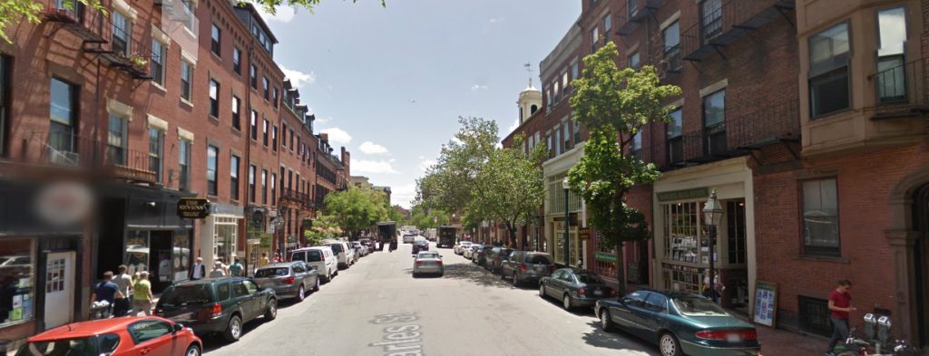
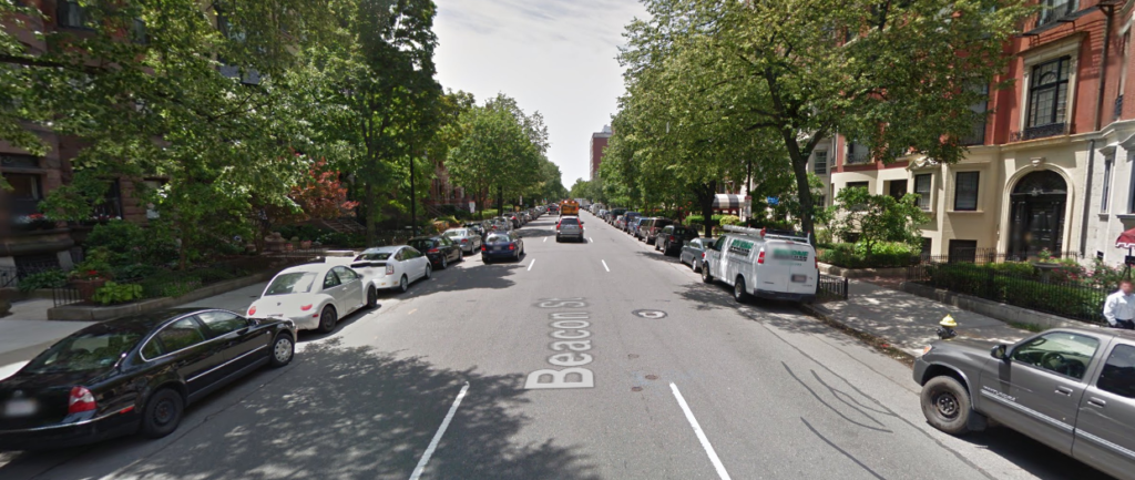
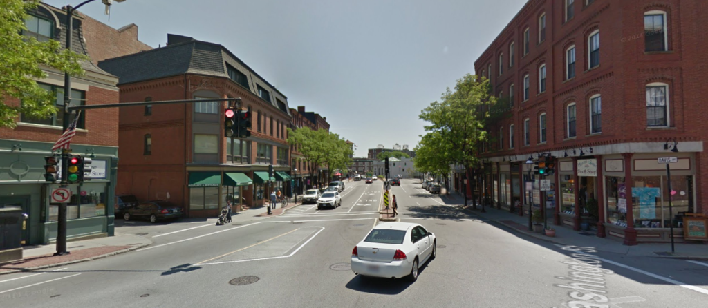
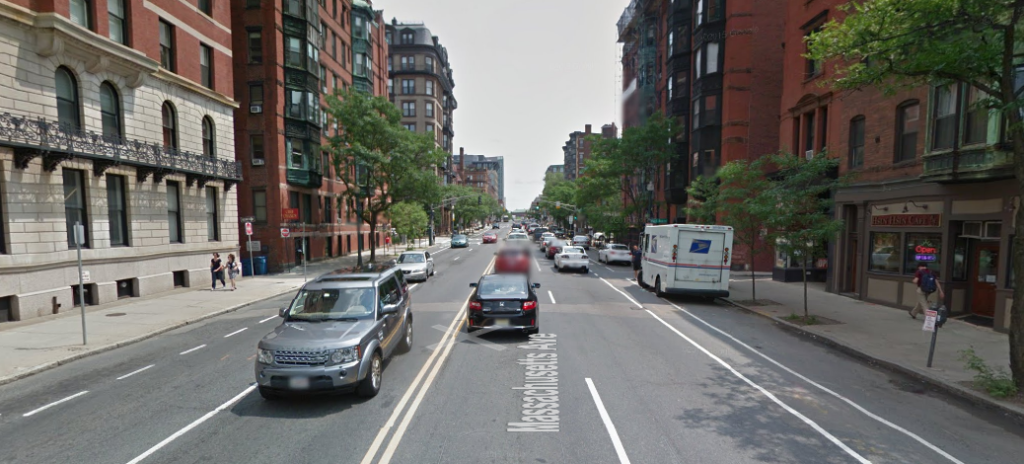
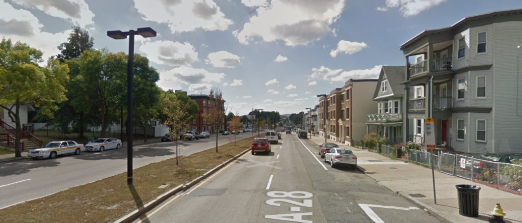
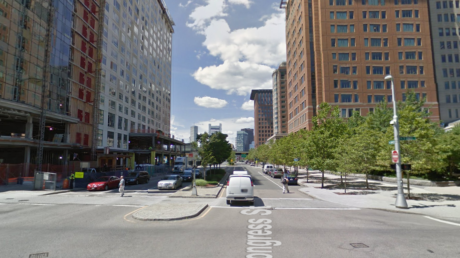
There has been a lot of discussion in the Allston task force about street widths in the area there. Since Google Maps and StreetView gives us a great way to measure the widths of streets and look at their profiles, here are many streets in Boston—most of them commercial streets but some others shown as well. They start from narrow streets in the oldest neighborhoods and range to the widest streets of the Seaport (I left out highways and streets with transit reservations). This should be a good resource for looking at what different street widths can accommodate. 
Note that these widths are building-to-building, or the outside edge of the sidewalk on each side. 
There seem to be groups of streets, and how a street is built is often very different even when the width is similar. In Boston, there are many streets that are 36 feet wide, 50 feet, 60 feet, 66 feet, 80 feet, 90 feet and 98 feet (many major roads are this wide, and their character varies significantly). Very few roads are any wider than that, except for some streets in the Seaport which are 132 feet wide. Here are streets shown, from narrowest to widest.
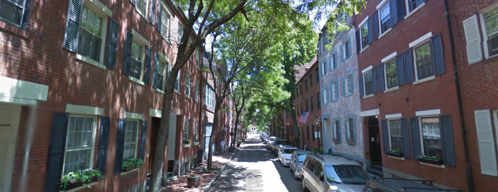
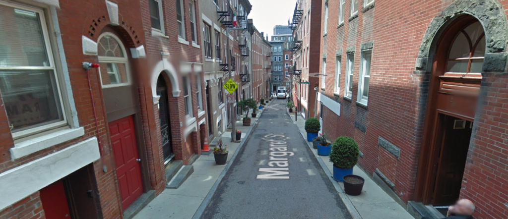
20 feet, Margaret Street, North End.
32 feet, Temple Street, Beacon Hill. 
32 feet: Melrose Street, Bay Village.
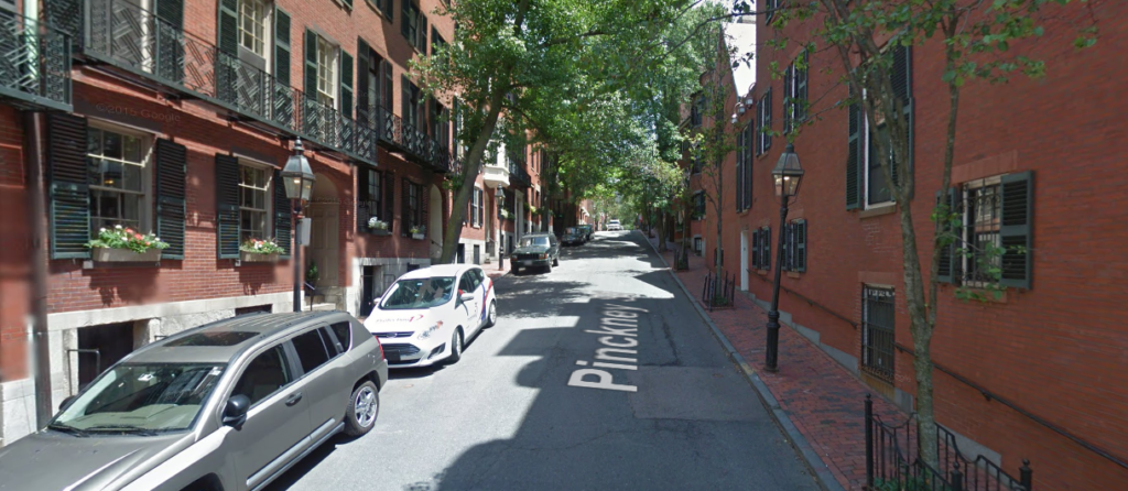
36 feet: Pinckney Street, Beacon Hill.
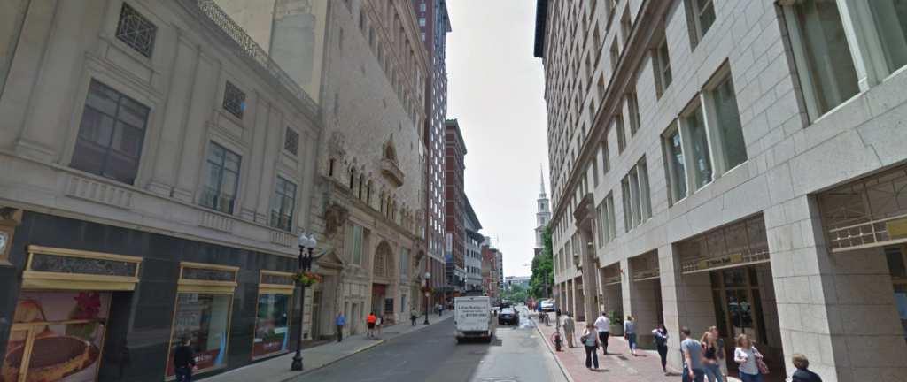
36 feet: School Street, Downtown.
50 feet: Mount Auburn Street, Harvard Square, Cambridge.

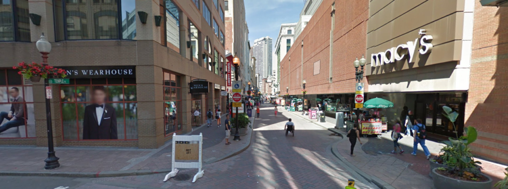
50 feet: Washington Street, Downtown Crossing.

50 feet: West Newton Street, South End.
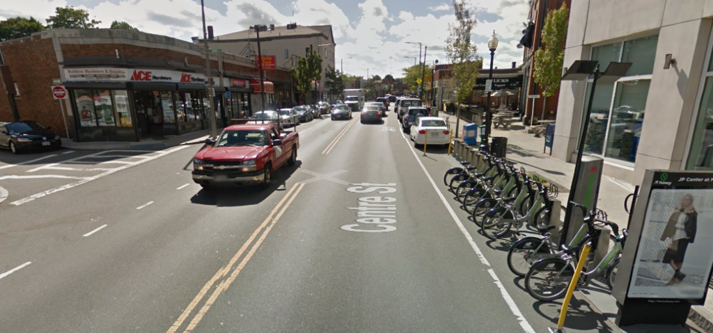
58 feet: Centre Street, Jamaica Plain.

58 feet, Tremont Street, Downtown

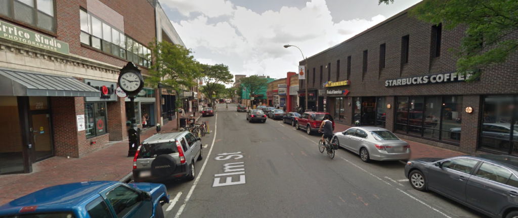
60 feet: Elm Street, Davis Square

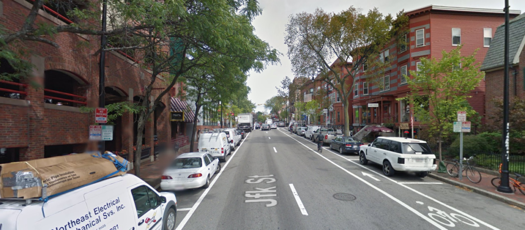
60 feet: JFK Street, Harvard Square.
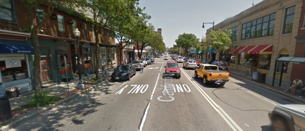
66 feet: Cambridge Street, Inman Square.
66 feet: Charles Street, Beacon Hill.
66 feet: Harvard Ave, Allston.
75 feet: Beacon Street, Back Bay.
80 feet: Washington Street, Brookline Village. 
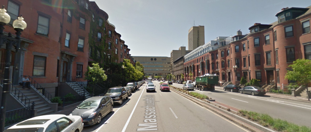
82 feet: Mass Ave, Back Bay.

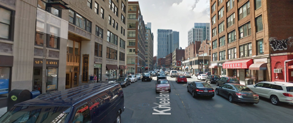
82 feet: Kneeland St, Chinatown
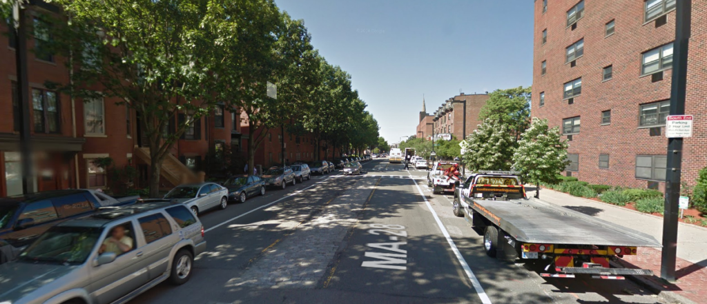
82 feet: Columbus Ave, Egleston.
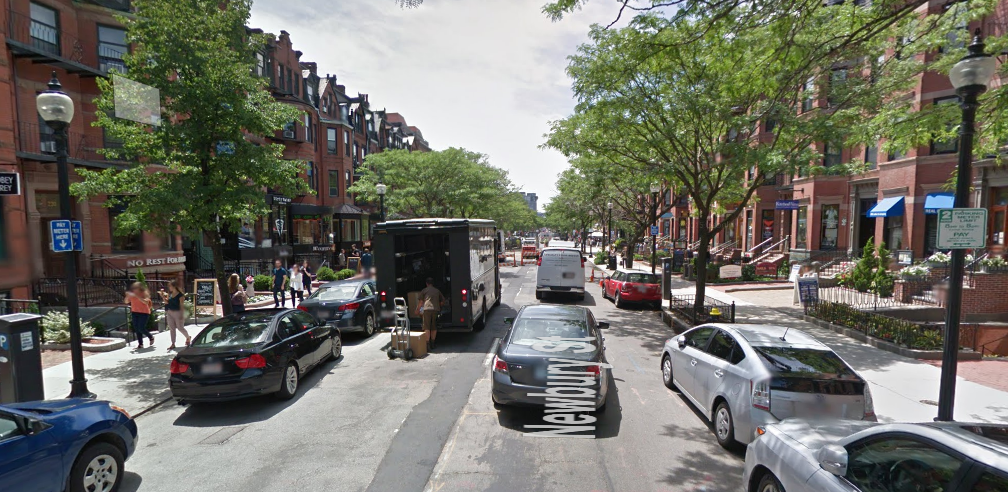
90 feet: Newbury Street, Back Bay.

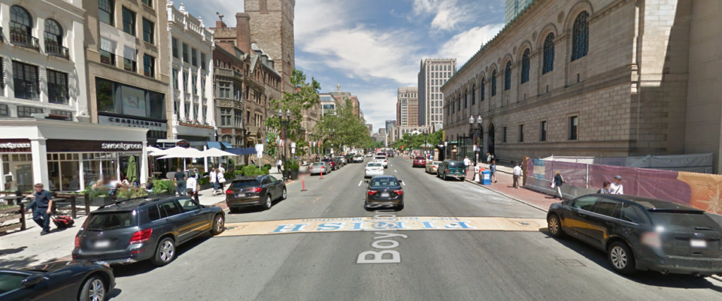
90 feet: Boylston Street, Copley Square. 
90 feet: Columbus Ave, South End.
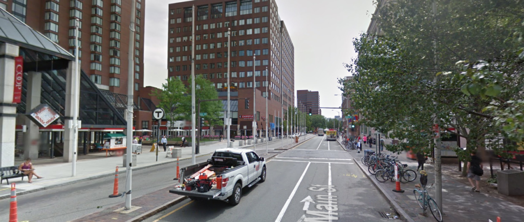
90 feet, Main Street, Kendall Square (under reconstruction).
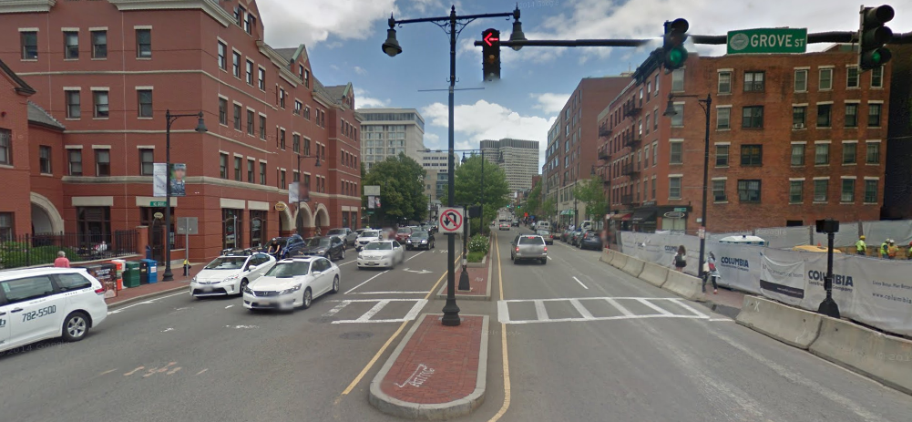
98 feet: Cambridge Street, Beacon Hill .

98 feet: Brighton Ave, Allston.

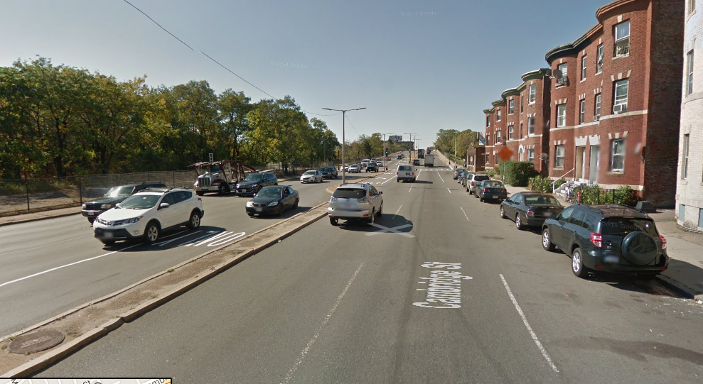
 98 feet: Cambridge St, Allston.

98 feet: Mass Ave, Central Square.
98 feet: Mass Ave, north of Harvard

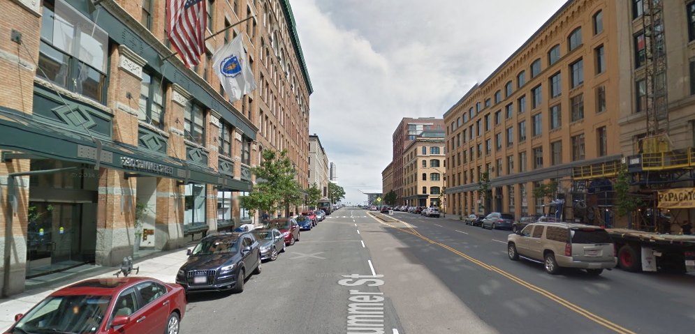
98 feet: Summer Street, Seaport.

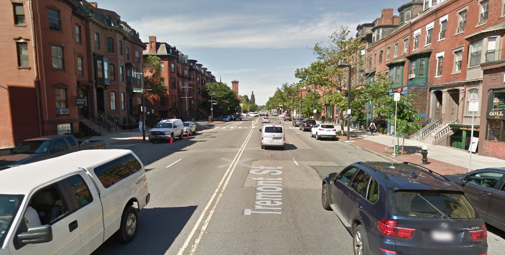
98 feet: Tremont Street, South End.

98 feet: Boylston Street, Fenway.

98 feet: Mass Ave, South End
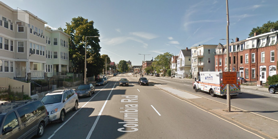
110 feet: Columbia Road, Uphams Corner.
120 feet: Blue Hill Avenue.

132 feet: Seaport Blvd

132 feet: Congress Street, Seaport.

A Complete Mass Ave in Cambridge

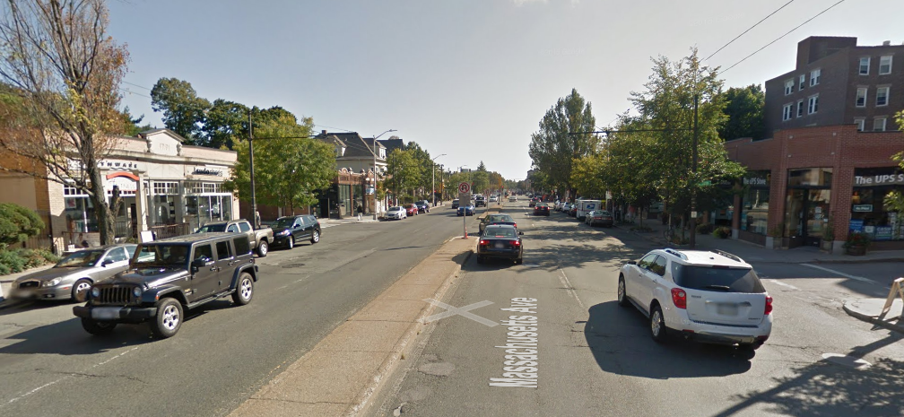
Cambridge is in the process of starting a citywide master plan (right now it’s in the naming phase). The major thoroughfare in Cambridge is Massachusetts Avenue (Mass Ave for short, of course), and it is pretty much the only street in Cambridge that is more than two lanes each way. Except for a couple of locations, north of Harvard Square Mass Ave is 72 feet wide, and it could be a great street.

Unfortunately, it’s not. It’s basically a highway.

Two wide lanes of traffic each way, parking and a median. Are we in Cambridge, or LA?
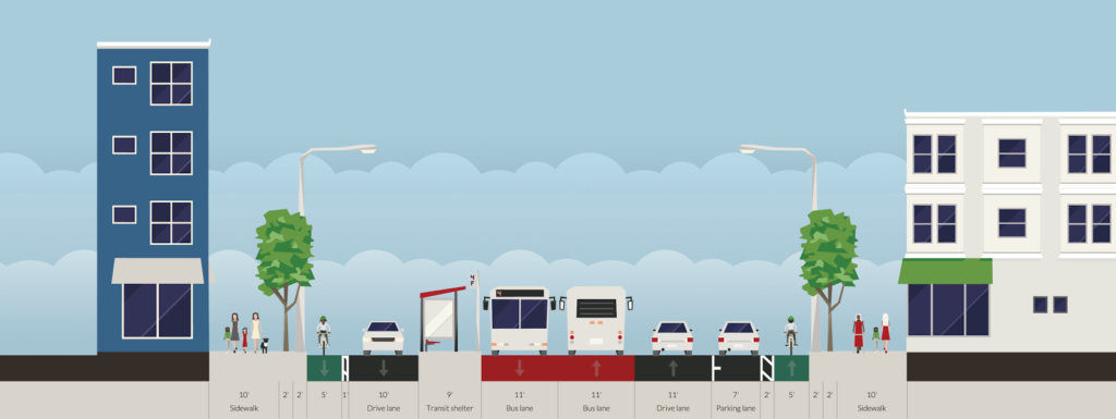
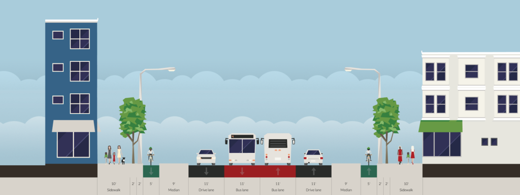
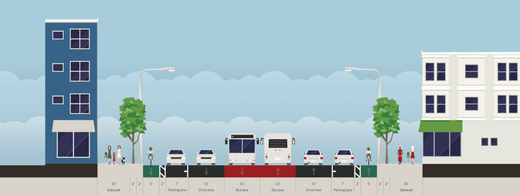
All diagrams shown made in Streetmix, which is a fantastic tool for this sort of exercise.

And that needs to change. The street currently serves two functions well: traffic and parking. There’s minimal traffic on Mass Ave because there is ample capacity (the bottlenecks are at either end of Cambridge). There is plenty of parking; nearly the entire stretch of the street has parking on both sides. And since the street is so wide, there is a median to help pedestrians cross, discourage left turns and make the traffic even faster. It is also a concrete waste of six perfectly usable feet.

The street does have 14 feet of pedestrian facilities on either side, but these are hardly enough for the various uses there, which include bus stops, bike racks, sidewalk cafes, building access, power and light poles, etc. And the current lane width is ridiculous. Each side of the street is 33 feet wide: a 7 foot parking lane and two 13 foot travel lanes. Considering that Interstate travel lanes are only 12 feet wide, and 10 foot lanes are used throughout much of Cambridge, this is far, far more width than necessary, meaning that with the median there are 18 wasted feet of space on Mass Ave. Wider lanes cause drivers to speed, which endangers other street users. As for transit, the 77 bus limps along Mass Ave, stuck in traffic and pulling to the curb at every stop, only to wind up stopped at a light behind the cars that passed it.

We need to re-plan Mass Ave, and we need to rethink our priorities. In the 1950s, when the removal of transit safety zones in Mass Ave sped traffic and the end of the streetcars (at the City’s behest, no less), the main priority was vehicular traffic, with no mind paid to cyclists, little to buses, and not much to pedestrians. This is nearly completely backwards. How we should plan is:

  1. Pedestrians. Every street user other than a pass-through driver is a pedestrian. We need to make sure crossings are manageable, sidewalks are wide enough, and traffic is slow enough to be safe.
  2. Transit. Right now there are four bus lines along Mass Ave, the 77, 83, 94 and 96, carrying 13,000 passengers daily (as opposed to 20,000 vehicles). In addition, the street serves as the pull-out route for the 71 and 73 buses, serving 10,000 more. At rush hour, there may be a bus every two or three minutes.
  3. Cyclists. Safe cycling infrastructure is imperative for Mass Ave, as it is the straightest line between Arlington and North Cambridge and Harvard Square and points south and east. It is also the main commercial street for the neighborhood, and safe cycling facilities will allow residents to access businesses without driving. Rather than shunt cyclists to roundabout side streets, we should give them a safe option on Mass Ave. 
  4. Cars. Yes, we need to provide for vehicles. We need a lane in each direction, enough parking to serve businesses (likely on both sides) and turn lanes in a few selected locations. Do we need two lanes in both directions? Certainly not; there are plenty of one-lane roadways which accommodate as much traffic as Mass Ave. And if we build a road that’s better for pedestrians, cyclists and transit users, many of the current drivers will travel by foot, bicycle or bus instead. We also need parking, and there’s enough for parking on each side. It would be eliminated where there are bus stops, but with fewer overall stops there would be only a minor loss of spaces. And with better non-driving amenities, fewer people would drive, anyway.
With that said, here are some Streetmix diagrams of the roadway, and an overhead sketch of how they would mesh together:

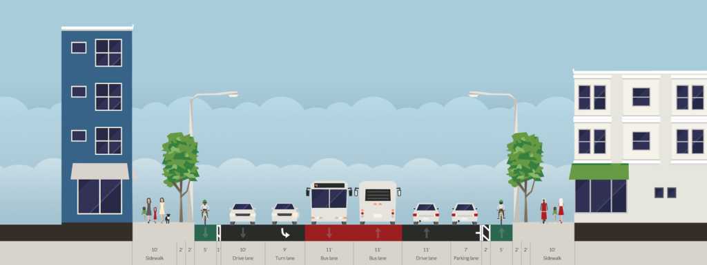
This is a typical section of street. The curbs and sidewalks are unchanged, but everything else is. Cars get one lane, plus parking. There are center bus lanes, which also allows cars to pass people parking, or a double-parked car, although this will require enforcement to keep drivers from using the bus lanes for travel or turns. Each lane is 11 feet wide, and emergency vehicles would also use the bus lanes to bypass traffic. On each side of the street, there is a 5 foot bike lane separated from parked cars by a 2 foot buffer (the bike lanes could either be at street or sidewalk level). This would be the baseline configuration of the street.

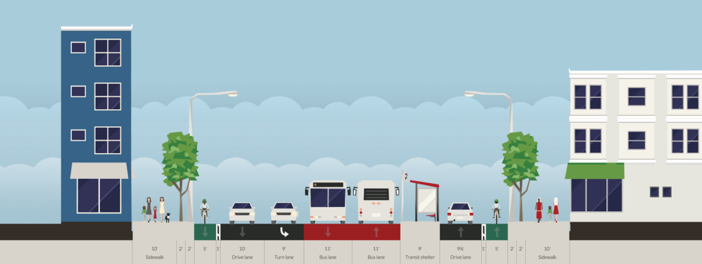
Now, how do people get on to the bus? A bus stop. Back in the day, this would be called a safety zone, so that passengers could safely wait for and board a streetcar in the center of the street. Mass Ave had these until the ’50s, as did Central Square, as did many other cities. (In fact, they still have them in Philadelphia and San Francisco.) Today, we’d call them part of Bus Rapid Transit. They’d be paired with a crosswalk to allow people to easily access the station, and allow buses to quickly and safely board and discharge passengers without having to pull in and out of traffic. The travel lane would be shifted towards the side of the road in these cases, and the parking would disappear; this chicane would also serve as a traffic calming measure. Of course, there would be no more curbside bus stops taking up parking. This would also reduce the crossing distance of the roadway at bus stops to 47 feet, although less since there would be refuge between the bike lane and the travel lane opposite the bus stop; meaning the longest distance would be only 33 feet.

When a crossing of the roadway is desired away from a bus stop, the parking lanes would be replaced with curb bumpouts beyond the cycle track, meaning that pedestrians would only have to cross four lanes of traffic—44 feet—instead of the current 72. Crosswalk treatments would be included in the cycletrack to warn cyclists of the pedestrian crossing.

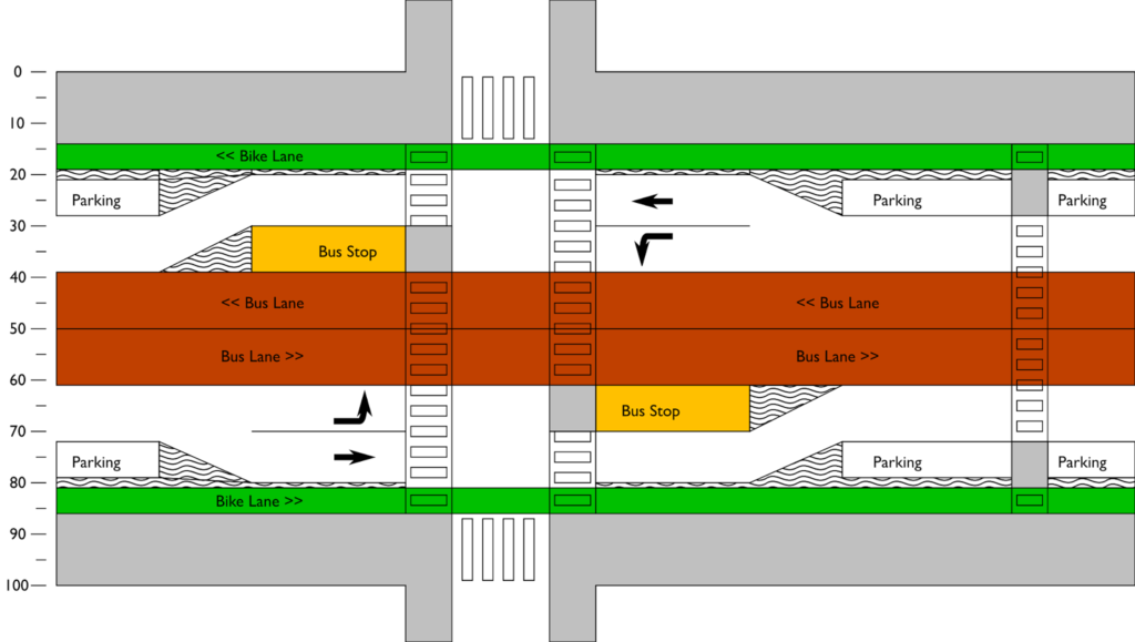
A turn lane could be accommodated by reducing parking in a manner similar to a bus stop. This would often be paired with a bus stop opposite the turn lane, with through traffic proceeding straight and the turn lane becoming the bus stop.

What would it look like from above? Something like this:

In the 1950s, we planned Mass Ave for cars. Cambridge can do better. In 2015, we were honored to have built what was described as the best new bicycling facility in the nation. It’s high time we remake Mass Ave, this time for everyone.

Tax gas more when it’s low. Less when it’s high.

Gas prices are low.

Really, really low.

But gas prices are also volatile. They can swing—and have swung—by 200% in a few months. What other such omnipresent commodity has such wild price swings? Eggs? Maybe. Gas prices were low in the early 2000s, rose mid-decade and then spiked after Katrina, rose further in 2008 to more than $4 per gallon, plummeted with the economy and bottomed out below $2 in 2009, rose back to $4 by 2011 and have since dropped back under $2.

This is all related to the base cost of oil, variable global demand and long lead times for production. But one thing that doesn’t change with gas prices are gas taxes. If gas is cheap, the tax is the same per gallon. Expensive? Same tax. There’s a pretty good reason that gas is not taxed as a percentage: it would be punitive when prices were high (which can be harmful to the economy) and wouldn’t raise enough money when prices are low. So we have a set tax per gallon.

But it’s not enough. In Massachusetts, the economy is doing well, but is held back by pesky infrastructure. We can’t rest on our laurels, but we seem unwilling to pay for what we need.

The problem is that—especially given the recent volatility in prices—raising the gas tax makes people worry, somewhat rightfully, that the tax will cause high gas prices to go even higher. Sure, gas might only be $1.79 today, but if there were another oil crisis and gas spiked to $4.25, would we really want to tack on another ten or fifteen cents? There’s a very cogent response that, no, we would not: gasoline usage is very inelastic as most travel is non-discretionary. Sure, some people will switch to other modes, and some won’t make trips, but higher gas prices mean that middle-class consumers have less money to spend on other goods. Raising the gas tax when the price is high is akin to hitting consumers while they’re down.

But low prices are just as perverse, for the external effects of gasoline usage. Low gas prices provide little incentive to purchase fuel efficient vehicles, so more consumers buy gas guzzling vehicles, which lead to more pollution, climate change issues, and boneheaded government programs when gas prices rise and everyone cries poor. Gas price volatility is a problem for pretty much everyone.

The gas tax is really different from every other tax. Few other taxes are on a good with a price as volatile as gasoline. Other taxes which we use, in theory, to reduce the consumption of a good (“sin taxes” on cigarettes, for example) can stay high even if prices rise, since there is no economic benefit to easy access to them. Many other taxes are collected as a percentage, but that is anathema for gas taxes as it would only serve to exaggerate price changes. What we really need is a tax that is high when gas prices are low, and low when gas prices are high.

Paul Krugman has cogently argued for a price floor for gas, but this has a couple of issues. It completely disrupts the supply and demand curves with a flat floor, so there is no natural variability in the gasoline markets. Second, if the price of gas rises above the “floor”, gas tax revenues cease; it it rises high enough, a major funding source for transportation dries up. (But, I must point out, one that does not come close to covering the full cost of our roadways; in fact, roadways in most states, including Massachusetts, have a “gas tax recovery” ratio of about 40%, similar to the MBTA’s farebox recovery, so subsidies are about the same.)

Another issue with a floor is that with volatile gas prices, it would mean that the floor price and the actual price would often be quite disparate, and it would have to be implemented on a national scale to keep motorists from having a high incentive to cross state lines. There’s no incentive built in, so it’s harder to sell as having any benefit when prices are high. It also requires all gas stations to charge the same price even though non-gas expenses—real estate, operations—often result in prices which differ by area and business. It’s a blunt instrument.

But what if you split the difference and had a gas tax which rose and fell inversely to the price of gas. When gas is cheap, the tax would be high, providing a sort of moving floor. When gas prices spike, some of the tax revenues could be saved and actually help to mute some of the spike with a rebate: so if the base price of a gallon of gas climbed to $4.50, consumers might only pay $4. I would contend that there is not much difference between gas prices of $1.75 and $2.50—both are considered cheap. Cheap gas is bad, and expensive gas is bad, and volatility is worse. With this sort of plan, when gas prices are low—which often correlate to a more sluggish economy—you get extra money for infrastructure improvements which provide jobs and economic stimulus. When they are high, the effect of the high price is muted somewhat, dampening the effect on the economy of high prices.

Let me put it another way. In the 2015, gas prices ranged from $1.97 to $2.71. Was gas expensive in the last year? No, it was cheap. What if there had been a tax which meant that prices ranged from $2.66 to $2.98? Would gas have been expensive? No, because under-$3 gas is still cheaper than any time since 2011. $3 gas doesn’t kill the economy. $5 might.

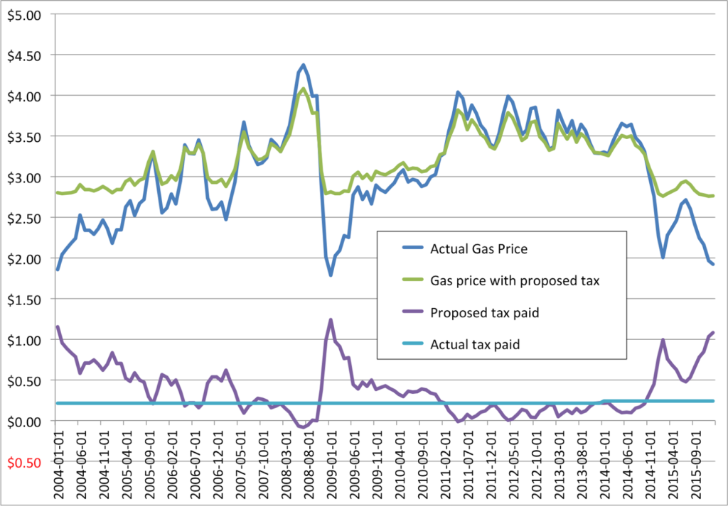
Looking back at the last twelve years of gas price data, I’ve come up with an idea which would raise the average gas tax—thus raising revenues for road and transit projects—but would also reduce the volatility of gas prices and, when prices are very high, actually reduce prices at the pump. Note that this is in relation to the Massachusetts state tax of 24¢, but would be just as applicable to the federal 18.4¢ per gallon tax. If the price of gas per gallon is G, then the tax would be:

4/G-$1

Note that these numbers can be moved around to increase or decrease the taxes paid, or to change the variability of the tax. For instance, $3/G-$0.70 would yield a tax with more variability; a lower floor but fewer savings when prices are high. But this seems to be a happy medium which matches the experience of the past 12 years well.

As for the costs—going off a baseline of the before-state tax price of gas (take the current price at the pump and subtract 24¢ in Massachusetts):

At $2, this would yield a tax of $1 per gallon and a price of $3
At $3, the tax would be 33¢ per gallon, for a price of $3.33
At $4, the tax would be 0¢ per gallon—a savings of 24¢ per gallon compared to the current tax rate—and the price would be just $4.00
At $5, the tax would be -20¢ per gallon, meaning that the price would be a quarter lower than it otherwise would have been; the price would be $4.80

If gas prices were to drop to $1—and this is unlikely, as it would equate to basically free oil—the system would break down a bit, as the tax would be $3.00 and the price $4.00, so some baseline could be built in (maybe a maximum tax of $1.25). If gas were to spike to $6, the tax would fall to -33¢, so the rainy day fund would be able to pay in to that for a while before becoming exhausted (and the tax could have a provision to readjust when a certain portion of the rainy day fund was paid out). 

Remember when we all had graphing calculators
in high school? Now, theres an app for that.
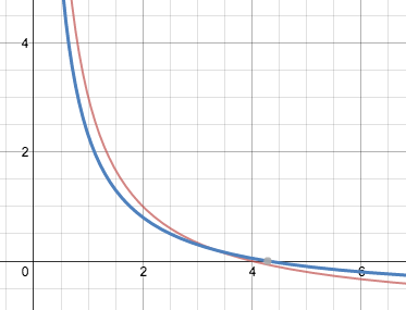
This graph shows the 4/G-1 (in red) and the 3/G-0.7
(in blue). Note that below $1.50, both increase
exponentially, so a cap would be needed.

Had this sort of tax been in place since 2004, prices would have ranged from $2.76 to $4.01 over that time, rather than the actual range from $1.82 to $4.38. (The 3G-$0.70 would yield a slightly larger range of $2.55 to $4.15.) It would mean a goodbye to very, very cheap gas. But we seem to have survived somewhat higher prices. We even celebrated when gas prices dropped below $3 for “the first time in, like, forever” back in the heady days of—let me check the dateline—October 2014. Having gas prices stay in the $2.50 range, even when the price of a barrel of oil plummets, is not necessarily a bad thing.

There would be plenty of benefits. One would be predictability for auto purchasers. Cars are durable goods, and a single vehicle can last through several oil price cycles. Consumers buying less-efficient cars would have a better idea of what gas prices would be, and they would no longer drop so low that inefficient cars would become (relatively) cheap to operate. And when prices spiked, it would be less of an impact for these consumers. High efficiency buyers would be incentivized to buy cars without the worry that recouping the extra cost for a hybrid or alternate fuel vehicle would be negated by a drop in prices. It would even benefit automakers, who would be able to better plan vehicle models and production schedules knowing that the volatility of gas prices would have less of an effect on consumer choice.

While this tax could be implemented as a revenue-neutral scheme, it would also make a revenue-positive gas tax more palatable. For instance, the tax described above would have averaged 37¢ from 2004 to 2015, during which time the gas tax in the Commonwealth was 21.5¢ (21¢ for 10 years, 22¢ for two). The gas tax in Massachusetts raises about 38 million dollars for every penny it goes up (and an average increase of 10¢—just 5% of the volatility in prices in the past decade—would be very unlikely to bend the demand curve significantly) so raising the tax from 21.5¢ to 37¢ would have raised a net of $7 billion dollars. That includes money for the rebate drivers would have received in 2008, when the tax would have been -9¢. That certainly would have been beneficial to the economy, which was already teetering on the brink for a variety of reasons, and certainly wasn’t helped by $4.50 gas.

There are some issues to this scheme, but they would be surmountable. First is that if the price of gas was consistently high, the tax—and the necessary revenue—would disappear. So any such tax would need a set amount that the rainy day fund would pay out and a specific criteria to recalibrate the tax towards a new baseline. If there were a few years of cheap gas, a months-long spike wouldn’t be an issue. If gas prices spiked for a long time, the tax would have to rise, but could keep the same adjustability provisions. (Why not set it to inflation? There are two issues. The first is that gas and inflation correlate very little. The second is that gas prices are part of the inflation, so if gas prices go up, inflation goes up, and this, if anything, causes a feedback loop.)

Another issue is that if prices are a lot higher in one state than in another, people are going to cross borders to buy cheaper gas. This would be an issue, but not a huge one. There are already disparities in gas taxes between states, although Massachuetts’ population is generally concentrated away from borders, and the distance that it’s worth traveling to save money on gas is relatively small. People are also more likely to feel the pinch of prices and try to avoid them when overall prices are high, and when prices are relatively high—above $3—the price disparity would be relatively small. And when gas prices are high, this gives the state an economic advantage, as residents would have more disposable income for other purchases. (You could even allow some gas stations very near the border to opt out of some of the increase in the tax when the prices were low, but they’d also have to give up the tax rebates when prices were high.)

Why not use a Vehicle Miles Traveled tax, or a VMT? There are variety of reasons. First of all, a VMT does not have the benefit of encouraging people who do need to drive to drive smaller cars, which this would. Second, it would be harder to sell a VMT than a gas tax, as there is a vocal minority of citizens very worried about the government tracking their movements (note to the tin foil hat crowd: that ship sailed a long time ago). The gas tax works. The main issue is that since it is so rarely raised, it has lost the purchasing power it needs

The idea of this plan is to pair a gas tax increase with the sweetener that, when the gas tax is most perverse and regressive, the pain would be muted. This has the potential to appeal to a wider portion of the population, because everyone remembers high gas prices, and it would actually help to reduce those spikes. We certainly need to increase transportation funding. The gas tax is a good tool, but we need to think outside the box and figure out how to make it work better, no matter the price of gas.

Would this work politically? There’s no way to know. But it would diffuse the argument that if we raise gas taxes and then prices go up, it hits low- and middle-income families hardest. This would actually give a tax break to motorists at times of high taxes. Maybe that would be a rallying point and a compromise to get the funding that we need while reducing the adverse impacts of the volatility of gas prices.

Rethinking MBTA weekend schedules

There is not much good that can be said about MBTA’s weekend Commuter Rail schedules.

A few lines have been graced with two hour, clockface headways (Worcester, Lowell, Franklin)—not frequent, but at least predictable—but most others have service only every three hours, and sometimes less frequently. Combine that with variable headways and a lack of off-peak fares, and it’s not surprising that ridership is less-than-stellar.

I suggested adding a station at Walden Pond, and today I’m going to go a step further. Rework the schedules, adding a small amount of service, to provide two-hour, clockface scheduling on all North Side lines. (I’ll leave the South Side to someone else, for now, although boy could the Providence Line use better service!) A caveat: I’m not sure about how crew rules work, and that may be the cause of some of the schedule irregularities here, but we should design a schedule for passengers first, and crews can be shuffled between lines at layovers to shorten or lengthen shifts as necessary.

Newburport/Rockport is relatively easy. The current schedule works relatively well, but has some bizarre gaps. For instance, Rockport has inbound trains at 7, 10, noon and 2, and then a 3:10 gap before the next train. Going in to Boston for the afternoon? You can arrive at 3 or 6. At the beach and want to get back to the city? You can go home at 2 or 5, but not in between. Even at Salem, where the two branches interline, there is a nearly two-and-a-half hour gap between 3:20 and 5:46. For a city with a significant tourist draw (the witch museum, the PEM), poor highway access and limited parking, this schedule is severely lacking.

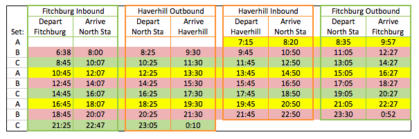
The two branches of the line have run times of 64 minutes (Newburyport) and 71 minutes (Rockport), so it is relatively easy to interline the two with three train sets:

This does add some service, with one extra Rockport trip and two extra Newburyport trips each day, adding about 22% to the current service. But the utility increases dramatically, with predictable train schedules and the elimination of service gaps. In terms of service hours, this schedule adds 6:38 to the schedule. The marginal operational cost per service hour, as calculated pertaining to the CapeFlyer, yields an extra cost of about $4500 per day. The line currently carries 5600 passengers on the average weekend day. Assuming an average fare of $7.50, just 600 additional riders—an increase of 11%—would cover the operational costs of these additional trains.

Fitchburg and Haverhill, however, are harder. Haverhill has a run time of 65 minutes, long enough that a single train set shuttling back and forth (see Lowell) can’t make a round trip in two hours, so the current schedule has service every three hours (or so), which is hardly useful. The Fitchburg Line’s current schedule is awful, with three-hour-plus service gaps and then short-turns running within a half hour of other trains.  The line is long enough that even with the new schedule accounting for higher speeds, the line would not even be able to attain two hour headways with two sets. The schedule is better than the current one, it’s nowhere near clockface, with service about every 2:25, or so.

But there’s no rule that says a train on the Fitchburg Line has to run the Fitchburg Line all day and all night, right? Imagine Fitchburg and Haverhill as two branches of the same line, with a train running first to Fitchburg and then to Haverhill, kind of like the Rockport and Newburyport lines. The relatively short Haverhill Line interlines well with the long Fitchburg Line, and the same three train sets can, combined, provide service every two hours on both lines.

I think that’s pretty elegant. This requires just 4:12 more running time each day, or $3150 of marginal operational costs. The two lines have a combined ridership of 4500, and would require just 420 additional riders—a 10% increase—for fares to cover the costs. And the benefit would be high: the frequency of trains on the Haverhill Line would increase by 50%, from every three hours to every two.

One final idea would be to have the trains operate on a “pulse” system at North Station to enable transfers, which is attainable if every line has clockface scheduling with the same headway. Every train would arrive at a similar time, allowing passengers going from, say, Lynn to Waltham, with an easy transfer at North Station (assuming trains are on time). With the current schedules, this isn’t possible. With a couple adjustments, the above schedules, with the Lowell Line, would work quite well for that.

Why is there no train station at Walden Pond?

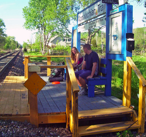
Photo from here.

When I was hiking the Appalachian Trail through New York, I passed MetroNorth’s Appalachian Trail station. Every weekend, a couple of trains stop there and drop off hikers, who can hike in either direction on the trail. There’s no parking lot at the station, nor road access (although Route 22 is only a couple hundred feet away). It is scheduled specifically for hikers, and while it only serves a few hundred passengers a year, the small station is sufficient for the crowds. Breakneck Ridge is a similar station, although not on the AT, as is Manitou, although it also has very limited rush hour service.

While the Appalachian Trail was built in New York in the 1920s and 1930s (meant to serve as a regional resource for city dwellers), the Appalachian Trail station is much newer. It was built in 1991 at the behest of MetroNorth and the New York-New Jersey Trail Conference, which maintains the trail in the area. The total cost of the station? Just $10,000, with negligible additional costs for a few trains to stop. Even if only a few hundred people use the station each year, their fares add up to more than that every year.

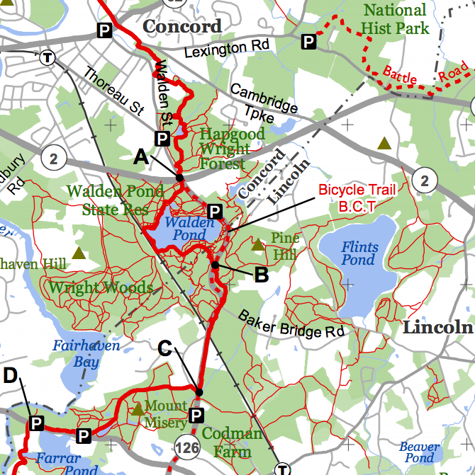
The Bay Circuit Trail runs 200+ miles around Boston,
including around Walden Pond. Full section map here.

Which brings us to Concord, Mass. While not on the Appalachian Trail, Walden Pond is one of the most heavily-visited outdoor sites in the region, both for swimmers and beach-goers in the summer, and walkers and hikers year-round. The Fitchburg Line goes right by the pond—Thoreau rode the train there, although he may not have liked the new technology—but the nearest stations are about two miles away (Concord, which is closest, is along a busy road with a crossing of Route 2, hardly conducive to pedestrian travel). While the pond abuts the railroad, and the Bay Circuit Trail—the 200-plus mile trail around Boston—comes within a stone’s throw, the trains roll through at 60 or 70 miles per hour, weekdays, and weekends.

And even if you choose to drive, Walden Pond can be hard to get to. There’s an $8 per car fee, but the 300-space lot routinely fills to capacity on weekends in the summer, with a line of cars idling on Route 126, waiting for an open spot (there is minimal other parking nearby on the narrow roads in the area). And while some people certainly come by train or bicycle, many more are put off by the relatively long walk from the local train station. But what if the train stopped at Walden?

The $10,000 MetroNorth spent on its station in 1991 would be about $18,000 today, with more cost, perhaps, because the site is more remote than the Appalachian Trail Station. And two platforms might be required since the railroad there has two tracks, so the cost might be upwards of $50,000 for a simple station. (I don’t know if you could get an ADA waiver given the remoteness of the station; if not a mechanical lift may suffice for infrequent wheelchair-bound visitors.) Stops could be made on weekends year-round (or at least during non-snowy months) and perhaps even on some afternoon and evening trains in the summer for late-day swimmers and picnickers.

From there, the Bay Circuit Trail provides hiking in either direction, and the station sits in the middle of one of the largest trail networks and conserved areas in the region. (We can have an argument about the merits of conservation land encouraging sprawl and high housing prices, but this at least is a large, mostly-contiguous portion.) For pond visitors, the swimming beach is a 15 minute walk along a wooded path, rather than a narrow roadway shoulder. This is about as long as the walk from Manchester-by-the-Sea to Singing Beach, at trek made by hundreds of beachgoers on warm summer days. At $15 per roundtrip, it would only take 83 passengers per day for 20 weekends of the year to make back the construction cost of the station—in one year.

Photo from here.

This could be sold as a partnership, or even partially funded through private sources. The MBTA can provide access to a DCR property and other outdoor resources. A station could even provide a safer crossing location for the tracks, which several trails cross and which now have a speed limit of 80, up from 60. It may also help tourism: the train I rode in late December had British tourists headed for Concord looking out the window at the pond, an international destination. Perhaps we should make it easier to access.

The Bay Circuit Trail, Appalachian Mountain Club and The Trustees of Reservations—two large, longstanding Boston-based outdoors advocacy organizations—could work to promote transit-friendly excursions for city dwellers. There would be more options for Walden Pond visitors to get to the reservation (and fewer cars), more revenue for the T with minimal expenses and more opportunities for people from the city who may not have a car to get outside and active. There are questions of erosion: perhaps such a partnership could put a portion of each ticket sold to and from Walden towards the maintenance of the trails there. Other than slightly longer trips for Fitchburg Line weekend riders (and given the padding currently built in to the schedule, I’m sure a stop could be built in without any delay), everyone is a winner.

This should happen.

Boston Transportation Data

Sometimes, people ask for transportation data that they assume doesn’t exist but, au contraire, it does. There are some other data I have which I can provide on request, but aren’t posted publicly (and some of those are based on calculations I’ve made which might not be entirely perfect). Here are some of the resources I know of. Most are large PDFs, because that’s where data exists, right?

  • Massachusetts traffic volume counts. This has most vehicular traffic counts in the Commonwealth.
  • MBTA Blue Book has a lot of detailed information on MBTA operations. It does not have everything, but a lot: bus and transit ridership, some historic data (older versions of the Blue Book have data going back further; at some point I would like to compile these older data in to one document beyond Commuter Rail, which I have).
  • Commuter Rail counts by train. These data are outdated (2012) but give a good idea of how many people rider specific trains, at least on the day the count was completed.
  • Commuter Rail system survey. These data are even more outdated (2008) but even richer, including access and transfer data. It’s pretty dense.
  • Changes to MBTA service since 1964. A very comprehensive look at every bus line in the system, and every change to service in the past 50 years. 
  • Summary of Commuter Rail operations, including the number of train sets required.
  • MBTA salaries, in a very not-useful PDF document. I have an Excel somewhere. 
  • Keolis bid document, with salary information for various positions and job descriptions.
  • NTD Database, with transit system comparisons. You can also download the whole database as a database or in excel.
  • Monthly data by mode, 2007-2014
  • Archive of Commuter Rail schedules (Dave Weebly).
I will update this post frequently as needed. 

Go to a Public Meeting … Tonight!

In the past, this page has implored people to go to public meetings. There’s one tonight that you should definitely put on your calendar:

The City of Boston and MassDOT is rebuilding the North Washington Street / Charlestown Bridge between Boston and Charlestown. It is designed with top-notch cycling and pedestrian facilities, but the designers seem to have forgotten about transit. Five bus lines cross the bridge carrying 20,000 passengers per day, including the 111 to Chelsea—a lifeline for that community—yet these riders are subject to the same delays as traffic.

There is plenty of room as the bridge is design for transit priority as it is designed, and it is most important to have a lane on the inbound side. At rush hours, 30 MBTA buses (as well as many private, last-mile shuttles) carry 1200 passengers across the bridge per hour. At the same time, the two lanes of traffic are used by about 2000 vehicles, or 1000 per lane per hour. So a lane of buses is more efficient at moving people than a lane of car traffic, even if there’s only a bus every 2 minutes.

What’s more, this will dramatically improve operations and reliability. Approximately 5000 people cross the bridge inbound by transit during peak hours inbound, at times when there are often five to ten minute delays. If a bus lane saves an average of five minutes of travel time on weekdays, this will amount to an annual savings of 100,000 hours for passengers on the buses serving this route. For bus operations, a five minute savings amounts to 10% of the route, which would allow 10% more riders to be carried on the same number of buses, increasing the efficiency of the route.

It’s also low-hanging fruit. The entire bridge is being redesigned, so it’s easy to add in a few feet necessary for a bus facility. There are no parking spaces, so there are neither impacts to the neighborhood losing parking nor issues with designing roads to accommodate bus lanes and parking spaces, one of many of the problems the Silver Line has. It should be a slam dunk. If we can’t get transit priority here, how ever are we going to get it elsewhere?

The details:

6:30 PM 

The West End Museum 

150 Staniford Street 

Boston, MA 02114

We need as many people to come and speak out for transit priority as possible! See you there!

Can’t make the meeting? Send public comments by Dec 25 to:

dot.feedback.highway@state.ma.us attn Project File No. 604173

or

Patricia Leavenworth, P.E., Chief Engineer, MassDOT, 10 Park Plaza, Boston, MA 02116, ATTN: Bridge Project Management, Project File No. 604173.

Saving GLX by (temporarily) cutting Fitchburg?

The Commonwealth of Massachusetts is mostly finished with a $300 million rehabilitation of the Fitchburg Line, which will yield more capacity on the line and faster speeds on the longest in-state line in the system. At the same time, the Green Line extension project has seen exponential growth in cost, mostly due to bizarre contracting methods and poor oversight. But it’s still a complex project. And now an idea is being floated to cut back a branch of the line to Union Square in Somerville—a branch which parallels the Fitchburg Line—which is in dire need of better transit.

But maybe this presents an opportunity for some out-of-the-box thinking. Both branches of the GLX are slated to be built alongside existing Commuter Rail lines, and building next to an active railroad is not particularly easy. There are safety concerns, FRA issues, and even the cost of staff to insure the safety of workers—and the safe passage of trains—comes at a significant cost. If you could cut all parallel rail service, you could save a lot of time and money: rather than having to rebuild in a constrained corridor, you could more quickly build the project in a much easier work environment.
This, of course, would require cutting Commuter Rail off from the the terminal in Boston. For Lowell, this is a non-starter: busing from Winchester or West Medford would be subject to the whims of traffic on I-93, as would buses from Anderson/Woburn. And the Lowell Line also serves Amtrak and some Haverhill trains which bypass traffic on the single-tracked portions of the Haverhill Line. At busy times on this line, there is a train every ten minutes.
But for Fitchburg, this presents an opportunity. Before getting to Boston, Fitchburg Line trains stop at Porter Square. Already, between 30 and 50% of Fitchburg riders begin or end their Commuter Rail trip at Porter, transferring for a trip to Harvard, Kendall or even in to Boston. What if, for a short period of time, you closed the line inbound from Porter to allow for reconstruction, and had everyone transfer at Porter?

While this would be inconvenient for some riders, and put a bit more of a load on the Red Line, it might save a lot of time, and a lot of money, in the construction of the Union Square portion of the Green Line extension, as well as the portion near Lechmere where the branches meet and cross over the Fitchburg Line. Shuttle bus service could be provided between North Station and Porter (a 20 minute ride) but most passengers would take the Red Line. Considering that nearly half the riders already get off, and most jobs downtown are located near or south of the Red Line (in the Financial District and Back Bay) this would be only a minor inconvenience for them. With faster track speeds on the Fitchburg Line, in fact, it might actually be a wash for many commuters.

Using GTFS, I’ve tested out a few test trips from South Acton:

+16 minutes to North Station
42 minutes via North Station
58 minutes via Porter, Red Line and Green Line.

+6 minutes to Seaport
66 minutes via North Station and #4 bus
72 minutes via Porter, Red Line and Silver Line

+5 minutes to Copley
56 minutes via North Station and Green Line
61 minutes via Porter, Red Line and Green Line

+3 minutes to Park Street
52 minutes via North Station and Green Line
55 minutes via Porter and Red Line

0 minutes to LMA
72 minutes via North Station and Green Line
72 minutes via Porter, Red Line and #47 bus

0 minutes to South Station, Kendall and Harvard
58, 48 and 42 minutes via Porter already faster than via North Station

It’s a wash for most commuters other than those traveling to North Station, and most commuters’ final destination is not at North Station, but somewhere to the south (since North Station is mostly surrounded by highway ramps and water). In the long run, running trains to North Station makes sense. But if service could be curtailed at Porter for a year to save millions of dollars, I think it is a worthy sacrifice.

In addition, service on the Fitchburg Line could increase in frequency. Each train terminating at Porter would save 20 minutes of round trip running time. This could be translated in to an extra trip in each rush hour to help spread the load, and an extra midday and evening trip as well using the same equipment. It would also be a good opportunity to, once and for all, construct high-level boarding platforms at Porter to allow faster boarding of trains at the station. The two-track station would be more than adequate for the current schedule on the Fitchburg Line, and during the midday, trains could be stored on the tracks beyond the station well shy of construction in Union Square.

The five train sets currently stored in Fitchburg would be enough for full service on the line; the first train arrives in Porter at 6:40 and could easily make the outbound run to Littleton for the 8:20 service back to Boston in the morning. In the evening, the first outbound train to Littleton could easily turn back to Boston in time for the late local departure at 6:20 (which could be pushed back a few minutes with no ill effect on passengers).

With the route mostly cut off from the network, light maintenance would have to be established somewhere along the line (perhaps at the maintenance of way facility near Alewife). For heavier maintenance, trains would have to be shuttled to Lowell across the Stony Brook line from the Willows. This railroad is slow and would need improvement for anything but occasional moves (if it were faster, it could host passenger service from Fitchburg to Boston via Lowell) but would likely be adequate for short-term moves. The extra crew costs would be offset by the savings of rebuilding the inner part of the line quickly and economically.

Is there precedence for this? There is. From 1979 to 1987, the Southwest Corridor was rebuilt below grade between Hyde Park and Back Bay for the relocated Orange Line. The issue was that the Needham Line was only accessible via the corridor. Rather than keeping a track in service and continually moving it around for the rest of the rebuild, they shut down Needham service, replaced it with express buses (which encountered less traffic on the Turnpike than they would today) and rebuilt the corridor in place, That project is obviously larger than the Fitchburg project, and necessitated a longer shutdown, but there are certainly similarities which could yield similar cost savings. See page 202 here.