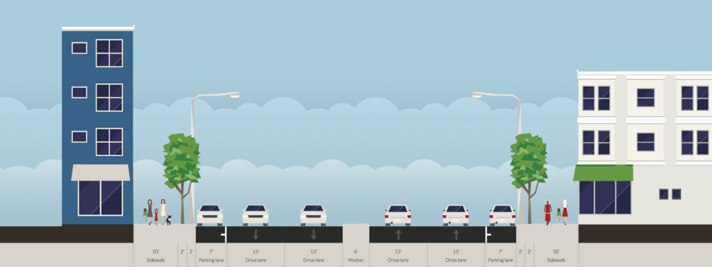
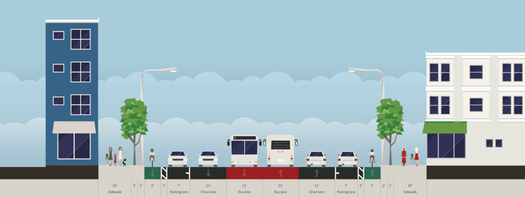
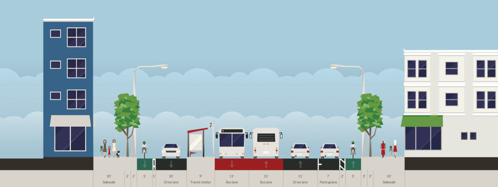
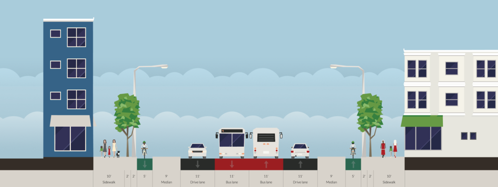
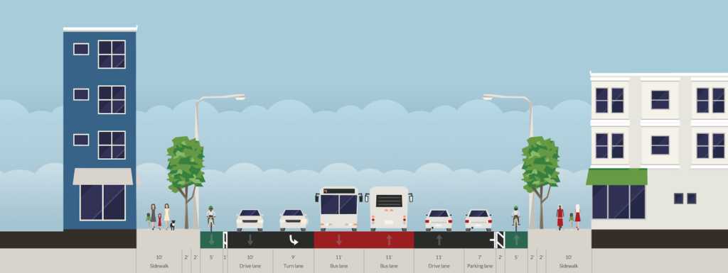
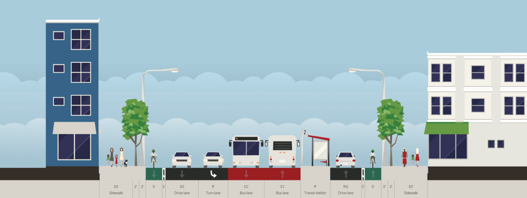
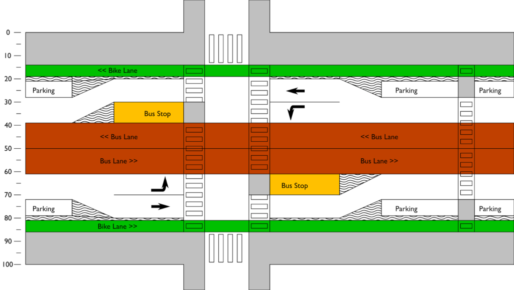
Traffic-wise, Central Square is a mess. Squeezed in to the streets are about 30,000 vehicles on Mass Ave and Prospect Streets, bus routes—most of which terminate in or near Central—serving more than 30,000 daily riders, thousands of cyclists and countless pedestrians going to and from work, home, businesses and transit. (This leaves out the tens of thousands of Red Line riders moving through under the street.) The street has been rebuilt many times, most recently between 2006 and 2009, to widen the sidewalks and realign Lafayette Square at the east end of the area. Sitting as it does adjacent to Kendall, Central has seen more traffic (of all types) in recent years, and often devolves in to gridlock at peak times.
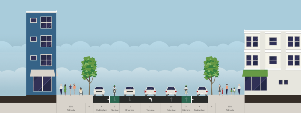 |
| That’s a lot of space for cars, isn’t it? |
Still, the Square is remarkably car-oriented for a community where the majority of residents don’t drive as their main means of transport. Bike lanes are an afterthought, and cyclists jockey for space as buses, taxicabs and parked cars pull in and out, crossing and frequently blocking the bike lane. It is one of the most dangerous locations in the city for cyclists, which is no surprise to anyone who bikes there. For pedestrians, crosswalks are frequent and Mass Ave and Prospect Street have five second leading pedestrian intervals, but sidewalks are still congested, especially near transit stops which often fill with riders if a bus is a few minutes off of its headway.
 |
Back in the day, transit riders boarded streetcars in the center of the street
in Central Square (these were not exclusive lanes but rather “safety zones“
where passengers could board streetcars while automobiles passed on the
right; cars could pass on either side of the platform. |
And transit riders? They have it worst. Long queues can form entering and exiting the too-narrow subway entrances at Pearl Street. Bus riders have a small shelter on Mass Ave, which is often inadequate for the number of riders waiting for the multiple routes which board there, and riders on Route 70 are forced to board buses a block away from the Square, on Green Street, with minimal shelter, narrow (just five feet wide!) sidewalks and on a grungy back street which is often so choked with traffic the bus can barely manage a crawl between the stops.
Unlike most other parts of the 1 Bus route, there are parallel streets in Central which could be used to alleviate traffic on Mass Ave and provide safer options for cyclists and pedestrians and better conditions for transit riders. It would require a major rethinking of how street space is used, changing the direction of Green Street and moving eastbound traffic one block to the south. That hurdle aside, Mass Ave could be reapportioned to allow for a safe, separated bicycle facility, bus stop consolidation at a single point adjacent to the Red Line (not, for many riders, a block away), and a transit-only facility stretching several blocks, free of the traffic snarls that routinely hold up buses. It would also (gasp) reduce some street parking, but the majority of businesses in Central cater to walk-in traffic, and there is ample parking at the too-numerous parking lots nearby and at the ugly-and-should-be-torn-down-for-housing Green Street Garage.
So, how do we create a Central Square where pedestrians, cyclists and transit riders are put first, and not an afterthought?
1. Green Street flips from west to east. This allows all of the traffic from Mass Ave to be shunted south on Pleasant Street by the Post Office and then left on to Green. (Franklin would probably also be flipped from east to west, which would have the added benefit of eliminating a the Franklin/River intersection, which has very poor sight lines.) Green would be two lanes wide, with one lane for through traffic and the other for deliveries and drop-offs and potentially parking between Magazine and Brookline. While this would increase traffic on Green Street, it would be mitigated by removing most if not all of the buses (more on that in a moment). Furthermore, there are very few residential buildings on Green Street, which is really mostly a service corridor for Central Square, so the impact of any additional traffic would be minimal. The street is 24 feet wide, which is wide enough for two 12-foot travel lanes.
Once past Pearl Street, traffic would be able to filter back to Mass Ave. Some traffic would take Brookline Street, mostly to zigzag across to Douglass Street and Bishop Allen. Traffic destined to Main Street could turn here, or signals could be changed to allow a straight-through move on Sidney Street. Traffic going towards Boston could continue on Green Street as far as Landsdowne, where the diagonal street allows for less severe turns.
What about westbound traffic via Bishop Allen and a transit-only corridor? There are several reasons this is suboptimal. First, it’s probably good from a political and practical sense to have some vehicular access to Mass Ave. Otherwise you wind up with some dead-ended narrow streets abutting the square. Second, the right turn for through traffic from Mass Ave to Bishop Allen is very hard to figure out. The Sidney Extension-Main-Columbia turn would be implausible increased traffic. Douglas Street is only 20 feet wide and is probably too narrow for trucks. Norfolk is 24 feet, but then you’re creating a busy turn right in the middle of the square. Finally, complete streets include cars. They just don’t make them the priority.
2. Mass Ave eastbound is rerouted to Green Street. As described above, all traffic from Mass Ave eastbound would be diverted to Green Street at Pleasant. Traffic wishing to turn left on to Prospect would take a right on Pleasant, and a left at Western. Light timings would be changed at Western to allow for additional traffic. Mass Ave Westbound would remain as is.
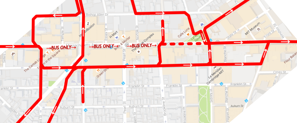 |
| Eastbound traffic patterns for traffic to and from Mass Ave. The dashed line shows where traffic would be allowed but not encouraged; signs would direct through westbound traffic to Mass Ave to proceed to Landsdowne Street, but right turns from Brookline to Mass Ave would be permitted. For simplicity, not all traffic movements are shown. |
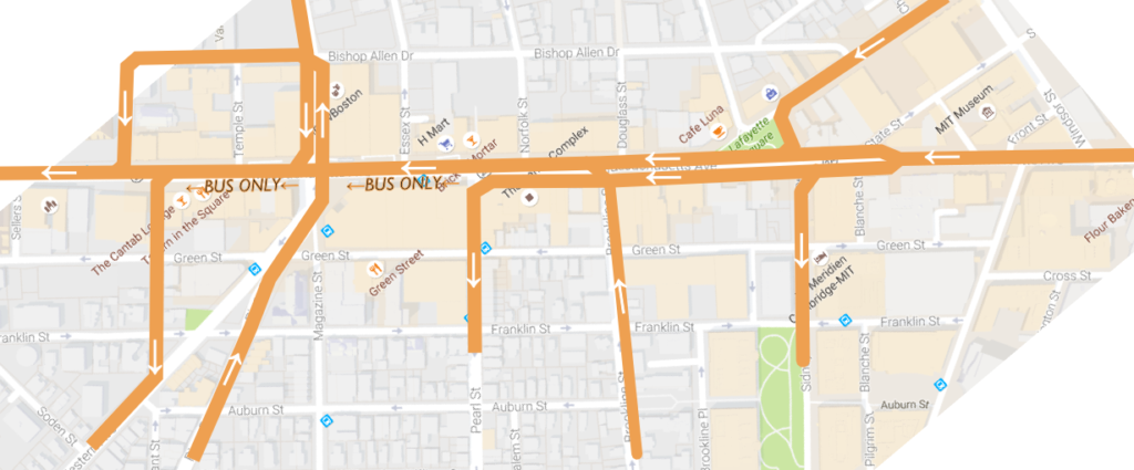 |
| Eastbound traffic patterns for traffic to and from Mass Ave. The main change would be the split for traffic destined to Sidney Street and Pearl Street, where turning traffic would share a separate lane with buses before turning left. |
|
3. A two-way busway would be built on the south side of Central Square from Pleasant to Sidney. Eastbound buses would be exempt from the turn to Green Street and instead proceed directly down Mass Ave. East of Pearl Street, this busway would allow for some general traffic: right turns from Brookline Street to Mass Ave and left turns from Mass Ave to Pearl. The busway would also allow emergency vehicles (including from the nearby firehouse) to bypass gridlock in Central Square, creating BRT elements in one of the most congested areas of the 1 bus route (as opposed to, say, the Silver Line, which has bus lanes in the least congested part of the route). Bus stops would be consolidated between Pearl and Essex for betteraccess to transit. (This 160-foot long section could accommodate four 40-foot buses.) Buses would be able to loop as follows:
- 1 is a through route. CT1 should be eliminated. Short turns could be made via Pleasant-Green-Western.
- 47 would go left from Brookline to the busway. Loop would be made via Pleasant-Green-Western. A single-bus layover would be retained at the end of Magazine Street. This would eliminate the need for passengers to walk a block to transfer.
- 64, when not operating through to Kendall, would loop via University Park, but instead of serving stops on Green Street, it would loop back to the busway. Left turns would be allowed for buses from Mass Ave to Western.
- 70 would loop via University Park as above, making inbound and outbound stops on Mass Ave, eliminating the walk to Green Street and the inadequate boarding facilities there.
- 83 and 91 would use a left-turn lane for buses only on Prospect Street (currently a painted median) to allow access to the busway. An actuated signal there would allow a left turn phase when necessary (approximately once every ten minutes, which would have a negligible effect on other traffic). Buses would then loop and layover in University Park like the 70. This would allow these routes to serve the growing University Park area, which has seen significant development in recent years.
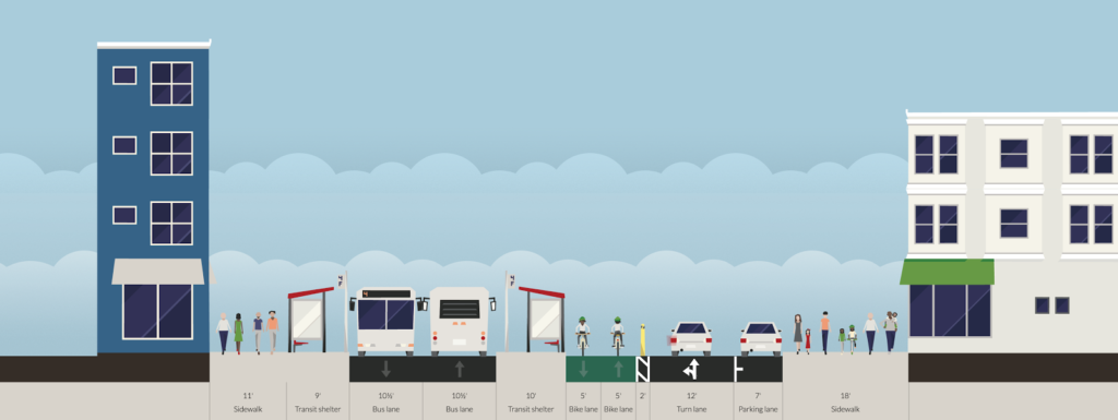 |
| A busway, a cycletrack, a travel lane and even some parking! Emergency vehicles would be able to use the busway, too. |
4. Eastbound bus stops would remain largely where they are on the south side of the street, but any pull-ins and bulb-outs would be removed to allow vehicles to maneuver more freely. (The additinal crossing distance would be mitigated by the bus platform mid-street.) Westbound bus stops would be placed in the center of the roadway; one between Pearl and Essex (approximately 160 feet long) and another east of Sidney Street (60′ long, for the 1 Bus only), where those buses (and Pearl Street turns) would be shunted to the left. These stops would be ten feet wide, significantly wider than the current stops on Green Street. Pedestrians transferring between the Red Line and westbound buses would have to cross just the westbound traffic lanes of Mass Ave, no longer making the trek to and from Green Street. West of Essex Street, the bus lanes would jog to the right to allow clearance between the headhouse and elevator for the main entrance to the Central Square station. The bus platform—which could be raised to allow level boarding akin to the Loop Link in Chicago—would span the distance between the Pearl and Essex crosswalks, allowing access from both ends of the platform. (The bus platform for eastbound buses could also be raised.)
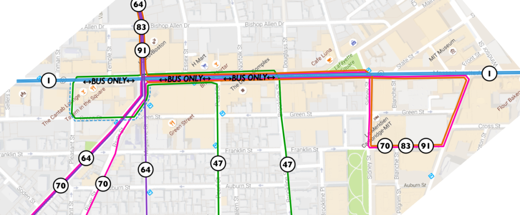 |
| MBTA bus routes shown, including loops for routes terminating in Central. At non-rush hours, the 64 bus would follow the route of the 70. The dashed blue line shows the ability for the 1 bus to short-turn (today known as the CT1). Other buses, such as the MASCO shuttle, could also use the busway. |
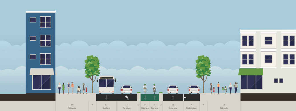 |
| East of Pearl, the busway would allow some general traffic (left-turning cars to Pearl Street). Through traffic would remain on the north side of the street, and the cycle track would have no vehicular crossings between Brookline and Prospect. |
5. In between the westbound bus stop and the westbound traffic and loading zone lane would be a 10- to 12-foot-wide cycletrack, running from Sidney to Inman. Except where adjacent to the firehouse, it would be raised above grade and separated from traffic. At either end, a separate bicycle signal phase would allow cyclists to move from existing bicycle facilities to the center of the roadway. This would eliminate the constant conflicts between cyclists, motorists and buses. Bicycle traffic calming measures would be required in the vicinity of the bus stop at Pearl Street with high pedestrian traffic, but cyclists would otherwise have an unobstructed trip from Sidney to Inman (with traffic lights at Brookline and Prospect, where a bicycle phase might be necessary for right turns). For turns to Prospect and Western, bike boxes would be provided to allow two-stage turns. For turns to minor streets, cyclists could use areas adjacent to crosswalks. Since bike lanes in Central Square are frequently blocked by vehicles, this would wholly eliminate these issues.
 |
| A bus-only facility would dramatically improve facilities for transit passengers, a cycletrack would eliminate car-bike conflicts make biking through Central much safer, and a bus platform would decrease crossing distances for pedestrians. And there would still be ample room for taxis and loading zones on the westbound side of the street. |
Why not side-of-street cycletracks? A few reasons. If it weren’t for the location of the Red Line headhouses, it would probably make more sense to have side bike lanes, but we should assume that the Red Line infrastructure are immovable. Putting the cycletrack in the middle of the street means that you don’t have right-hook issues (although right turns from the cycletrack are trickier). Second, bus stops. Central is one of the busiest bus transfers in the MBTA system without an off-street facility (think Alewife, Harvard, Forest Hills, Ashmont, Sullivan, Kenmore, etc). You’d need large floating bus stops and really need to pull the cyclists back from the street. Third: pedestrian traffic. There are a lot of pedestrians in Central Square. A successful cycletrack would need significant separation from the sidewalks to avoid becoming choked with pedestrians. This is a lot easier to do in the middle of the road than it would be alongside the sidewalks. Finally, the busway creates the need for a buffer between the westbound travel lane and the buses, which is a perfect place for the cyclists. You do have two points of conflict on either end of the cycletrack to transition from the existing lanes (which can be signalized) but otherwise have relatively clear sailing for cyclists devoid of the current maze of turn lanes, parking spaces and taxi stands.
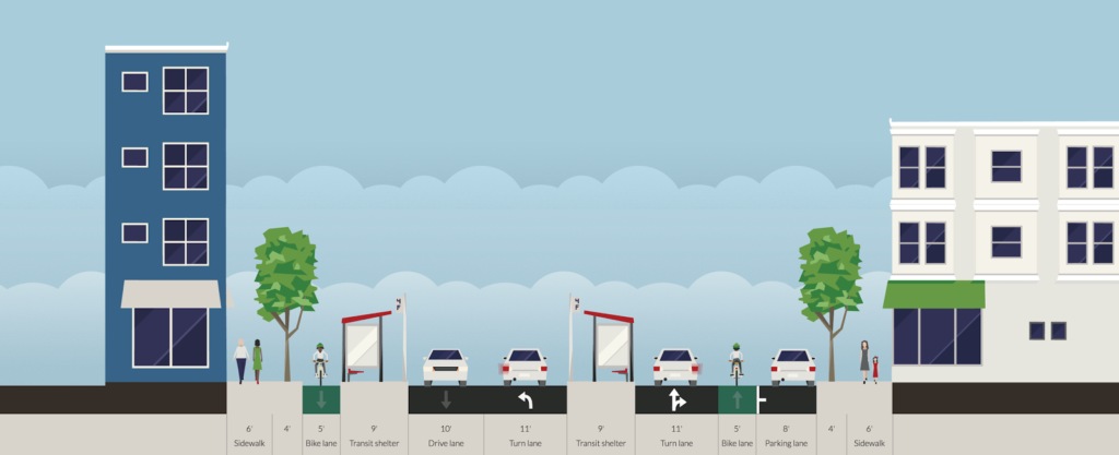 |
| East of Sidney Street, Mass Ave westbound would split, with left-turning traffic to Sidney and Pearl to the left of the bus stop island for the 1 bus (the floating stop on the south side of the street would serve the 1, as well as routes short-turning at University Park). The westbound bike lane could be cycletracked inside parking. Both bike lanes would have a signal phase at Sidney to allow a safe transition from the side of the street to the center-street cycletrack. |
6. The westbound lanes of Mass Ave would be 22 to 24 feet wide, allowing the current travel lane as well as a wide area for a loading zone for area businesses, a taxi stand and other pick-ups and drop-offs near the transit station. These uses would no longer conflict with bicycle traffic. Some street parking could be provided, but it is probably best relegated to side streets nearby or parking lots (there are generally few on-street spots today anyway).
All of this might increase traffic congestion for some drivers. (Horrors!) But it would benefit the large majority of users of Central Square who arrive by transit, walking or biking, or a combination of all of them. Central once had transit stops in the center of Mass Ave (for streetcars), and it’s time that those users were the priority for the heart of Cambridge, not an afterthought.


