It’s Time to Radically Rethink Memorial Drive in Cambridge

Memorial Drive in Cambridge—a pleasure roadway and a park—is actually a death trap. The wide, straight roadway encourages cars to speed, and speed they do, running over a pedestrian several times per year and killing people far too often. The roadway hosts no commercial vehicles, and the eastbound lanes serve only a couple of boating facilities between the BU and Longfellow bridges, yet the roadway—which was designed for low-speed horses and carriages—is built as if it were a highway, and any efforts to improve pedestrian safety have been stonewalled in the name of keeping traffic moving.

Except for a couple of traffic lights and poor-visibility sidewalks, traffic can proceed unimpeded from the BU Bridge to East Cambridge, on a straight, flat, mostly divided highway, where the 35 mph speed limit is honored in the breach. It’s no fun to walk across and only slightly more fun to walk or bike along. Officially, it’s a park, but it doesn’t seem like one.

Memorial Drive is part of the Charles River Basin park and there is a 2002 master plan for the basin. Portions of this plan have been implemented, including the new paths along the Cambridge side of the river, but the roadways have not been touched. (Believe it or not, until the 1990s, parking was allowed on both barrels of Memorial Drive, so there was even more pavement on Mem Drive east and a line of cars along the river.) The plan proposes narrowing the road slightly and moving the eastbound barrel inland from the river, slightly increasing the width of the park along the river. It says that other options were considered, but not advanced further in to the plan. One of these would have eliminated the eastbound roadway entirely, channeling all traffic on to the combined westbound barrel. Apparently removing the roadway would be incongruous with the historic nature of the roadway:

While there is some flexibility in applying
preservation criteria, the historic value of this cultural landscape would
be entirely lost under this alternative.

I call shenanigans. I don’t remember Frederick Law Olmsted planning for two lanes of 40 miles per hour automobile traffic in each direction, and parking. I think the DCR is afraid of reducing the number of lanes on the roadway. Rather than focusing on what the road looks like today, what if the DCR prioritized what would best serve as parkland for the public?

Instead of trying to rebuild the highway-like park (or is it a park-like highway) let’s consider moving traffic to the westbound lanes. Use this roadway for two lanes of traffic, turning lanes at intersections, pedestrian refuges between the lanes to minimize crossing distances and some parking where needed (and charge for it if you can’t figure out how to pay for the roadway changes). At the same and the eastbound lanes can be converted to parkland, increasing green space and allowing us to reclaim the dead space in between the current roadway. It might not match his parkway, but it would create a Cambridge esplanade. I think old Frederick Law would be proud.

There is an 80-foot-wide median between the two barrels of Memorial Drive today, but this is lost parkland, since it is nearly impossible to access and cut off from both MIT and the river, and who really wants to sit in a park in the middle of a highway anyway? If the roadway were consolidated, it the amount of useful parkland would go from 40 feet wide to 145 feet wide. On the MIT side, the portion of the parkland between the road and the sidewalk isn’t even grass, but instead wood chips and mud, since it receives heavy pedestrian use, so the road could actually be pushed north there. This would provide enough room for one lane of traffic in each direction, left turn bays on and off of Memorial Drive where needed, and parking spaces elsewhere. By using part of this space, no trees would be impacted (which would be the case of the roadway were moved south).

But only one lane for cars in each direction? Yes! Memorial Drive in Cambridge carries about 36,000 vehicles per day. While this is high for a single lane in each direction, it is not without precedent, especially for a roadway with few intersections or interruptions. In fact, the DCR has a very similar stretch of roadway with a single lane in each direction which carries the same number of vehicles a few miles west: Nonantum Road, along the river in Brighton and Newton. Most notably, this roadway used to have four lanes but, according to the same master plan, was reduced to two in 2010, yet with turning lanes, traffic throughput has not decreased. The new design allowed room for an expanded bicycle/pedestrian path alongside as well.

These two roadway designs carry the same number of vehicles.

2007:
2018:
The 2002 master plan is dated, but it provides a blueprint for improving Memorial Drive. The DCR and MIT have started to implement some improvements, but these are small steps. It’s time that Cambridge had an esplanade along the river, not a strip of parkland and a wide highway.

Free Parking? Good in Monopoly. Bad on Memorial Drive

Cost to park: $0.

If you want to go to a Massachusetts State Park, you generally have to pay a parking fee. For $5 or $8 or more you have the privilege of parking on DCR-owned land. If you want to go to Kendall Square—where the going rate for parking is $25 to $30 per day—the DCR has a great deal for you! You can park in one of the 130-or-so parking spaces along Memorial Drive (and another 70 along Cambridge Parkway in East Cambridge) for free!

Does this make any sense?

Everywhere else in Cambridge is either metered parking or resident permit parking (and, yes, resident permits should cost more). The only free spaces in town are on DCR roadways: these spaces, and a few more along Memorial Drive up near Mount Auburn Hospital. The DCR is sitting on a bit of a gold mine: installing meters and charging for parking could bring in close to a million dollars per year.

Let’s imagine that the DCR decided to charge market rate for parking in the area: $2 per hour with a maximum of $20 per day. The cost to install a dozen-or-so parking kiosks would probably run in to the range of $100,000. Enforcement would likely pay for itself with parking tickets. The revenue? Assuming an average of $20 per day on weekdays (through casual parking or charging a daily rate) for the 200 spaces would raise $4,000 per day. With 250 work days in a year (give or take) it adds up to one million dollars. (Even if it was charged at a $1 per hour rate commensurate with the too-low rate for meters along Mass Ave and Vassar Streets, it would bring in $500,000 per year.)

There would be benefits for users, too. Right now, MIT has precious little short-term visitor parking on campus other than a lot on the corner of Vassar and Mass Ave (Rates: $8 per hour, $26 daily). By properly pricing spaces on Memorial Drive, it would give the area a source of open short-term parking, not long term car storage where finding a spot during the day is all but impossible. It would also help to reduce the demand for parking along the adjacent portion of Mass Ave, which could be reused as room for transit lanes and protected bicycle facilities.

And the money? It could be earmarked for non-road projects in the area. The DCR often cries poor when it comes to building sufficient bicycle and pedestrian facilities, but they’re all too happy to keep the roads in ship shape for cars. (There are too many examples including: 1. they refused to rebuild Greenough Boulevard until a private organization coughed up nearly half of the $1.2 million cost. 2. They get New Balance to sponsor the snow clearance of the bike paths along the Charles, yet they don’t hold drivers hostage until Ford and GM pony up to plow Storrow Drive.) A million dollars a year could keep the paths clear of snow, and pay for sorely-needed upgrades. They have a master plan for the Charles River basin but haven’t identified a source of funding. Uh, guys …

This is such a no-brainer that it’s almost criminally negligent that the DCR hasn’t been cashing in on parking fees on Memorial Drive for years. This could be implemented tomorrow (although the historical society would probably throw up a frivolous objection) and the money would start coming in immediately. The DCR has done a fine job rebuild the paths between the BU and Longfellow bridges. There are plenty more sections of the bike paths which could be improved.

Let the market decide how many spaces to build

There’s a lot of chatter about a proposed development on an otherwise-unused piece of land in Allston. It’s been mentioned in the Boston Globe, on The Atlantic Cities and elsewhere. It’s not the size of the development, but what it lacks: the property owner plans to build 44 apartments without a single private parking space.

Boston, like most other cities, has minimum parking requirements for new development. This is the case even though much of the older housing stock has no parking, and it still perfectly habitable and in many cases quite desirable. But since the 1950s, adding housing without adding lots of parking has been frowned upon. In order to have even a chance to get the plan through the zoning board, the developer, Sebastian Mariscal, is throwing out all sorts of mitigation efforts. These include public green space, private gardens for each unit, storage units, bike parking (two spots per unit) and storage lockers. But he goes further still: he proposes making each resident sign a lease addendum that, while living in the development, they will not own a car.

It is this rather radical part of the plan that has gotten a lot of attention, and in some cases, praise. I don’t fault Mariscal for proposing it, but he shouldn’t have to. The minimum number of parking spaces a developer builds should be dictated by the market, not by the zoning board of appeals. If a developer wants to build a lower number of parking spaces than would be allowable, they should darn well be able to. Forcing them to build more spaces increases the cost of each unit, which in turn reduces the amount of housing available, which in turn raises the cost for everyone.

Neighbors may whine about the potential for reduced parking availability clogged streets and gridlock, but their complaints should fall on tin ears. There is no guaranteed right to parking. Especially in a neighborhood like Allston, which, as the Atlantic points out, is mostly pavement, there should be ample parking available to those who need it. If the area is developed enough that there is a dearth of parking (and 44 units won’t do this), someone who owns a driveway or parking lot will rent spaces. Then residents can use the marketplace to decide between the cost of a guaranteed, monthly parking spot and the time it takes to search for street parking.

Cities should have a vested interest in making sure that parking is not overbuilt. Too much parking raises the cost of housing, detracts from street life and, as cost for parking falls, disincentivizes the use of alternative modes of transportation. But disallowing projects because they fail to provide parking only serves to drive up the cost of housing, increase congestion and pollution and, in turn, detract from the city’s tax base as less housing is built. In addition, if more parking is built than required, it can lead to half-empty concrete parking hulks which have too much sunk cost to be converted to another use (see: Kendall Square). Plus, Allston has plenty of parking, even though you don’t need a car. The proposed housing is a stone’s throw from a drug store, a major supermarket, half a dozen bus lines and the streetcar. It’s a place that doesn’t need parking. So why force it to be built?

Toronto has allowed a skyscraper—first proposed in 2011—to go forward with 42 stories, 315 units and no parking spaces. The developer said “if we couldn’t sell a unit without providing a parking spot, then we wouldn’t be selling those units. The proof is in the pudding—we sold 270 units without parking in nine days.” And, so far, Toronto has not (yet) devolved in to a gridlock of traffic looking for a parking space.

Lack of parking is a perfect instance in which the free market should take charge. It’s high time that cities stop meddling in developers way and let them build the housing they want to build, whether it has “enough” parking or not.

Site, situation and planning: Target Field

Game three at Target Field, looking east.

I managed to catch one of the games in the first series at Target Field in Minneapolis this week (my Red Sox were in town) and although the Sox lost, it was great to see a new stadium. It was actually the second in a week—I was at Kauffman Stadium in Kansas City last weekend for a Sox game (nice ballpark, in the ‘burbs surrounded by a sea of parking, and I didn’t have time to explore KC)—and it was very interesting to see how the park is sited, and how people are adapting to the new experience, both inside and out.

From a baseball perspective, it’s fun to see how people like the inside. I was born and raised on Fenway, and the Metrodome was, um, atrocious. After a Sox loss there, I was depressed. Watching my team get shellacked on Thursday, having skipped out of work, with the sun beating down and the cool breeze blowing, well, it was nice. There are some cute features (the two baseball players—Minnie and Paul—shaking hands across the river when a home run is hit or the game is won), the usual odd angles of a new ballpark, and no baggie in right field. And the view of the skyline is a great touch. Otherwise, it’s a perfectly good replacement for what was a perfectly poor excuse for a baseball stadium.

But this isn’t a baseball blog.

The geographic term “site and situation” is usually applied to whole cities or settlements, but it can really be used to describe the location of nearly any geographic feature. And with 40,000 people, Target Field (or any baseball stadium) can be described as a small city for three (or, in a Red Sox-Yankees game, four and a half) hours at a time. Basically, the site is physical characteristics of, in this case, the stadium. Situation is how it interfaces with what is around it; how it connects to other buildings, roads and transit.

Of all the arenas cities build to glorify their teams (or their selves), baseball parks generally see the most traffic. A football stadium may seat 70,000, but it only sees 10 games a year. Even with other events, such a stadium is hard-pressed to break a million fans. (There’s a good reason football stadiums are often, and maybe should be, built away from downtowns: their demand for parking does not mesh well with surrounding land uses, and moving that many people in and out can strain all but the best-equipped transit systems.) Indoor arenas, even when the combine basketball and hockey, sell out shy of 20,000, and there are only about 80 games a season. That’s 1.6 million. Add in some other shows, and you can break two million. (The Staples Center in LA, with two basketball tenants, may see more fans, although I can’t imagine Clippers games sell out.)

But baseball parks? They usually seat at least 40,000 (most new parks are around this figure). And they have 81 home dates a year. Throw in a few concerts, and you can bring more than three million fans in each year. From an economic development standpoint, baseball stadia are probably the best generator of people in sheer numbers. Even if they don’t have anything beyond baseball, they still bring in more visitors than any other arena.

Of course, the Metrodome didn’t do much for its surroundings. Much as it was 28 years ago, it is surrounded by, well, mostly by parking lots—a suburban stadium in the middle of a city (or, at least, a tangle of highway ramps). Target Field, for many reasons, may not suffer quite the same fate.

Target Field’s Site

Target field sits on a not-quite square plot of land on the northern fringe of Downtown Minneapolis. The street grid in Downtown is oriented to the Mississippi river, which flows five blocks to the site’s east. South of Hennepin, the grid is shifted slightly, but where the ballpark is located, the streets run almost perfectly 45˚ off of the cardinal directions (i.e. NE-SW and NW-SE). Before the ball park was constructed, there was a ditch between 2nd Avenue N and where 4th Avenue N would run. The southeastern half was taken up with the exit ramps of Interstate 394; the rest was a parking lot until it reaches the railroad tracks. The stadium is built above the former parking lot, with a pavilion extending above the railroad tracks.

The park is oriented due east—that is, the batter is looking straight at the rising sun and the pitcher throws the ball to the west. To fit the field in the confined location, the stadium needed to be oriented in a cardinal direction, and baseball stadiums are best located to the northeast. Baseball games are rarely played at sunrise, and this allows for the smallest chance that the sun will be in a player’s eyes. (Although there are two baseball stadia which are oriented due west—and they sometimes have to suspend play at sundown.) With baseball games starting in the afternoon (with one exception, the 11:05 a.m. start for the Patriots Day game in Boston), some parks face south of east, and some due north, but most face northeast. Here’s a great diagram of all the ballparks. And, in case you were wondering, this orientation is set forth as “desirable” in Major League Baseballs rules (1.04).

There’s another major reason for the orientation of the ballpark, but we’ll explore that in the situation discussion. Other than the fact that the stadium is built on stilts over a highway and a railroad (and, in the future, a bike path), there’s not much else exciting about the ballpark’s site, since it is basically reclaimed land (discussions of sites for cities often go on for much longer, incorporating terrain, water sources, deep harbors, rail corridors and the like). Basically, it’s a rather cramped city block in Minneapolis.

Target Field’s easterly orientation gives is a grand view of the Minneapolis skyline; it should be even better at night.

Target Field’s Situation

The situation of the ballpark—how it interfaces with the rest of the city—is much more interesting. The orientation, which is a site feature, is, perhaps, more importantly, part of the park’s situation. The reason that the park was sited facing east instead of north is the proximity of Minneapolis’s skyline—the highest buildings between Chicago and Seattle—sits to the southeast of the field. A northerly facing diamond would have nothing in view beyond the stadium’s walls. With the east-facing ballpark, several 800-foot-tall buildings loom less than half a mile above the field (and, yes, you can see in from the higher floors of some of them).

In fact, Target Field is significantly closer to the center of Downtown Minneapolis (we’ll define it as the IDS Center) than the Metrodome. As the crow flies, the nearest gate to Target Field is about a quarter mile from Nicollet. The Metrodome is more than twice that distance. There is quite a bit less surface parking around Target Field, too. Minneapolis has a lot of parking downtown, and, for the most part, these spaces are empty nights and weekends—which is precisely when they are needed for baseball. The Metrodome was almost completely surrounded by surface parking, while Target Field has only a few nearby surface lots.

This lack of surface parking is going to have several interesting effects on the parking market. First, the land near the Metrodome will lose much of its value for parking as the parking for the Twins and Vikings will be disaggregated. The Twins drew 2.4 million fans in 2009, many of whom parked in these surface lots. While Vikings fans will need somewhere to park, there are only about 600,000 Vikings fans, one fifth of the pre-2010 total. If the real estate market picks up in Downtown Minneapolis (one of the few under-construction buildings in the city is on a former parking lot near the Dome), these lots—especially the ones a bit further from the Dome—will net less cash from parking revenue, and thus be more likely to be sold for development.

Around Target Field, the parking situation is a bit more developed. Minneapolis has a many car commuters, and, thus, a lot of parking structures (and some surface parking). The Central Business District is strong enough that it is not infiltrated by surface parking, although there is a good deal on the flanks. The city operates three “ramps” (as parking garages are called here), called the ABC Ramps, which surround the field, have direct freeway access, and about 7,000 parking spaces (assuming 2.5 passengers per car, that’s half the stadium). There are, of course, dozens of other garages downtown, and even some surface parking. With the Target Center (home of the basketball Timberwolves—the hockey Wild play in Saint Paul) and several theaters nearby, the events parking market is rather well established, and there may not be a need to claim more land for parking. However, the few surface parking lots nearby will become more valuable as parking, which may hamper redevelopment efforts in the neighborhood, unless the ballpark increases their value as developed land.

The Twins, who originally played at suburban Metropolitan Stadium (now the Mall of America) have decreased nearby surface parking with each move. Their original ballpark was similar to Kauffman or Miller Park in Milwaukee—everyone drives, and many tailgate. Thirty years later, they are now playing in a very urban-feeling environment.

Target Field is also accessible by transit, and these connections are well publicized by the team and city, which hope to limit the volume of traffic around the stadium on game days. Amongst stadia with transit connections, there are actually few which are located as centrally on a transit system as Target Stadium, or at least as it has the potential to be. Stadia require quite a bit of land and, recently, quite a bit of parking, which are not generally compatible with the centers of transit systems. If you look at older ballparks (or former locations)—Fenway, Wrigley, Yankee Stadium, Shibe and Baker Park (in Philadelphia), Comiskey, Ebbets Field, the Polo Grounds—they are generally on transit lines, and far from the nexus of the transit system. Even in cities with new stadiums, like AT&T Park in San Francisco or the ballpark in Washington, D.C., the parks are generally not near main transit stations. In cities with major transit systems, land near major centers are just too damn valuable for a block of grass and stands which are only used 250 hours each year.

In other words, most baseball stadia require a transfer. They’re not near commuter rail terminal stations. They were built where there was cheap, vacant land, which, for older stadia, was usually a few miles out from the middle of the city. In Boston, this means that thousands jam the trolleys to Kenmore (when this coincides with the end of rush hour, for a 7:00 game, the trains are jammed). In New York, the two lines which serve the Stadium—the IRT Jerome Avenue Line (4) and the IND Concourse Line (B, D)—easily reach crush capacity, especially the over-capacity Lexington IRT which is already way beyond capacity (which is why they’re building the Second Avenue Subway), and the L to Addison in Chicago gets pretty full up to Wrigley.

Minneapolis has one rather-well used transit line, which was extended a stop to serve the stadium. The light rail vehicles on the line are rather large, with a crush capacity of more than 200, meaning a two-car train can carry nearly 500 passengers. Right now, the stadium is at the end of the line, meaning that fans can pour in to empty trains, and as long as the end of the game doesn’t conflict with rush hour (any weekday day games begin at noon, likely in the hopes the game will end before the height of the evening rush) and the trains should be able to clear passengers out before the rush. For 7:00 games, baseball fans will be traveling against rush hour, which is desirable. On evenings and weekends, the trains are relatively empty—the line is rather commuter-oriented—so they an be mostly devoted to game traffic. And the line was designed to stop adjacent to the stadium to allow for ease of boarding and alighting. There are no stairs, escalators or treks to the station. Many bus routes also pass nearby or terminate near the stadium.

In addition to the light rail, a new commuter rail service serves Minneapolis and stops below the stadium.  The 500 fans it can carry is small potatoes compared with the light rail (which can carry that many every few minutes) and it won’t even serve every game (it buys trackage rights from a very well-traveled section of one of the BNSF’s main transcontinental routes). However, it has large parking lots in the suburbs and special fares for ballgames, and appeared to be well-used this past week.

The line for the light rail was long, but orderly. Still, the boarding process needs to be streamlined.

There are definitely some kinks to work out. At the Metrodome, 4000 of the average of 30,000 fans came by train. Target Field seats 40,000 and should be sold out most of the season, and parking is harder and more costly; it’s presumable that upwards of 6000 fans will ride the light rail to the stadium. On Thursday, the line after the game was several hundred people long (but very orderly, as opposed to what happens in Boston or New York; it probably also meant that it was slower and that the maximum nuber of people were not filling the cars). MetroTransit had staff on hand, but did not have the vehicular capacity. In Boston, where the main sticking point is line capacity, the MBTA runs full rush-hour service before and after Red Sox games on the Green Line, and usually stores several cars in the Kenmore Loop, allowing them to run several trains outbound, one after the next, to deal with the post-game rush. Here, the line could support three car trains at three minute headways—700 people 20 times an hour—but was not utilized to that level.

MetroTransit needs to take heed. They have stub tracks beyond the station, and should have as many trains stored there as they can. With 300m of double-track, they should be able to have 10 cars—for 2500 people—stored there, although with two-car trains, only 8 cars for 2000 people may be feasible. They should then run these at three-to-five minute headways for the first half hour after the game. Additional cars stored just south of Downtown at the maintenance facility should be sent as quickly as possible, with boarding on both tracks. With the ability to run three-car trains, this would be a capacity of 8400 to 14000 per hour, more than enough to clear out the stadium traffic in 30 minutes after a game.

In the future, Target Field could become one of the most transit-centered ballparks in the country. Plans are moving forward to build the Central Corridor (to Saint Paul, 2014), and long range plans have these two lines, which will terminate at Target Field (thus doubling capacity through downtown), interlining through downtown with the Southwest Corridor (2015) and the Bottineau Transitway (to the northwest). With 7.5 minute headways (the current rush hour headways on the Hiawatha Line), 32 trains, each carrying up to 500 to 700 passengers, could pass Target Field each hour, carrying 16,000 to 22,000 passengers—more than enough capacity for the ballpark, and a capacity rivaling the transit capabilities of Fenway and Wrigley.

With ample parking in place and the possibility of increased transit service, Target Field may do a better job of drawing nearby development than the Metrodome. The Dome is in a no-mans land. It is surrounded by parking on all sides, and by freeways in two directions. Once transit showed up in 2004, its days as a baseball stadium were all but numbered. Target Field helps connect Downtown Minneapolis to the North Loop, a hodgepodge of new lofts, hip restaurants, and still-operational warehouses. It has a bit of parking, but most of this is a good distance from the ballpark, much further than the huge ramps nearby (thus, its value as parking won’t increase dramatically with the new ballpark). There is a rather obtrusive highway offramp between the stadium and the North Loop; however, if it were dismantled, would yield a plethora of developable land with half a mile of the Mississippi River, Downtown, transit and bicycle facilities. It is also slated to have a line of Minneapolis’s proposed streetcar network pass through it. The North Loop could benefit greatly from being linked to downtown by the park, which bridges the former two-block-wide trench between the neighborhood and the downtown with rather wide pedestrian concourses, and be further developed as a transit-oriented, mixed-use neighborhood, where there are currently underutilized light industrial plots or warehouses within a mile of downtown.

Finally, with Minneapolis currently the top bicycling city in the country, I’d be remiss to not mention the stadium’s situation regarding cycling. And walking. As far as walkability, the ballpark is a few blocks from Hennepin and, while not connected to the Skyway system (which are used more in the winter than summer) it is better connected by sidewalks and by the new pavilion built between the ballpark and the Target Center.

Ten minutes before game time (and ten minutes before the sun came out), the bike racks at the field were full, even though it had rained lightly in the morning. Several other similar racks line the stadium walls.

As for cycling, Minneapolis probably has more people who bicycle to baseball games than any other city. The bike racks at the Metrodome, which was actually located near more bike trails than Target Field, were always well used, but they were tucked away on one side of the building, away from most of the trails. The field is surrounded by bike racks (map [pdf]), including racks which line the northwest promenade of the field—built over the railroad tracks—and when I visited this week, they were all packed. Perhaps the Twins need to install some more.

In addition, the Cedar Lake Bike trail, which extends in to downtown from the southwest, is being extended under the ballpark. It will connect the bike trail along the Mississippi River to the stadium, and allow grade-separated bike access to the stadium, avoiding foot and car traffic. With these improvements, the bike facilities near Target Field will be unparalleled in the major leagues. (And, no, when I was living a similar distance from the ballpark in Boston, I never even thought of biking to Fenway.)

With easy transit options (a bus straight from my house; a nice bike ride along the river) and a lovely field I do want to see at night, I’ll be back.

How much parking has Minneapolis nixed …

… and how much will it cost?

When Minneapolis put in to place “winter parking restrictions” this week (as we discussed earlier), how many parking spaces disappeared in to thin air (or in to a snow bank as the case may be)? It’s not hard to get a rough estimate. But first, which neighborhoods will be most affected? Downtown won’t be, since it has almost no street parking and every road is a snow emergency route (only non-emergency routes are subject to the parking ban). Many areas of the city have ample off-street parking and/or ample on-street parking, generally due to low population densities but, in some cases, due to low rates of car ownership, so parking will not be a major issue there. This leaves high-density areas with relatively high levels of car ownership as the main locations where parking is going to be come nightmarish:

  1. The quadrangle between Loring Park and 36th Street S and I-35W and the Lakes
  2. The West Bank of the U of M (north of Franklin, east of Hiawatha)
  3. The area along University Avenue on the East Bank

Obviously, the first area is far and away larger than the others, and it has many more non-snow emergency residential streets which are impacted by the parking rules. Home to many pre-war apartment complexes with little or no off-street parking, it is already the hardest residential area of the city to find parking. And it’s about to get harder. But by how much?

Looking at satellite photos on Google maps, it’s relatively easy to get a rough estimate of the number of parking spaces. For every north-south block (the long block in Minneapolis, with eight blocks to a mile) there are approximately 25 on-street parking spaces on each side of the street. Each east-west block, which are half as long, have about 10 spaces (most have an alley in the middle, and because of the alleys, there are few driveways in this section of the city). So for every non-emergency block, there are 70 parking spaces. 35 are gone for the next two months.

But every block is not a non-snow emergency route. Many main streets in Minneapolis are designated as snow emergency routes: pretty much any street which is a one-way, any street which carries a bus line, and many others (see a map, a large .pdf). This means that between Franklin and 36th, half of the east-west streets are snow emergency routes. And about a third of north-south streets are. But once we take a look at the map, we can pretty easily count the blocks, multiply, and have a good idea at the number of lost street parking spaces.

East-west streets: 120 blocks * 10 spots per block = 1200 parking spaces
North-south streets: 170 blocks * 25 spots per block = 4250 parking spaces
For a total of 5450 parking spaces.

Without a GIS at my fingertips, I can’t quickly calculate the population of these neighborhoods, but the location we are talking about fits in rather well to several Minneapolis neighborhoods: Lowry Hill (3,999), Lowry Hill East (5,912), East Isles (3,340), ECCO (2,545), CARAG (5,907), Lyndale (7,690), Whittier (15,455), Stevens Square/Loring Heights (3,948) and Loring Park (7,501). In these approximately four square miles reside nearly 60,000 people, with a population density of more than 14000—a density similar to Chicago and Boston, which are not easy places to park. It also means that for every ten residents a parking space is disappearing.

How does this number stack up to the total number of spaces in the area? A very rough estimate would be that there are approximately 20,000 on-street parking spaces (which are not time-restricted or metered) in the entire aforementioned area, or one for every three residents. And approximately 5000 will be removed.

This is actually something we can use elementary economics to try to figure out. Once parking reaches a certain level of utilization—once you can’t expect to easily find a convenient space—it becomes a market. Basically, if you need parking, you’ll either pay for an off-street space, or there is a opportunity-cost to finding an on-street space. If you need to find parking every day, it might mean spending five minutes circling the block and then walking five minutes each way to the space—at a time valuation of $12 per hour, that’s a cost of $3 per day, or $75 to $100 per month, which is generally what a parking space will cost in a neighborhood without ample street parking. (But also without exorbitant property values; a parking space costs, per square foot, about as much as living space. In this section of Minneapolis, housing costs around one dollar per square foot per month, so a 100 square foot parking space would cost about $100 per month. In other cities, where housing is more expensive, so is parking.)

Let’s consider that the average utilization of the on-street parking is above 90%—about one free spot, on average, per block. That means that at any given time, there is a “market” for at least 18,000 free parking spaces in this area of Minneapolis. If we assume that this market is in equilibrium (There’s no reason we shouldn’t. People who have cars pay the ~$100 per month it costs to park, whether it is included in their rent, in a spot they pay for separately or in the opportunity of finding street parking. Those without have decided to take the money they save on parking, and other facets of car ownership, and put it towards transit, walking, bicycling and others uses.), there is currently a surplus of 2000 parking spaces.

Now, parking supply is not perfectly inelastic, but it’s close. The only way to increase the supply of parking is for people with existing spaces to rent their spots on Craigslist (a common practice in Boston and San Francisco, but less so in Minneapolis); there are few major parking lots in the area. But if we consider that the market for spaces is rather maxed out, that’s a relatively small market, and there are significant barriers to entry and difficulties in marketing; plus, it’s barely worth the time to rent out a space for a couple of months and a couple hundred bucks. The other way to increase the supply of parking would be to increase the utilization of existing spaces, but even if you were to raise the utilization to 100%, it would only add 2000 spots to the mix. And utilization will never reach 100% as the market is not perfectly dispersed—the opportunity cost of walking a mile each way to a parking space is far higher than the cost of circling the block a few more times.

So parking has a vertical supply curve, or something close to it, as it has, for most intensive purposes, inelastic supply. (The example given for inelastic supply is the supply of land, and that’s basically what parking is.) So, when the supply is shifted downwards, the quantity can not change; only the price can. And as far as demand—in the long run, demand is elastic. If you added 5000 parking spaces, more people would have cars, and if you made the parking changes permanent, people aggravated with parking would sell their cars. But in the space of two months, few people will have the opportunity to make these changes. So demand is elastic in the short run, and inelastic in the long run.

Now, back to our assumptions of 20,000 parking spaces decreasing to 15,000. How much is this going to cost Minneapolis parkers? Well, we first need a couple assumptions. Let’s assume the current cost of a parking space, at 20,000 spaces, is $90 per month. And let’s assume that as parking becomes scarcer, the overall amount paid for parking goes up, by $100,000 for every 1000 spaces lost. To make sense of this second variable, we can convert these numbers in to time costs. $90 a month equals 15 minutes a day, with 10,000 spaces it will be exponentially harder to find a space; instead of spending twice as long block-circling and twice as long walking, the distances may be triple as long (15 minutes block circling, 15 minutes of walking each way). In any case, the numbers give us a chart as follows:

Using this model, the price of parking would be zero at 38,000 spaces, which seems to make sense (double the number of spaces and everyone would likely get one out in front of their front door). At the current supply of 20,000, the average cost of a parking space is $90 per month, which correlates to 15 minutes of “parking time” per day. However, if you move the supply to 15,000 spaces, as has now happened, the cost increases to $153 per month, or 26 minutes per day. This seems to make sense: the average parker will have to spend an extra ten minutes, or so, per day, looking for parking, and walking further from the parking they find.

In other words, the parking ban is, over the next two months, going to cost the average resident of these neighborhoods $120. Or, if they don’t own a car, $0.

We can introduce a similar graph which assumes that there are 10,000 off-street residential parking spaces in the area (with a similar utilization rate, probably a bad assumption but one which keeps the calculations simple):

 
This curve is not as steep, but in it the cost of parking would increase from $93 to $132, or six minutes of “parking time.” This model would have “free parking” at 58,000 spaces, which is greater than the population, and in this neighborhood, at least, probably a tad high.
So, it seems that parking in Uptown is about to get significantly harder, but not impossible. There are a ton of variables to consider—does the marginal value of time increase as you circle the block looking for parking (I’d say it does)? Can we quantify the extra costs of looking for parking (gas, potential for damage from driving on narrow city streets)? There are also long-term policy implications—at what point does a lack of parking drive people to give up their cars? Would it be prudent to slowly increase the cost of parking to create more livable, walkable neighborhoods? Would this model hold up based on the number of cars and people in other cities?
And the big question, of course: will the parking woes in Uptown fit this model? We’ll see.
(I really should quite and study parking policy and economics. It’s very, very interesting.)

What happens when you halve parking?

Not when you have it. When you cut it in half. Minneapolis is not a city where finding a place to park is really a big deal. There are a few residential neighborhoods where you might not get a spot in front of your house—Uptown, Wedge, Whittier, and over by the University of Minnesota—but usually, even there, it’s not a huge deal to find a spot. In winter, there are snow emergencies, and everyone does a little dosey-do moving cars from one side of the street to another; then it’s back to normal.

Except, well, every once in a while. Starting on Thursday, there will be no more parking on the even side of the street. Until April, or whenever the snow melts. Apparently, Minneapolis has the authority to ban parking on one side of the street. Once fire trucks can’t get down the street because it’s too narrow (and they claim if they plowed all the way to the curb the sidewalks would be impassible), the regulations go up. The last time this happened was in 2001—nine years ago—and, well, it’s about to happen again.

So, what happens now? In much of Minneapolis, parking will go on as normal, just on one side of the street. But in the aforementioned perpetually parked-up neighborhoods, parking is going to be drastically decreased. It won’t be halved, exactly—snow emergency routes are exempt, so it’s only residential streets which are affected, and it doesn’t take in to account off-street parking—but in many areas there is going to be a significant decline in the availability of parking.

So, basically, Minneapolis is going to turn in to the parking equivalent of Boston, San Francisco or Chicago, pretty much overnight. It will be interesting to note several things. Will transit ridership go up—will it be worth a trip by bus if you don’t know if you’ll get a parking space when you get back? Will people start posting spaces on Craigslist for rent? Will some folks ditch their cars and make do with car sharing services? You better believe we’ll be watching.

The saga of the Snelling Median

Over several years, a median has been proposed on Snelling Avenue in Saint Paul, to calm traffic and aide pedestrians. A long saga may soon be coming to fruition, although the local city councilmember is holding up the process. In several parts, here is the story.

A. An anecdote
B. Background and history
C. Current conditions
D. Crossing the street
E. The Grand Avenue median
F. Bring the median to Snelling
G. Project status.

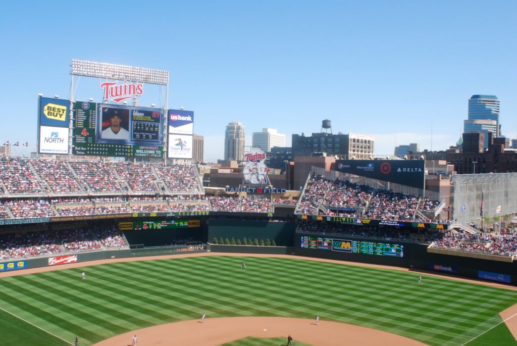
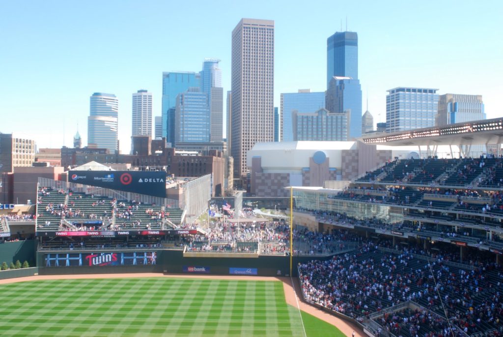
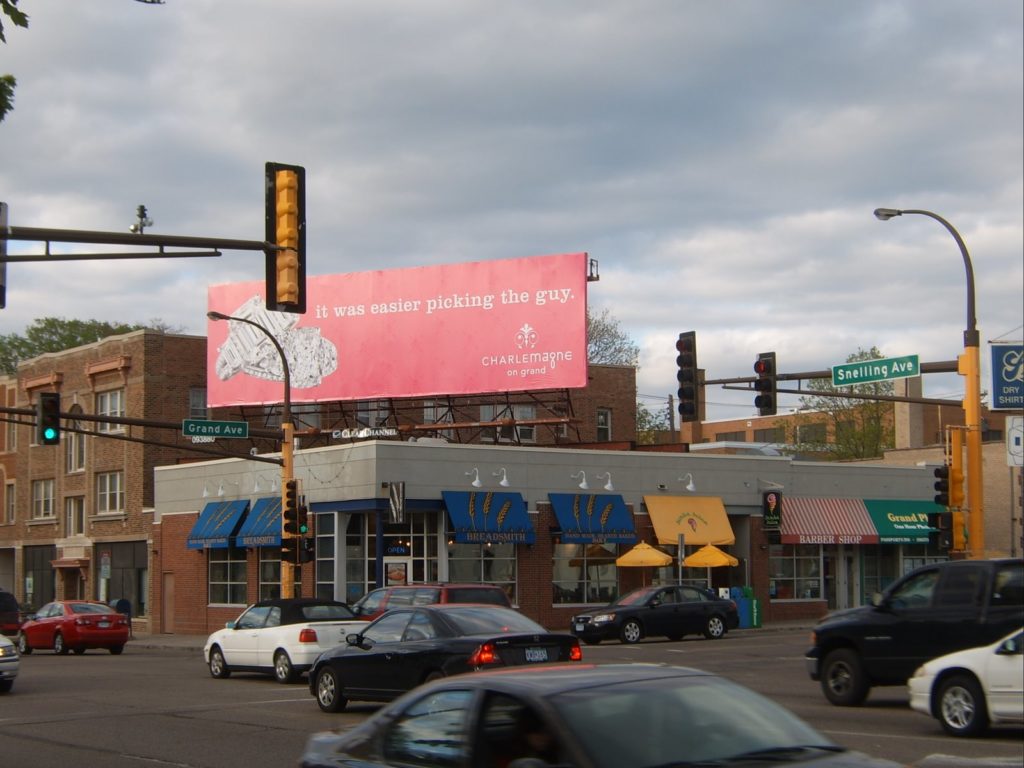
Snelling and Grand, the north end of the proposed median.

A. An anecdote

Last August, I walked from my house two blocks east, planning to attend the opening of a new athletic facility at my alma mater. There is one barrier between my house and the college, a quarter of a mile west: Snelling Avenue.

I walked down to Snelling, and—well—I’ll let my archived chat (cleaned up a bit) from that evening tell the story:

… I got to Snelling, which is four lanes wide and I did my usual walk out in the crosswalk and start waving my arms and pointing at the crosswalk as the idiotic traffic goes by completely neglecting crosswalks (I swear people are worse about stopping at crosswalks here than in Boston).

Finally, a guy in a minivan in the nearest lane stops and I slowly walk out in front of him as he glares at me. Then the car in the next lane slows down, honks at me, and speeds up.

I cross behind it and go on my way, but these cars aren’t done. The guy in the van flips me off, and then goes to bang an U-ey to come back and yell at me (Minnesotans bottle up their anger and let it out when they are driving.)—Except, the other car was in his blind spot, so he turned RIGHT IN TO IT!

No one was hurt, but the drivers were mad at me (even though the accident happened 100 feet down the road from the crosswalk). The woman in the car ran across four lanes of traffic—not in a crosswalk, mind you— and started screaming at me. I told her that it was a crosswalk and I had right of way.

Her response: “But it’s rush hour. You can’t go walking across busy streets at Rush Hour” and then claims that her mother, who was driving, is from Arizona, where the laws are different (they aren’t). The other guy also told me that, sure, maybe there is a law about pedestrians having the right of way, but it’s rush hour—they had conferred and this was their best defense. Obviously it is okay to break the law at certain times of day. (“I’m sorry officer, but I’m allowed to carry around half a kilo of cocaine at night, right?”)

The woman wanted me to stay until the cops came so they could give me a ticket … I said I highly doubted that I’d get a ticket. The cop came, and they rushed up to him. “And a pedestrian—” they stammered, but he cut them off.

“Someone was struck? Where are they.”

“I’m right here, officer, I’m fine,” I said. He sort of told them to go away and then told me that I certainly do have the right of way, rush hour or not.

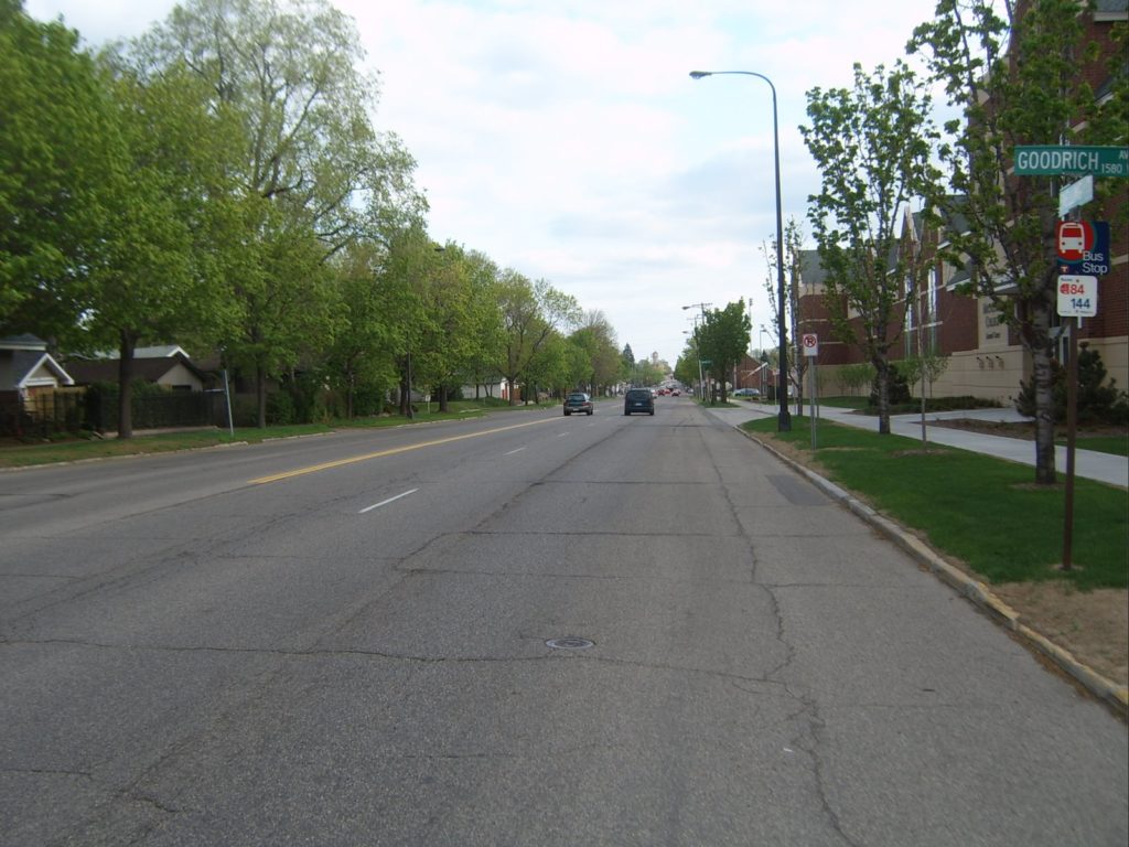
The Goodrich crosswalk where the above incident was triggered. The cars actually collided about 100 feet to the north (right) of this picture.

B. Background and history

Snelling Avenue is a main north-south road in Saint Paul, and lies about three miles west of Downtown and a mile and a half east of the Mississippi, running down the center of a lobe of land around which the river curves. It was undeveloped until the early 1900s when several streetcar lines running from downtown ran west, and one of two “crosstown” lines (the other being on Lake Street in Minneapolis) was built on Snelling. Because of its location and streetcar history, it was built relatively wide—sixty to seventy-five feet—for its entire length from Ford Parkway to Como Avenue, plus parking in most areas. When the streetcar tracks came out, Snelling became a major north-south artery—it is designated as Minnesota State Highway 51—and given four lanes of traffic plus parking.

However, it was never designed to be a freeway and serves neighborhoods which, despite the Twin Cities’ reliance on the automobile, are still rather walkable. Nearly all of the construction along and near Snelling is pre-war, and most of it is still in existence. The avenue itself is lined with a mixture of single- and multi-family housing, a few apartment blocks and commercial development. While a few sections have been given over to surface parking and strip malls, most development is still built flush with the sidewalk, and the majority of the storefronts date from the 1920s or before, often with housing above. The route is still served by a bus line, the 84, which is designated as a “high frequency route” and has 15-minute headways every day but Sunday.

Still, despite the development along the street, the wide, straight nature gives it a resemblance to many of the four lane “streets” which grace the suburbs and have 45 or 50 mph speed limits. And, for a variety of reasons, it receives quite a bit of traffic which ostensibly does not orignate or terminate along the street. The local neighborhoods have, thus far, been successful in keeping Ayd Mill Road (I will, in the future, post about Ayd Mill) from being completed to connect Interstates 35E and 94, so quite a bit of traffic crossing the Mississippi on 35E chooses Snelling to travel north to the Midway and I-94. In addition, since I-35E is not open to trucks north of the river, many big rigs use Snelling to go north. And because these drivers often have navigated wide, fast roads they often don’t heed the 30 mph speed limit on Snelling. Enforcement is relatively good—more often than not a patrol car sits at the end of Goodrich Avenue, midway between Saint Clair and Grand Avenues, looking for speeders (although not drivers failing to yield right-of-way, it seems), and usually does not have to wait long. Still, traffic, especially at rush hour, is rather frenetic.

C. Current conditions

Between Saint Clair and Summit Avenues, Snelling is bounded on the west by Macalester College. From Saint Clair to Grand, about 0.4 miles, there are no lights and no cross-streets—all of the streets end at Snelling. Thus, along this section of road, there is little to keep traffic from moving slowly. The college generally opens away from Snelling on to quads, and while the street is well-landscaped, there are not uses which interact with the street. On the east side of the street, it is generally bounded by houses which face on to the cross-streets. It feels like a road that should have a faster speed limit than 30.

However, it is highly trafficked by pedestrians as well as cars. It carries the aforementioned 84 bus route plus an express route at rush hours to Minneapolis (the 144). And while most Macalester freshmen and sophomores do live in on-campus dorms, most upperclassmen do not. During the school year, there is a steady stream of pedestrian traffic from rental properties in the neighborhood to the east to the college and back, several times a day. None of this is a problem—the college interacts surprisingly well with the neighborhood (there are isolated incidents, and some resentment of student housing causing the decay of some property, but real estate values are quite high in the area). Added together, there are thousands of trips across Snelling every day in addition to the thousands of trips along the street.

D. Crossing the street


The crosswalk south of Lincoln

Herein lies the problem: it’s not easy to cross the street. Often at crosswalks, both marked and unmarked, one lane of traffic will stop for a pedestrian. However, walking in front of a stopped vehicle is nothing short of a death wish: traffic often passes stopped cars oblivious to pedestrians and statute at speed, making it absolutely necessary for pedestrians to check other lanes when crossing. With four lanes of traffic, waiting for traffic to stop in all lanes is often a cumbersome task, leading to irritation of both the crossing party and law-abiding motorists who have to wait for their less-lawful peers.

And then, as illustrated by the anecdote at the top of this post, there are those motorists who believe that they are somehow exempt from the law, and don’t find it necessary to look for or stop for motorists. While no one, to my knowledge, has been seriously injured or killed crossing Snelling, it is a proverbial accident waiting to happen. And a couple of motorists this past summer had some time with their cars in the shop because of their failure to obey the law. Perhaps, during that time, they had to walk as well.

E. The Grand Avenue median

Just west of Snelling, Grand Avenue bisects the Macalester College campus. Originally, Grand terminated at the campus, which ran north to Summit, but was extended west in 1890 to accommodate the streetcars. Grand is one of the major commercial corridors in Saint Paul, and both east and west of the college are blocks of stores. Grand is slightly wider than most of the east-west streetcar streets in Saint Paul (Randolph, Saint Clair, Selby, Minnehaha) and today sports, along most of its length, two lanes of traffic, a turn lane (despite the general absence of driveways along the street) and parking on both sides. Through the college, however, the parking lanes were eliminated and the turn lane became a striped median. Traffic didn’t zoom through campus, with a traffic light at the east end and a commercial corridor to the west, but was still able to make some speed through the campus without parked cars or storefronts.

The Grand Avenue median. Much nicer than yellow striping on asphalt.

The issue was less the traffic and more the fact that this portion of Grand Avenue divides the academic buildings and dining hall at Macalester from most of the housing. Thus, approximately 1000 students daily cross Grand for classes, meals and to go to the library. On any given day are likely more feet than tires on the avenue. And for decades, the students generally crossed the street at three intersecting sidewalks between Snelling and Macalester avenues. The median was first proposed in the fall of 2002, at a time when students periodically painted crosswalks across the street, which would then be blacked out by police. (Despite current signs which state that pedestrians do not have the right of way, the crossings would appear to be “unmarked crosswalks,” extensions of sidewalks across the roadway.)

The spring of 2003 brought the beginning of experimentation, with a chain-link fence erected in order to funnel students to one crossing, but the fence was taken down repeatedly by students (not that I know any of the culprits or anything). Subsequent surveys showed that students felt safer crossing in the temporary medians which were erected. Designs changed over the next few years; parking spaces which had been planned were eliminated, and the communited supported the median as well. It was erected in late 2004 and has beautified the street, created a better environment for pedestrians and not had any major ill effects.

F. Bringing a median to Snelling


View this map larger in a new window
Map of the area of the Snelling median

The median on Grand was not very controversial. The only abutter was the college, the center of the street was already striped as a median, and no businesses were impacted. The college footed most of the construction bill and the street is safer today for all. On Snelling, the median would be quite a bit longer and involve dozen of abutters and several cross streets. Furthermore, since Snelling is a state highway, the Minnesota Department of Transportation is involved. In other words, there is a much greater opportunity for dissent.

The median is being spearheaded by the Macalester High Winds Fund, Macalester’s community liason and real estate management. The Mac-Groveland community has also been heavily involved in the process. The community has generally been in favor, but not completely. The pros are generally rather obvious (calmer traffic, easier crossings, &c.) but the cons are a bit harder to figure, but still somewhat important to examine. According to several articles, they break down to:

• The potential loss of parking, especially near Grand and the new athletic facility
• Increased congestion related to slower traffic
• The elimination of left-turning traffic on to two streets (Sargent, Fairmont, Lincoln is currently one way and on to which turns are not allowed), and the subsequent addition of traffic to some streets (Goodrich and Osceola)
• Loss of access to some businesses, notably Lincoln Commons between Lincoln and Grand
• Narrower areas for bikers
• No pull-offs for buses

There are other concerns, but these are the most well-founded—the others are raised by citizens going on about the spoiled brats who dare to cross Snelling or residents who refer to Snelling as a highway (which it, historically, is not).

First, parking. Parking is a very frequent planning concern and probably one of the most unheralded (since it is not at all “sexy”), even in neighborhoods such as Mac-Groveland where parking is ample and generally free. Along Snelling, there are three distinct parking issues. The first is near Saint Clair. Here, some street parking would disappear, but its impact would be minimal. The stores along Snelling north of Saint Clair have parking behind, and on the west side the street borders the Macalester stadium, which is rarely a driver of major traffic. During events which do create traffic, the street parking fills rather quickly and then spills on to neighboring streets, but, again, this does not occur frequently.

Between Sargent and Lincoln, parking is rarely an issue. On the west side of the street, it is bordered by college buildings which do not drive huge amounts of traffic or, if they do, provide ample parking. The on-street spaces which might be eliminated are already minimized by bus stops and loading zones, so at most a few cars would spill on to the east-west streets, which, except during events at the athletic facility, have ample parking. The new athletic facility lots provide more parking than the ones which were replaced, even though it serves the same sized community. Except during events, it is rarely full. The church across the street has a large parking lot which is also underutilized.

The main concern is north of Lincoln. Here, street parking is rather heavily used for local businesses, especially at the end of rush hour. While businesses do provide their own parking (Lincoln Commons is a very small strip-mall) it is sometimes not adequate in the evening. However, the number of street spots available is minimal. North of Lincoln Commons is a bus stop and turn lane, and parking is prohibited. South of it, there are several driveways which preclude parking. Five spots, at most, would be eliminated which directly serve these businesses, and the lack of these spaces may ease congestion entering and exiting the lot.

This segues well in to the next issue: the elimination of left turns in to Lincoln Commons. Lincoln Commons is a four-store (a Kinkos-Fedex, a coffee shop, a hair salon and a fish store) urban-strip mall development. Unlike some parts of Snelling (notably the Cheapo Discs north of Summit, which has a parking lot far larger than necessitated) it is not set back far from the street and the parking is minimal and well-landscaped. Lincoln Commons is on the west side of the avenue, and while Lincoln Avenue, at the south end of the block, is one-way towards Snelling, Lincoln can be entered and exited to the southbound side of Snelling. There is a minimal turn lane from these lanes, which allows traffic to access the complex without tying up Snelling while waiting for the northbound lanes to clear. However, the rigmarole to access the complex seems quite dangerous—sitting in the middle of a busy street with cars passing by on both sides in opposite directions. In fact, it does not meet current safety protocols and would likely be eliminated by the Department of Transportation in upcoming years. It is also not particularly pedestrian-friendly, with traffic turning from thirty or forty feet and often gunning across the sidewalk in an attempt to clear small breaks in traffic.

The left turn “lane” in to Lincoln Commons.

The proposed median would cut off the southbound lanes of Snelling from Lincoln Commons, meaning that it could only be accessed and enterd from the northbound lanes. The concern amongst the businesses is that this will necessitate a longer procedure for southbound customers. Instead of a left in to the parking lot and a left out, they’ll be forced to make a U-turn in to the northbound lanes, a right turn in to the lot, a right out of it, and another U-turn at Grand, or a combination of turns to return to Snelling southbound. These will add time, but they will also require much less risky maneuvers, namely nixing the double mid-block left turns across the Northbound lanes of Snelling. It will help pedestrians as well, as cars will only come from one direction, and won’t have to worry about opposing traffic and pedestrians. It is not a perfect situation—it will probably have a minor effect on these businesses (especially the fish store, which is often visited by commuters for a short time to pick up dinner during evening rush hour)—but also not one which will effect the businesses to the extent that they will see a major negative impact in sales.

In fact, in the long term, it may help. If the neighborhood is more walkable—that is, if Snelling is no longer perceived as a barrier—they will expand their market for customers who do not drive. In fact, if the procedure for parking involves four moves (U-turn, right turn, right turn, U-turn) instead of two, it may entice some local residents to walk or bike, rather than driving. Consider, for instance, two potential markets. The first lives several minutes drive from Lincoln Commons, or pass the complex as part of a longer commute. They are coming to the stores there for a specific service they can not find closer to home, and driving is likely their only means of transportation. For these customers, the median may add one minute to a fifteen minute trip, an insignificant change. They’ll still come, and they’ll still drive.

The other market is made up of nearby residents, who may live only two or three minutes’ drive away, comparable to a walk of five or ten minutes. Most notably, I am thinking of residents who live west of Macalester. For these customers, adding a minute to their drive time would be an increase of 20-25%, making it significantly longer. However, their walking time would remain the same, and may even be shorter, and certainly more pleasant. For this customer base, the complex would be further in terms of driving time, but perhaps closer overall. And pedestrians do not require parking spaces.

There is also the concern that eliminating left turns on to and off of some streets will result in an increase in traffic on others. This is not a major issue because these streets only serve the immediate neighborhoods—all through traffic follows Grand or Saint Clair which lack stop signs. Traffic on these streets is quite minimal, with no more than a few dozen cars each hour. Doubling the traffic on any street would not be noticeable—they’d still be quiet, residential streets. In addition, with some turns blocked off, traffic would be more likely to utilize the north-south streets to access Grand and Saint Clair, and subsequently Snelling. Traffic patterns will change, and traffic may become more concentrated, but the number of cars involved are low enough that it will be a nonissue.

The Snelling “raceway.” Note the lack of any parking lane markings, making the street seem even wider than it is.

The next issue, congestion related to slower traffic is, in my opinion, a very minor concern. The main issue with more congestion is for those who consider Snelling to be a trunk highway. It is not. It is a city street, and for a variety of reasons, has a lot of traffic. Still, it is not congested. Traffic counts on the street are approximately 25,000 per day, which is not particularly high for a four-lane road. It is rare for traffic to have to sit at lights for more than one light cycle, and between intersections, traffic moves too quickly if anything. If anything, traffic calming would ease congestion. Instead of jackrabbit starts and braking for red lights from 40 mph to zero, it would allow for smoother traffic flow. The amount of congestion on such a street is not dictated by the speed of the traffic, but by traffic lights and turning vehicles. Reducing turns would do far more to ease congestion than reducing speed would to create it.

The median will mainly change conditions for motorists and pedestrians, but will also effect cyclists and transit riders. There is some concern that the narrowing of the street from five lanes (or even seven, if the parking lanes are included) to four will create a hardship for bikers, who will no longer have a wide, and often empty, parking lane in which to seek refuge. There are two reasons why the new design may actually benefit cyclists. The first is that it will better define the uses of the street, on which there is currently no delineation be the travel lanes and parking lanes. While bike lanes are not in the current design, it is possible they could be demarcated at a later date. The second is that biking on Snelling is currently rather horrid. If the avenue becomes more like Lexington Parkway, the north-south street a mile east, it will be superior to the current conditions.

Finally, the buses which ply Snelling four (or more) times per hour will no longer have stops in which to pull off at minor cross streets. This, too, is a minor issue. First of all, most bus ridership is concentrated at Grand and Saint Clair, where there are bus shelters and benches, as opposed to signposts. So buses usually stop for only a few seconds. Secondly, buses waste quite a bit of time pulling off the travel lane to pick up passengers and then having to attempt to merge back in, where drivers only sometimes yield right of way. And since Snelling will still have multiple lanes in each direction, traffic will be able to pass buses if they need to stop for longer periods of time.

G. Project status

The High Winds Fund at Macalester has been instrumental in securing funds for the Snelling median, which has received the approval of the neighborhood council as well. In addition to state funding, an appropriation of $475,000 was received from Congress, since it was federal legislation which made Snelling the de facto route for truck which might otherwise use I-35E. However, to received the state funds, and probably the federal funding, the project must start by June 30.

The ducks are all in line, except for one: The local councilmember, Pat Harris, has long been opposed to the project. The Lincoln Commons landlord has been unhappy about the perceived lack of business (which, as discussed, may not even be the case) and wanted the median to start south of his complex—negating the effect of the median where the plurality of accidents have occurred, and cutting off the possibility of state money. It will come down to a few days and community participation as to whether the median will come to fruition—or get caught up in local politics. If it does, it will be to the detriment of thousands of pedestrians in a supposedly walkable neighborhood.

Finally, like it or not, this is a shovel-ready stimulus project. Assuming we can agree that on its merits it is at least palatable, it will bring in jobs to the community. Can we afford not to do something like that?