When streets were streets

About a week ago, Infrastructurist posted about the various materials used for sidewalks. The consensus is that concrete is cheap and functional if not very environmentally friendly (both in its construction and its low permeability). Of course, in Paris, the streets are cobbled, which is beautiful, if a bit jarring to drivers and cyclists (although perhaps better than potholed asphalt).
Now, in America, except in a few instances (historic districts, or places where rich people gather, or both), streets are pavement. In some cases, concrete. Pavement is good when it’s good, but when it’s bad, it’s real bad. In other words, asphalt seems to have a wide range of conditions: new asphalt is silky smooth, but it doesn’t last in good shape. For a while it’s tolerable, until there’s a year with a lot of freeze-thaw cycles and gaps, gashes, frost heaves and, yes, potholes take over.
And that’s where we are in the Twin Cities. We’ve had an about-normal winter, but it’s been marked by a decent amount of warmer and colder temperatures. And snow. And plows. Minneapolis had enough snow accumulated that they had to ban parking on one side of narrow streets to allow traffic to flow, and all over there are huge gaping holes in the streets. And that’s meant we get to see what lies beneath.
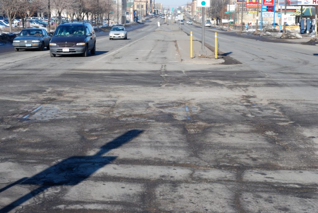
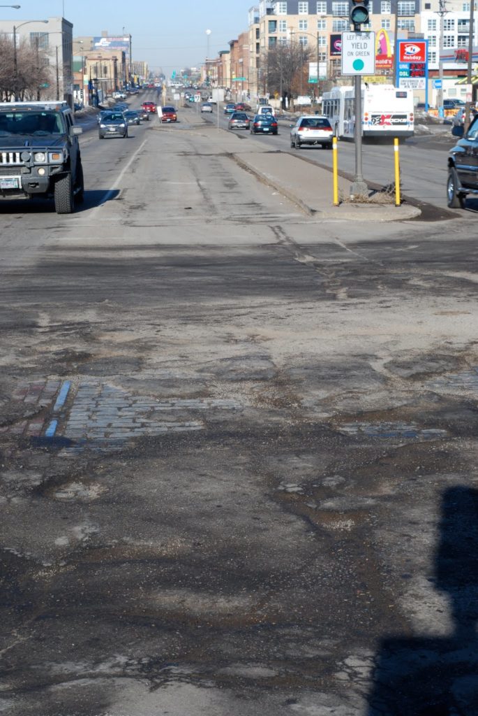
Here’s the middle of the intersection of University Avenue and Vandalia Street in Saint Paul. University was once the main thoroughfare between Saint Paul and Minneapolis, and while most traffic now takes the paralleling I-94, it is home to buses and will, in a few years, be home to the Central Corridor Light Rail. Of course, University had a streetcar line, which was very well patronized (the buses still run at 10-plus minute headways, with limited service at rush hours) until it was closed in favor of buses in the early 1950s. 
But 55 years later, the streetcar tracks, at least, are making a (re)appearance. The Google Street View from a couple years ago shows solid pavement at the corner of Vandalia and University. However, Vandalia is the route to the interstate for many trucks serving the nearby industrial area, as well as going to a large BNSF multi-modal facility, and the corner sees a lot of heavy traffic. So with the current winter, the pavement has been torn up pretty well.
It’s actually not bad to drive on—the holes are wide enough that they aren’t all that deep (the sides generally slope) but so much pavement is gone that you can see the streetcar tracks as well as the pavement. And it’s really quite interesting. First of all, for such a wide road, the streetcar tracks really take up a small amount of room. The image above shows that the tracks are contained in a lane-and-a-half of a turn lane and median (no comment on how ugly the University streetscape is), and there are two lanes of traffic and a wide parking lane on either side.
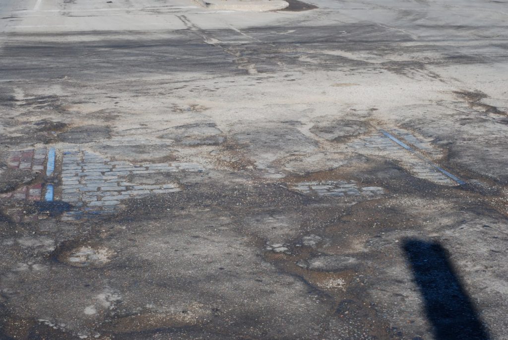
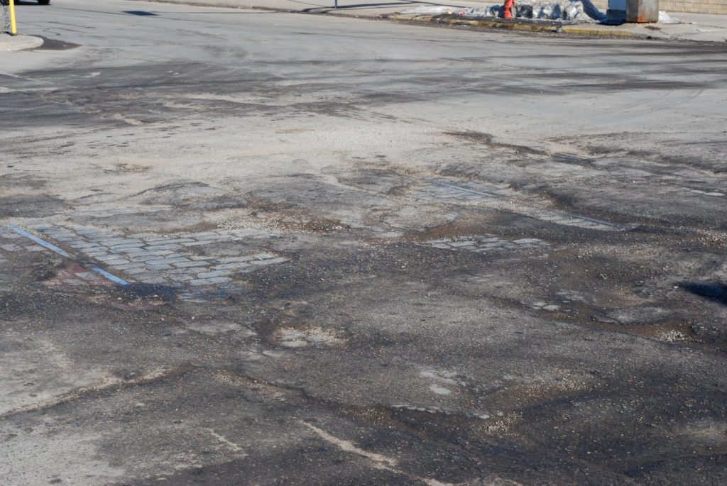
But second, it gives us a really good idea of what streets used to look like. Here’s a closer-up look at the exposed section. The rail on the left is the southern rail of the eastbound track, the rail visible to the right is the southern rail of the westbound track. So, between the tracks were (are) gray cobblestones, and on the outside red brick. There isn’t much color film from the time, but it seems that University, with red and gray stone and silver, steel rails would be almost elegant (some trees would be nice as well). Now, with gray, gray and more gray, it’s quite drab.
Apparently bricks and cobbles don’t hold up well to heavy truck traffic, although this section seems to be doing just fine. Apparently bricks and cobbles were used along streetcar routes because they could be more easily picked up and laid down when track work was necessary. Of course, there’s a possibly apocryphal tale that Melbourne, Australia’s trams were saved when, in the ’50s, the tracks were set in concrete, so that ripping them up would be prohibitive (in the US they were mostly just paved over). The union’s intransigence there—they required two-man operation on buses, and streetcars had conductors until the 1990s, when their removal caused a crippling strike (long story short: government says “one person tram operation”, union says “no” and runs trams without collecting fares, government plans to cut power to the system, union drives trams on to streets in city center, where they sit for a month)—was probably more to blame.
When Lake Street was rebuilt in Minneapolis in 2005, the street below was in similar shape—shoddy asphalt over a firm streetcar base. Since it was not just repaved, it was dug up completely, and Twin Citians flocked to scavenge bricks from below. University, which is wider and longer than Lake Street, should be a field day for anyone who wants a new, free patio or walk—it will be fully rebuilt for the light rail line (yes, they’ve studied it, and they can’t just reuse the tracks already there).
But, why not build streets out of these materials again? The upside to pavement is that, for a while, you have a really nice road. But in the long run? You have ruts, dips and potholes. Another layer of pavement is a panacea; cracks almost always form where there were cracks before (it’s easy to find old streetcar tracks—they’re wherever there are parallel cracks running down the road). Bricks and cobbles are attractive and permeable. Water filters through, which is better for the environment. As long as there’s no heavy truck or bus traffic, they’re fine. If something goes wrong, it’s easy to make small repairs which actually last (as opposed to patches which tear out during the next thaw). And for cyclists, constant cobbles are almost better than old pavement with huge potholes and ruts, even if you have a good bunny hop.
I’m not saying it’s the way to go for every street, but in certain cases—especially if there are streetcars involved, red bricks and granite pavers may be the way to go. And in many cases, they may be lurking just below the surface already.

Tracing transportation epochs

I was in Rochester, New York this weekend for my sister’s college graduation and finally got to see a bit of the city. (My previous trips there were a crash on a road trip to Chicago that had started off with a three hour delay twenty minutes outside Boston from an accident and a trip in 2006 which was mainly involved with skiing north of Syracuse; Rochester is a bleak place in early December anyway.) From a urban planning point of view, Rochester has some interesting sights, such as the at grade crossing of the Erie Canal and Genesee and the high falls in town. I also liked the fact that I flew from Rochester, once the leading flour milling city in the country, to Minneapolis, which succeeded it as the leading flour milling city in the country.

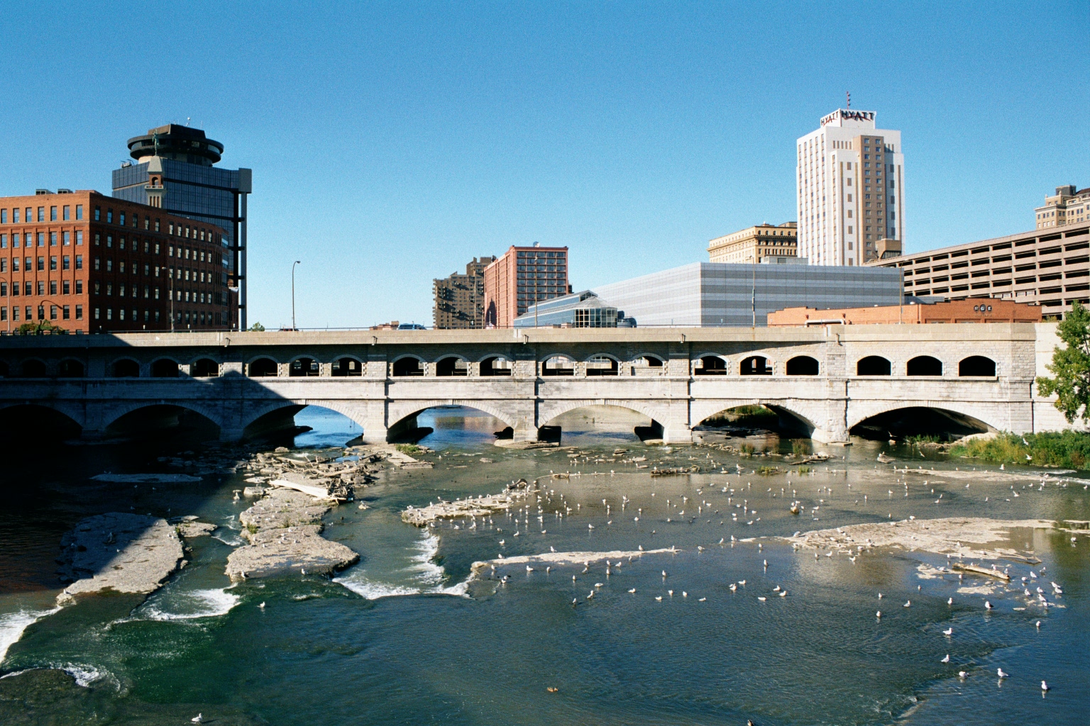
But the most interesting bit I saw was the old Rochester Subway. One of very few subways to be abandoned, the Rochester line ran similar to Boston’s Green Line, with surface lines feeding in to a subway. However, only a bit was actually underground; most of it was built on the old bed of the Erie Canal, which actually crossed over the Genesee in downtown Rochester. When the canal was relocated south of town, it was converted in to a grade-separated streetcar line, what we might today call light rail. Downtown it was covered by Broad Street, including across the Broad Street Bridge. Usage of the system peaked by World War II, but fell with suburbanization, and by 1956 the subway was abandoned. Most of it then became the right of way for Interstate 490 in to town.

The Broad Street Bridge in Rochester, with the lower level, previously the canal and subway, now abandoned. (“Rochester NY Broad Street Bridge 2002” by Andreas F. Borchert – Self-photographed. Licensed under CC-BY-SA-3.0-de via Wikimedia Commons.)

There’s a lot of good information about the subway at RocWiki and there’s a good reference Google Map of the subway, too. Also of note are the USGS topographic maps from 1920 of the city, particularly the southeast and southwest portions of the sheet, which show the pre-Subway configuration, with the canal bypass of the city under construction.

As a geographer, amateur planner and a bit of a history buff, I like how one single section—by Court Street and South Avenue, between the library and the river. From 1822 to 1926, the bridge there served as the Erie Canal. From probably the late 1800s to the mid 1900s, the the station for the Lehigh Valley Railroad was operational (it still stands). The main player in town, the New York Central, had a station to the north. From 1926 to 1956, the site was served by the Rochester Subway, and from the mid-1960s to the present it is next to Interstate 490. To the west is, from what I know, the only canal to be converted to an electric railroad to then become a highway, with no major gaps or other uses in between. Thus, the site is represented by four of the five main travel modes of the country’s history: canal, rail, electric rail and automobile. It’s missing just an airport, and I doubt that will ever be built there!

A professor called John Borchert came up with several periods—or transportation epochs—of the development of transportation in the United States. They generally begin with the beginning of prevalence of a certain technology. These epochs, and various transportation milestones in Rochester, can be compared below: