
I was in Rochester, New York this weekend for my sister’s college graduation and finally got to see a bit of the city. (My previous trips there were a crash on a road trip to Chicago that had started off with a three hour delay twenty minutes outside Boston from an accident and a trip in 2006 which was mainly involved with skiing north of Syracuse; Rochester is a bleak place in early December anyway.) From a urban planning point of view, Rochester has some interesting sights, such as the at grade crossing of the Erie Canal and Genesee and the high falls in town. I also liked the fact that I flew from Rochester, once the leading flour milling city in the country, to Minneapolis, which succeeded it as the leading flour milling city in the country.
But the most interesting bit I saw was the old Rochester Subway. One of very few subways to be abandoned, the Rochester line ran similar to Boston’s Green Line, with surface lines feeding in to a subway. However, only a bit was actually underground; most of it was built on the old bed of the Erie Canal, which actually crossed over the Genesee in downtown Rochester. When the canal was relocated south of town, it was converted in to a grade-separated streetcar line, what we might today call light rail. Downtown it was covered by Broad Street, including across the Broad Street Bridge. Usage of the system peaked by World War II, but fell with suburbanization, and by 1956 the subway was abandoned. Most of it then became the right of way for Interstate 490 in to town.
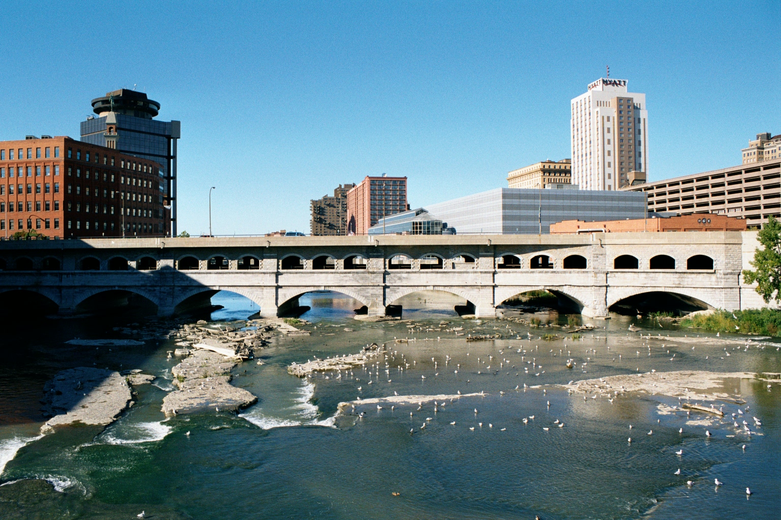
The Broad Street Bridge in Rochester, with the lower level, previously the canal and subway, now abandoned. (“Rochester NY Broad Street Bridge 2002” by Andreas F. Borchert – Self-photographed. Licensed under CC-BY-SA-3.0-de via Wikimedia Commons.)
There’s a lot of good information about the subway at RocWiki and there’s a good reference Google Map of the subway, too. Also of note are the USGS topographic maps from 1920 of the city, particularly the southeast and southwest portions of the sheet, which show the pre-Subway configuration, with the canal bypass of the city under construction.
As a geographer, amateur planner and a bit of a history buff, I like how one single section—by Court Street and South Avenue, between the library and the river. From 1822 to 1926, the bridge there served as the Erie Canal. From probably the late 1800s to the mid 1900s, the the station for the Lehigh Valley Railroad was operational (it still stands). The main player in town, the New York Central, had a station to the north. From 1926 to 1956, the site was served by the Rochester Subway, and from the mid-1960s to the present it is next to Interstate 490. To the west is, from what I know, the only canal to be converted to an electric railroad to then become a highway, with no major gaps or other uses in between. Thus, the site is represented by four of the five main travel modes of the country’s history: canal, rail, electric rail and automobile. It’s missing just an airport, and I doubt that will ever be built there!
A professor called John Borchert came up with several periods—or transportation epochs—of the development of transportation in the United States. They generally begin with the beginning of prevalence of a certain technology. These epochs, and various transportation milestones in Rochester, can be compared below:
