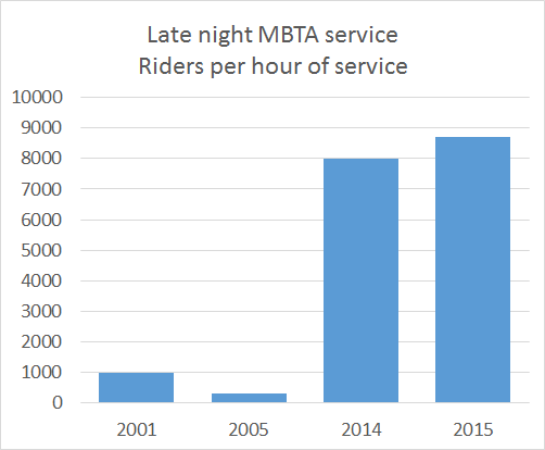
Surprising no one, the T cut late night service. Why? Because it cost money to operate (like any transit, but still). Because it wasn’t as efficient as rush hour passengers. While we don’t have all of the T’s data, we have some, so let’s look at it, shall we?
Monthly Archives: February 2016
Penciling out cost savings from a working D Street
Last week, I was quoted in the Globe (*) about the travesty that is the D Street light. The city has said they’ve fixed it, but they haven’t, because oh noes, cars might have to wait! So buses still wait at a 100-second-long traffic light for a green signal. Apparently they tried transit priority and it didn’t work (which is a pitiful excuse; it’s proven technology) and gave up. So we’re back to square one.
Now, there’s a lot of discussion about the T’s huge deficits and the need for fare hikes, but this sort of low hanging fruit is apparently anathema. I’ve calculated it out before, but here is a quick sketch of how much money could be saved in operational costs by having a working transit signal preemption at D Street. One caveat is that at rush hour there might actually be enough bus traffic that signals might not be able to let every bus through at speed: there are 30 buses per direction per hour, so one bus per minute, and the cross traffic needs at least, say, 20 seconds for a pedestrian signal. But given that the current average delay, with deceleration and acceleration, is one minute, even 20 seconds is a heck of a lot better.
Let’s say that the average bus experiences a 45 second delay (this is conservative, especially since schedule padding is required based on the longest time possible to wait, more than three minutes per round trip, or nearly a quarter of a Silver Line Waterfront round trip). For the Silver Line Waterfront shuttle from Silver Line Way to South Station, this accounts for 10% of the total run time, for the SL2 it’s 7% and for the SL1 4%. How many trips are affected? Based on recent schedules:
SL1: 128 trips weekdays, 99 Saturdays, 126 Sundays.
SL2: 142 trips weekdays, 75 Saturdays, 70 Sundays.
SLW: 67 trips weekdays.
Total: 337 trips weekdays, 174 trips Saturdays, 196 trips Sundays. Or 2055 trips per week. And these are one-way trips, so actually 4110 trips per week (this will go up once Silver Line Gateway service begins running). Assuming that each of those trips loses 45 seconds, we’re talking about 3082.5 minutes of operating time per week wasted sitting at the D Street light, or 51.375 hours per week. 52 weeks in a year gives you 2671.5 hours of savings, and at $163 per hour (the cost in 2013 to run a T bus) the cost savings amount to $435,455 per year. It’s probably higher by now.
Let me repeat that: by fixing D Street, the T could operate the exact same amount of service on the Silver Line, but cut costs by nearly half a million dollars. The argument that it would just be built in to schedule padding is spurious, since a more predictable light would save considerably more time, and the run times are short enough that the same amount of service could be operated with fewer vehicles, or the same vehicles could run more frequently. (For instance, if the Silver Line Waterfront service time went from 15 minutes to 13.5, a bus could make 9 round trips in two hours instead of 8.)
If the FMCB is serious about cutting costs, they should be banging down the doors at BTD for this sort of common sense solution to save money. There’s no need to cut service; in fact this would increase service quality. Yet everyone is content to pass the buck, and years later, service never improves.
(* Kind of funny story, but Nicole reached me at the Birkie Expo in Hayward Wisconsin, and I spent ten minutes going on a rant about how dumb everyone at the T and BTD is and basically said “yeah, all of this is on the record.” Because it’s all true. And if you think this blog is excitable about transit, I may get just as excited about ski marathons.)
Suburban car sharing at Commuter Rail park-and-ride lots
Suburban park-and-ride lots are a fact of life. While rail stations near housing result in better land use and higher ridership (Windsor Gardens in Norwood, for example, has 600 riders per day with no parking. Of course, driving downtown from Windsor Gardens is a 1 to 2 hour endeavor at rush hour, on the train it’s 35 minutes.), there are some areas where sprawling populations are too dispersed for walkable stations and park-and-rides make some sense. (And, no, I’m not referring to somewhere like Ashland, Westborough or Kingston, where 1990s-era stations were built away from downtowns but next to big parking lots; despite this these stations have ridership no higher than Windsor Gardens.)
Take Littleton, for example. Its old train station is little more than a crossroads, not even the center of town, so the park-and-ride nearer routes 2 and 495 makes sense (the town itself is quite dispersed, a combination of sprawl and conservation land). The same could be said of South Acton, where the always-full parking lot combines with a small density node, although a walking-based station at West Acton would help to relieve some of the parking capacity issues at South Acton. Littleton’s parking is also at capacity, and will likely continue to increase when new schedules come in to effect this spring with 30-minute travel times to Porter Square, speeds unattainable by car without traffic, let alone on Route 2 at rush hour.
Littleton’s observed catchment extends to several nearby towns, and grassy areas adjacent to the lot are frequently used by motorists to park when the lot is full. Expansion is possible but not cheap: the MBTA-owned parcel is on a slope and construction costs would exceed the $5000 to $10000 per space typical of construction on level ground. But there is a need for more parking: the Fitchburg corridor serves a dispersed population with poor highway access to Downtown Boston, and providing parking allows many more people to use the train rather than drive downtown.
What makes Littleton somewhat different from other park-and-rides is the presence of several large nearby corporate campuses, most notably Cisco three miles to the south and IBM three miles to the north. Each campus houses more than 1000 employees, and each has abysmal non-driving access. (IBM is served by the end of the LRTA Route 15, which takes only 45 minutes to get to Lowell’s train station.) For all intents and purposes, access to either of these campuses requires a car.
Until the double track was completed to Littleton and the station there rebuilt, there were no reasonable reverse-peak transit options to get past South Acton, a longer drive from either of these campuses. But with the new schedules—and the recent promise of an even earlier train to Fitchburg—there are now hourly-or-better reverse-peak trains to Littleton, allowing city dwellers to get to Littleton’s train station without driving (even against peak traffic, getting to and from Littleton at rush hour is no picnic). Of course, this station is still miles from major employers, hence the proverbial last mile issue.
There are some possible solutions. Bicycles are allowed on reverse-commute trains, and the roads in Littleton and Boxborough are relatively bikeable (cyclists can use a closer back entrance to Cisco closed to vehicular traffic to keep cars from cutting through local neighborhoods). But cycling isn’t for everyone, especially given the narrow area roads and heavy rush hour traffic. Uber operates in the area, but the density of cars is relatively low (meaning potentially long wait times) and fares high: $7 to $10 from the train station to employer, as much as the train ticket from Boston. Corporate shuttles are another option: RedHat and Juniper run a shuttle from Alewife to their Westford campuses and the new CrossTown Connect TMA is exploring shuttle services from Littleton. But shuttles are expensive; a single route can cost $50,000 to $100,000 annually.
If only there was a parking lot full of cars sitting unused all day …
Imagine the following:
Jack lives in Boxborough and works in Boston. He leaves home at 7:30 to catch the 7:45 express train at Littleton. He arrives at the parking lot and parks in a reserved parking space at the Littleton station and takes the train to work. In the evening, he takes the 5:35 express from North Station which arrives at 6:25, gets in his car and drives home.
In the meantime, Jill, who lives in Cambridge, gets on the train at Porter at 7:53 and arrives in Littleton at 8:38. She then gets in Jack’s car—parked in that reserved space nearest to the platform—and drives 10 minutes to IBM, where she works. In the evening, she returns the car to the same spot in the station and gets on the 5:15 train back to Boston, and the car is awaiting Jack’s return.
What incentive would Jack have for letting Jill borrow his car like this? Cars aren’t cheap, gas isn’t free, and most people won’t lend their car to a stranger. But Jack can be incentivized to lend Jill his car. Littleton’s parking availability is 2%, meaning that Jack isn’t guaranteed a space, especially taking this later express train. And the cost to park is $4 per day, or $70 per month, meaning that the annual cost for Jack to park is $840. In this scenario, we can offer Jack free parking with a guaranteed space; money is nice, but the extra 10 minutes at home every morning may be worth a lot more to Jack than $840. This idea might work at park-and-rides which aren’t at capacity, but the guaranteed space is a kicker.
But with free parking, isn’t the T just subsidizing Jack and Jill’s arrangement? Not at all. If there wasn’t a vehicle available for Jill’s last-mile commute, she wouldn’t take the train, which costs her nearly $3700 per year. So the net increase in revenue for the T is nearly $3000 annually.
Jack is still letting a stranger borrow is car. But maybe Jill isn’t such a stranger after all. There is some precedent: car sharing company called RelayRides (now Turo) pioneered peer-to-peer car sharing in the past decade, although they have now relaunched based on longer rentals. FlightCar has a very similar model to the plan proposed here, except for longer periods of time at airports. Instead of paying $20 to $30 per day to park at the airport, your parking is free—and you get paid if someone rents your car. More to the point, Jill is an employee of a major corporation, not a random person getting off of a train. Jack would be assured that she wouldn’t go off joyriding during the day, but rather drive the car a few miles to the company parking lot (where, perhaps, Jill would have preferred parking). And because employee schedules are very set, it would be the same person driving Jack’s car every day, not whoever swiped their Zipcard.
Once money changes hands, car sharing does get more complicated, although this model could be used in the longer term to help further reimburse Jack for fuel and maintenance expenses beyond the parking savings. Insurance would also be an issue, and an umbrella policy would have to be set up, perhaps through a TMA or a larger organization overseeing this program if it were to grow. A safety net would need to be provided, but one already exists: both Jack and Jill could participate in an employer-based guaranteed ride home program in case Jack needed to come home early and there was no way for Jill to get to work otherwise, or if Jack called in sick and there was no car for Jill to drive to work, or if Jill stayed late at the office and Jack needed to fetch his car.
Technologically, the car could be set up in a number of ways. The easiest (and cheapest) would be to give Jill a spare key; this would work for a test project. A Zipcar-esque swipe-in system could be set up, but these cost hundreds of dollars to install, and might not be appropriate for a pilot. Installing GPS doesn’t come free, but Jack might have more peace of mind with tracking of Jill’s movements (when she’s driving his car) and even text alerts to let him know when she had returned the car to the station, so he would be assured of having a car waiting for him to get home at the end of the day.
There’s also the question of vacation schedules: if Jack goes on holiday, there is no car waiting for Jill. At those times, back-up cars could be used. Jill would have separate keys for back-up cars of other participants in the program. When Jack wasn’t working, she could use some of those cars, and those participants would also benefit from the guaranteed and free parking. (This would be even easier to set up with car sharing technology.) And since Jack and Jill would have each other’s emails, they would know vacation schedules ahead of time, so there wouldn’t be surprises. (It’s only an issue when Jack is on vacation anyway; when Jill is out of the office, Jack’s car just sits in Littleton all day.) If there were five outbound participants in this program, perhaps two back-up cars would be necessary.
In addition to cost, this program would be superior to shuttles because of the flexibility involved. Because Jack’s commute downtown from Littleton is nearly an hour each way and Jill’s commute from Littleton is only a few minutes, she has the ability to take an earlier or later train and still get in a full work day without affecting Jack’s commute. With a shuttle, it would require multiple trips at a higher cost. With shared cars, Jill could shift her schedule by an hour with no ill effect for Jack. Shuttles also lose efficiency when they have to make multiple stops at multiple employers, which are often not in a straight line (violating Jarrett Walker’s “be on the way” principle) while car sharing would allow commuters to more easily disperse to suburban job sites.
Assuming Jill switches from driving the whole way to driving and transit, and assuming 225 work days per year, she would save more than 10,000 vehicle miles traveled annually. Jack might save VMT as well; on days when the lot is full, he’d have a guaranteed parking space and wouldn’t have to drive in to work—or to a nearer park-and-ride like Alewife—when the lot was full. In addition, this sort of scheme, at a larger scale, may actually increase the utilization of the parking lot. It’s not too far-fetched to imagine one inbound commuter parking at 7:00 and a reverse-commuter leaving at 7:45 and a second inbound commuter parking at 8:30 and a second reverse-peak commuter using that car at 8:45, which doubles the efficiency of a single parking space.
With enough utilization, a shuttle would make sense: if 15 cars were being driven between Littleton and Cisco, for example, a 14-person van meeting each train would be feasible. But shuttles often suffer from a chicken-and-egg conundrum: without riders in place, there’s little incentive to invest $100,000 annually in a shuttle. Car sharing could provide a bridge to shuttle service for larger employers, and for smaller ones, provide a link for employees living in the city to work at suburban campuses.
Like park-and-rides, suburban office parks are a feature of the suburban and exurban landscape—like it or —although they are quickly losing allure (GE moving from suburban Connecticut to downtown-ish Boston is one such example). But they won’t disappear overnight. By leveraging the existing Commuter Rail network, park-and-ride infrastructure and the idle cars occupying the lots, we may be able to provide better options for commuters trying to get to these offices without trying to retrofit transit on to a landscape where it doesn’t work well. This wouldn’t be a panacea for the poor design of dispersed office parks. But it would provide transit accessibility for minimal cost.
Fairmount lessons from … Staten Island?
Set apart from the New York Subway system is the Staten Island Railway (SIR), which runs the length of Staten Island and connects to the Staten Island Ferry for the trip to Manhattan and beyond. While it operates somewhat-modified New York City subway equipment, it is part of the national railroad system, so the cars have meet FRA regulations and until 1997, fares were collected by on-board conductors. Since then, fare collection has been simplified and staffing reduced to a single operator.
Conductors make some sense on commuter rail systems: they have to raise and lower stair traps at stations with different platform levels and collect fares where trains pass through different zones. (Could zones be simplified on most US Commuter railroads? Yes, but that’s the topic of a different post.) But the SIR runs subway-style equipment at all-high-level platforms with one fare, so all the conductor was there for was to to collect the same fare from everyone. And unlike most subway lines in New York, nearly everyone on the train was traveling to one station: the Saint George terminal and the connection to Manhattan. So when the MTA came out with the Metrocard, the conductors disappeared, turnstiles and MetroCard machines appeared at Saint George, and passengers paid a fare upon entry and exit (similar to the MBTA’s exit fares when higher fares were charged for the Quincy extension). A few years later, after many passengers made the short walk to Tompkinsville, fare gates were added there, too.
But there was no need to put fare gates on the rest of the system. Most people use the line to access the ferry and get to Manhattan, and the cost of installing fare mechanisms at the other 20 stations on the line was far too high for the number of passengers using them, so travel between intermediate stops is free.
There aren’t many other systems that could use such a procedure: most either have multiple fare zones or multiple terminal stations (shared with other services, making faregates less feasible), or both, making it much harder to implement these sorts of efficiencies. But in Boston, the Fairmount Line meets both these criteria, and would be a good candidate for this sort of fare system.
Now, before we get too far in to the weeds, let’s posit that the Fairmount Line at some point gets more frequent service (the SIR runs every 15 minutes at rush hour and 30 minutes midday to match the ferry schedule, but the Fairmount Line should really run every 10 to 15 minutes), preferably from DMUs (or as this page has argued, EMUs). In the short term, four coaches and a diesel engine could be used for more frequent service, although doors might need to be automated. It wouldn’t have the look and feel of a subway, but it could be operated as much as possible as one (frequent service, all door boarding).
Most Commuter Rail trains operate with three crew members: an engineer and two conductors; at rush hours, there may be additional conductors. Their direct responsibilities don’t really extend beyond collecting fares and operating doors. These are important functions, especially for trains with 1000 passengers which run on lines which don’t have full-length high platforms and with multiple fare zones. But the Fairmount Line has neither. Tripling the current headways to 15 minutes at rush hours and 20 minutes at other times could be attained with the current level of staffing (you need more trains, but not more staff, and the marginal cost of running a train is half staffing costs; likely lower with EMUs). That doesn’t quite get you to subway levels of service, but it’s a lot better than the hourly service today. There may be FRA issues with removing personnel from the trains, but the FRA does grant waivers, and the SIR operates under FRA rules with one person train operation. Other than a low-level platform at Readville, union issues and entrenched bureaucracy, what would keep the T from doing the same with the Fairmount Line?
Most everyone would pay their fare. The easternmost platform at South Station—tracks 12 and 13—could be set aside for Fairmount passengers with Charlie Card gates at the end of the platform, and a couple of ticket machines on the inside for passengers arriving without fare. Charlie Cards could (probably) be set up to allow a free transfer to and from the Red Line. If South Station is expanded, a Fairmount Terminal could be built with a direct transfer to the Red Line within fare control through the station’s basement, although it’s unlikely that the never-used underground loop could be repurposed for rail service, it could serve as a pedestrian passageway.
Since the first station on the line at Newmarket is a relatively-unpleasant, two-mile walk from South Station, there would be no Tompkinsville issue. According to 2012 counts, more than 99.5% of trips on the Fairmount Line were to and from South Station. With more stations open since then and possible free rides, a few more people might use the train for inter-Dorchester travel. Even then, the cost of collecting fares would still far exceed the fares collected, and any such travelers would not be able to access the rest of the system without paying an additional fare.
Unfortunately, the Fairmount Line is an ugly stepchild of the already rather ugly MBTA Commuter Rail system. Without increased service, it seems destined to serve few riders; while it provides relatively fast travel it is so infrequent riders are usually better off taking a bus and transferring to the subway. But with a relatively small investment in linking the electrification already present at both ends of the route, and with some common-sense fare payment initiatives aping the SIR, it could act much more like subway line straight in to the core of the city, with easy connections to other subway lines and the airport. And in a disadvantaged community with poor transit, this would go a long way towards better job access and prospects for workers there.
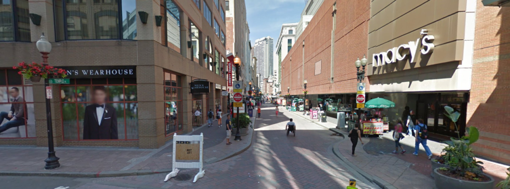
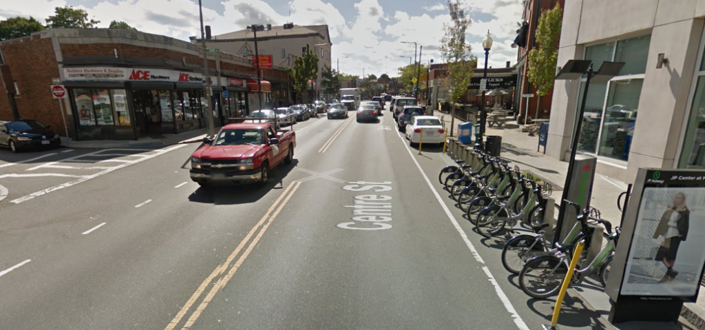
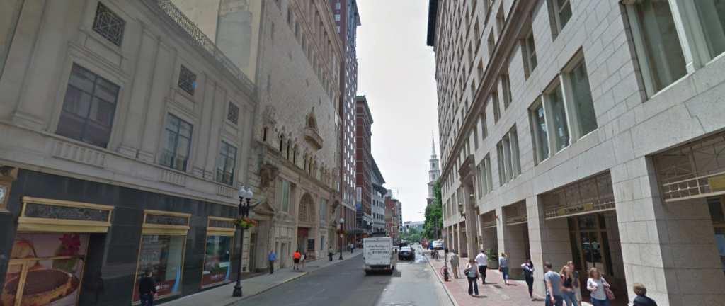
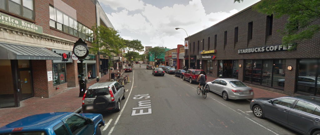
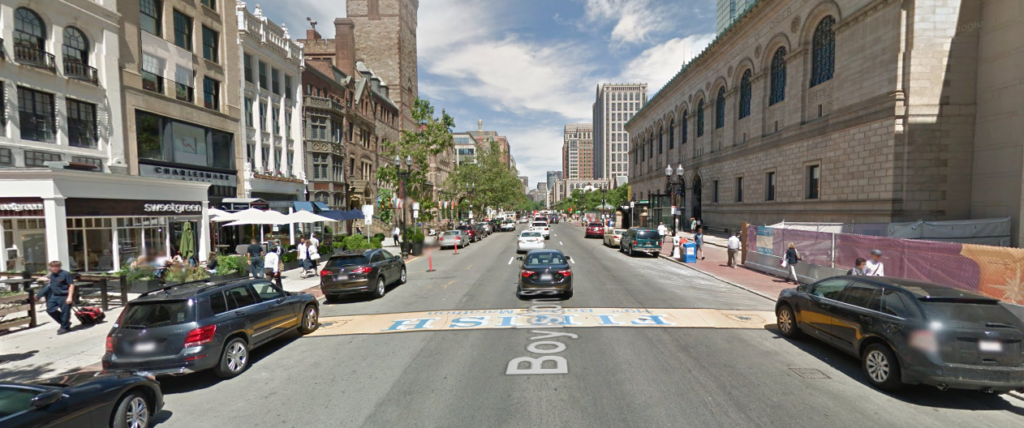
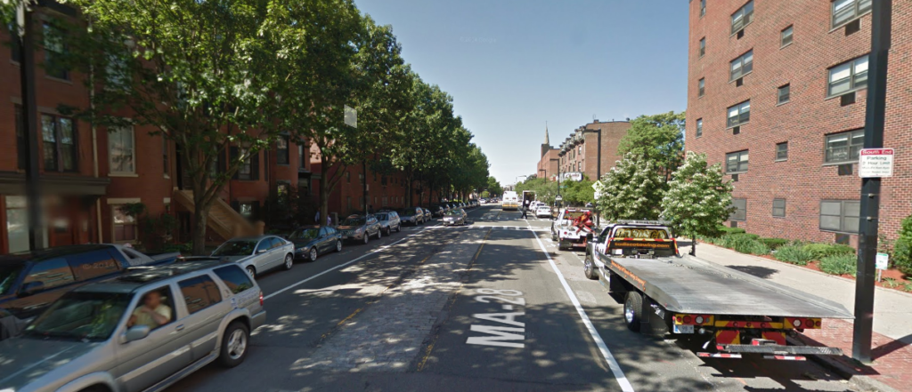
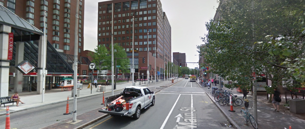
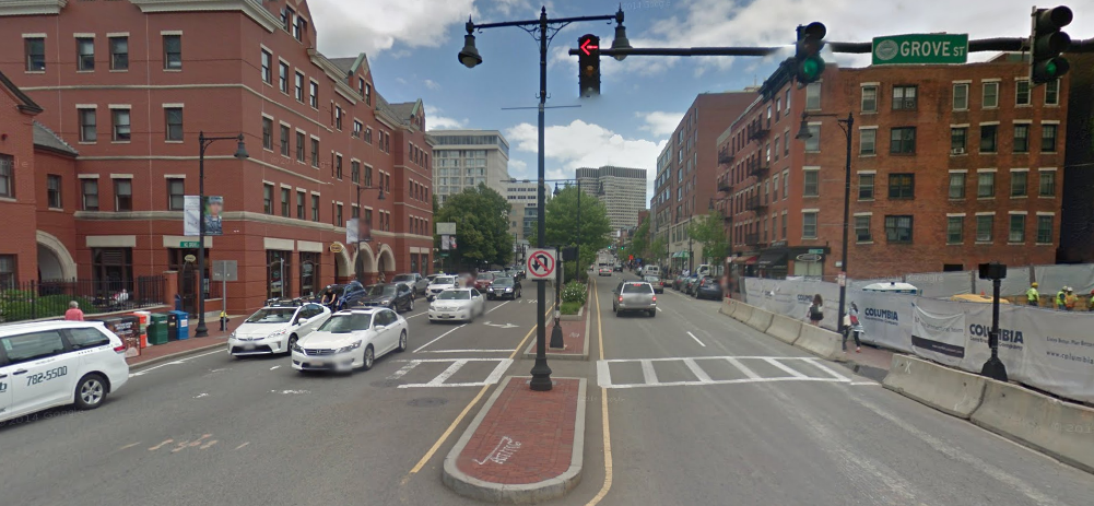
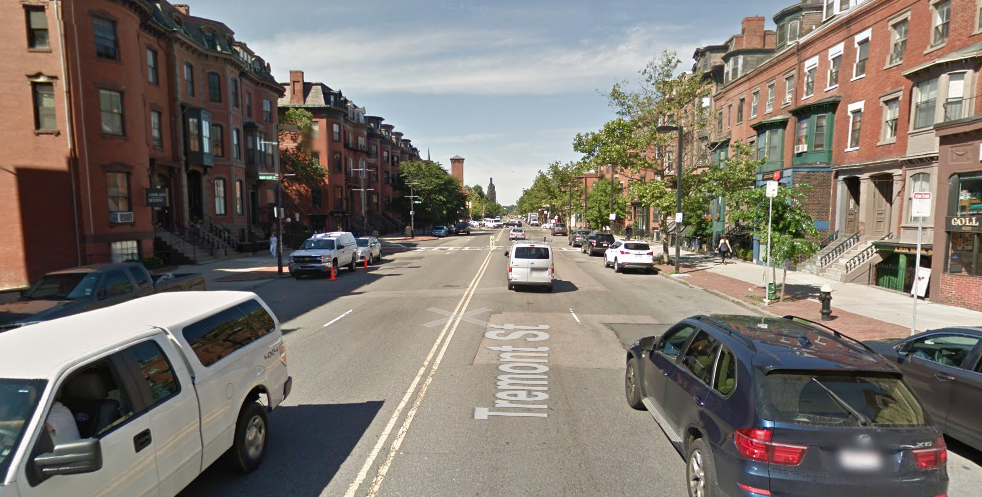
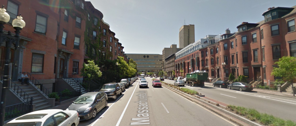
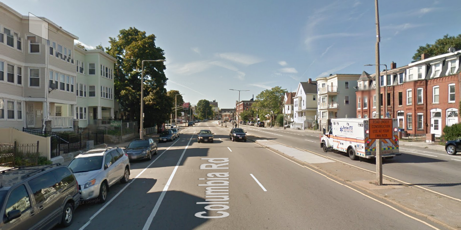
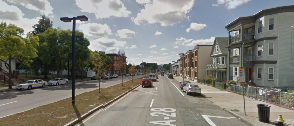
Visualizing Street Widths in the Boston area
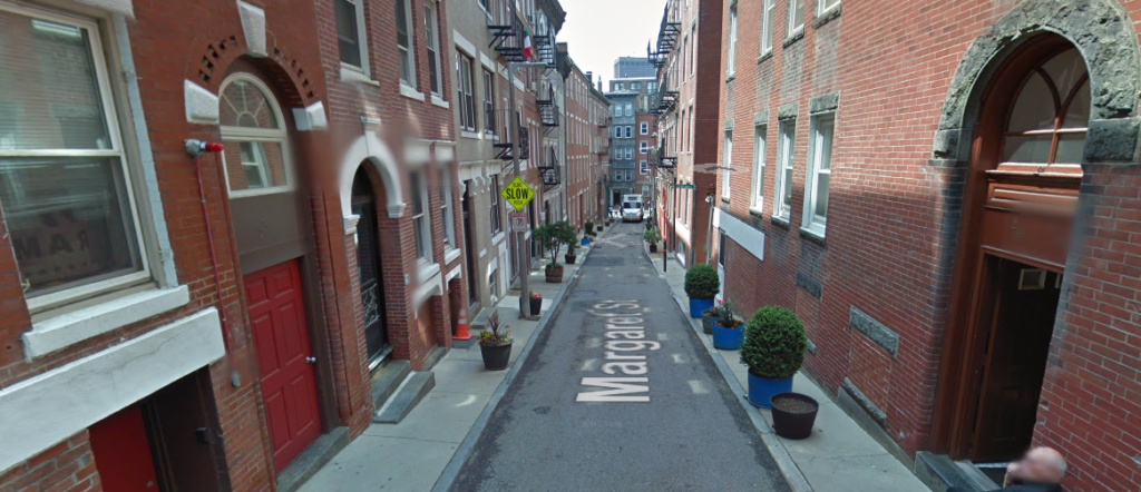
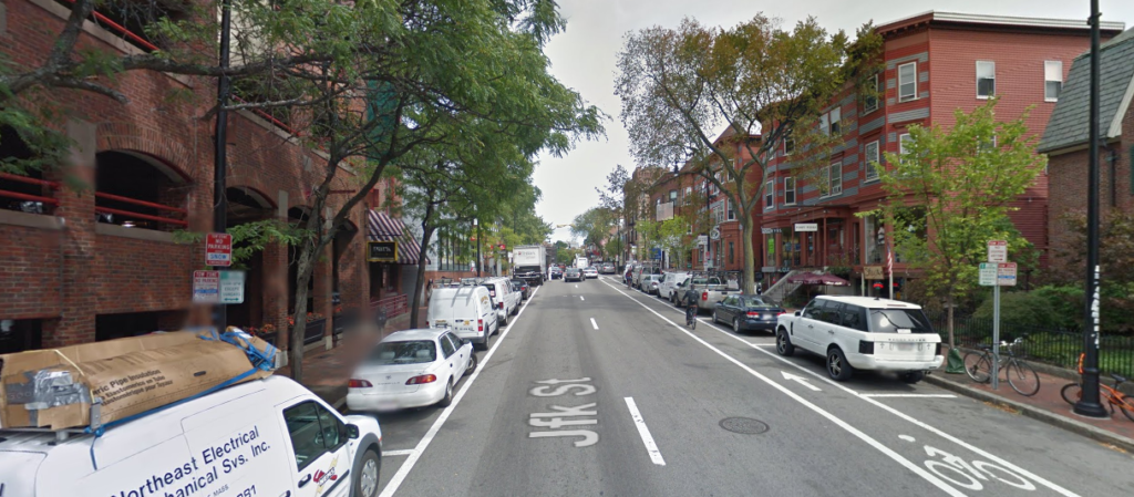
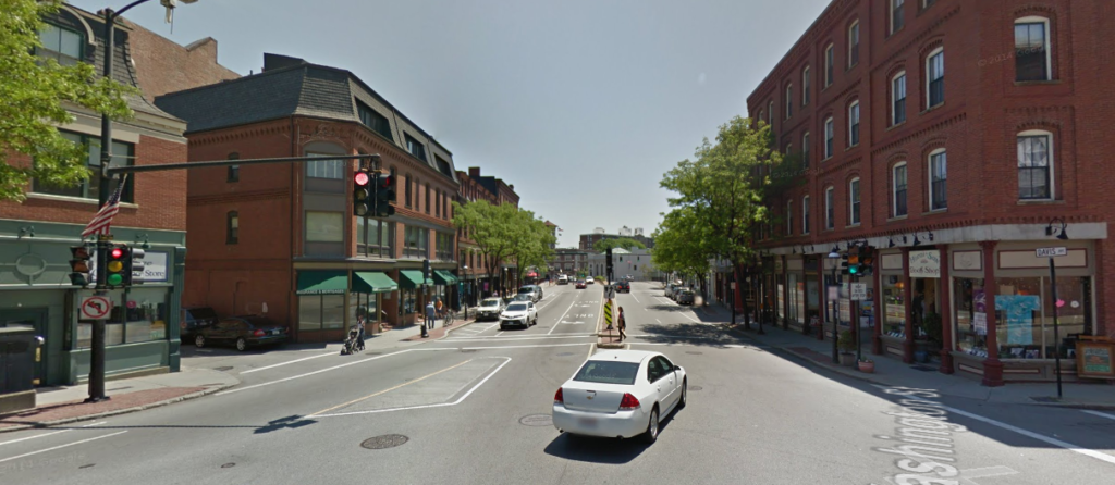
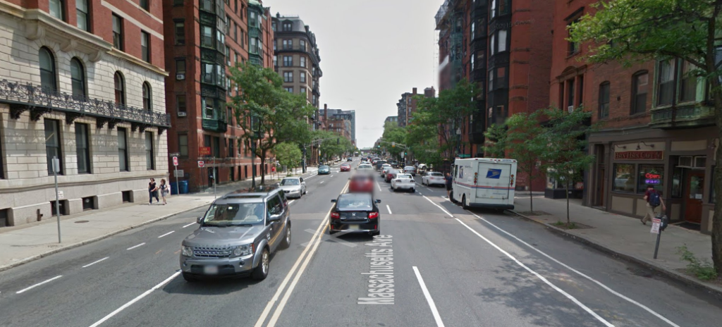
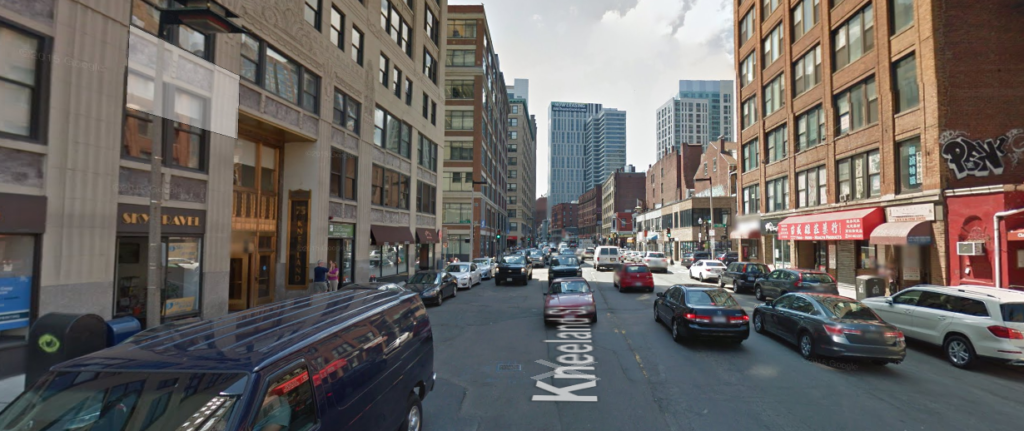
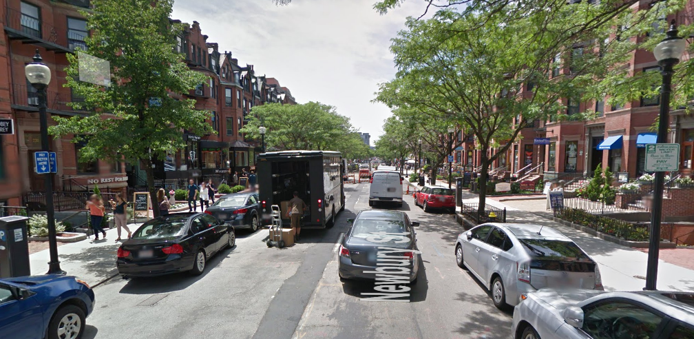
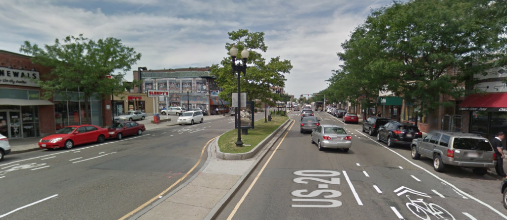
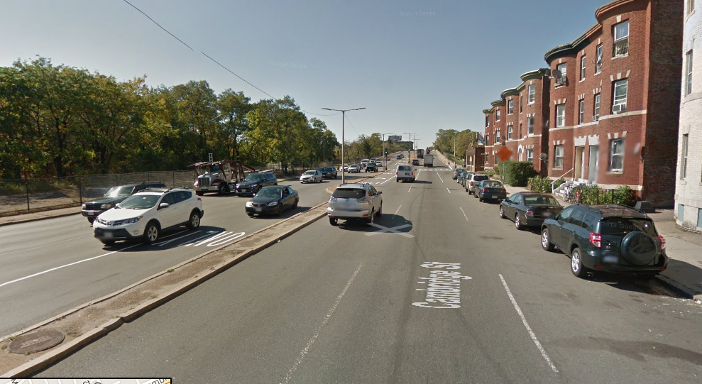
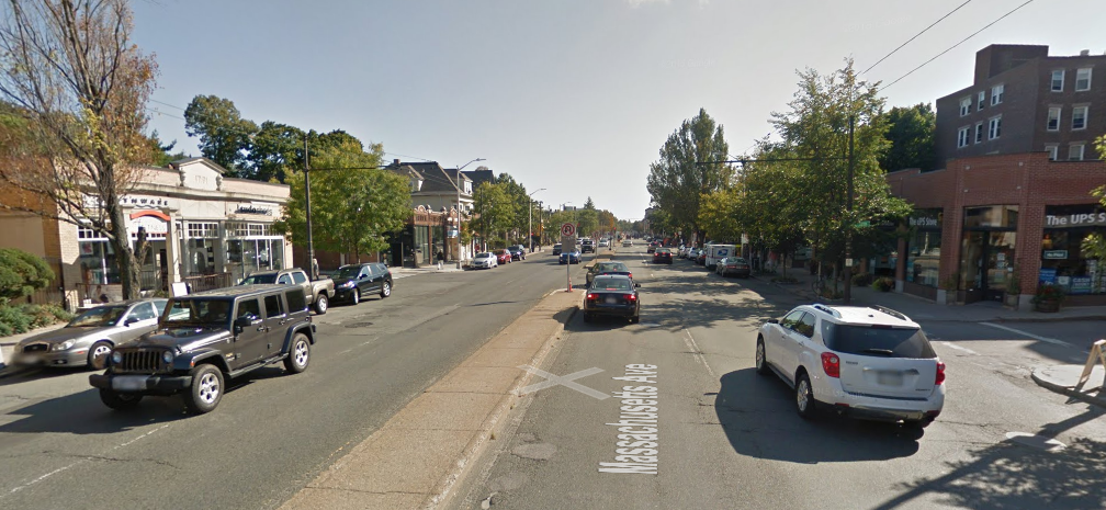
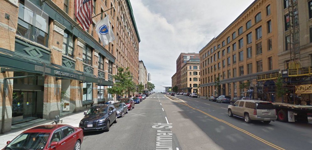
58 feet, Tremont Street, Downtown
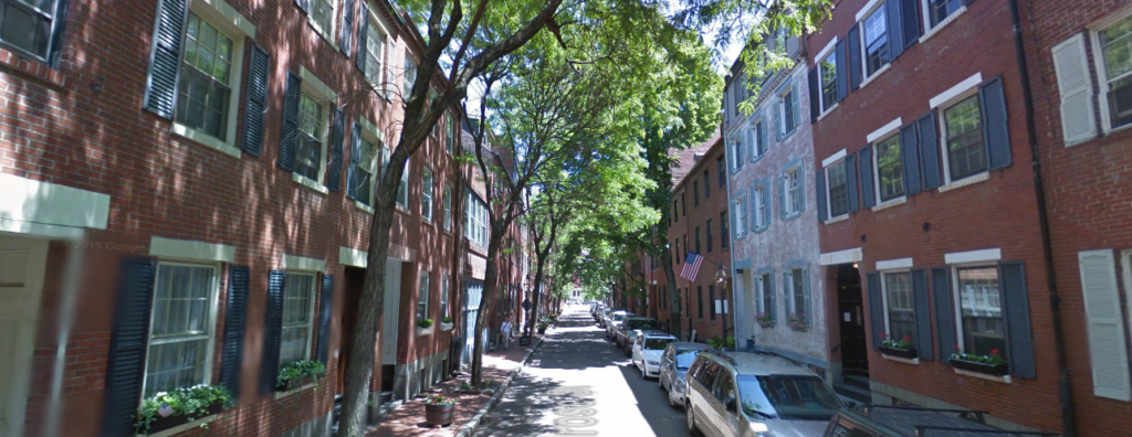
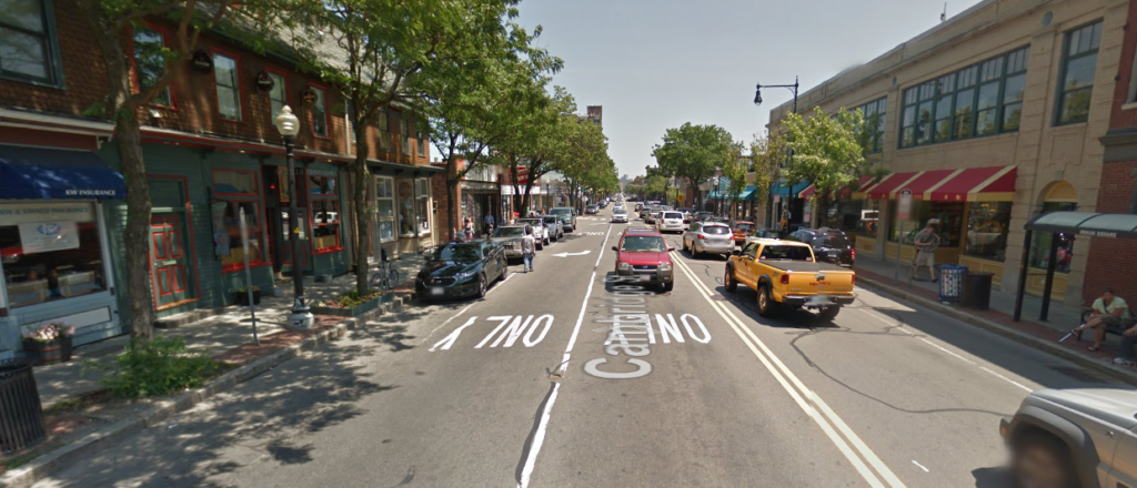
60 feet: Elm Street, Davis Square
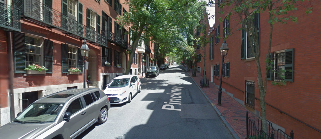
98 feet: Cambridge St, Allston.
A Complete Mass Ave in Cambridge
Cambridge is in the process of starting a citywide master plan (right now it’s in the naming phase). The major thoroughfare in Cambridge is Massachusetts Avenue (Mass Ave for short, of course), and it is pretty much the only street in Cambridge that is more than two lanes each way. Except for a couple of locations, north of Harvard Square Mass Ave is 72 feet wide, and it could be a great street.
Unfortunately, it’s not. It’s basically a highway.
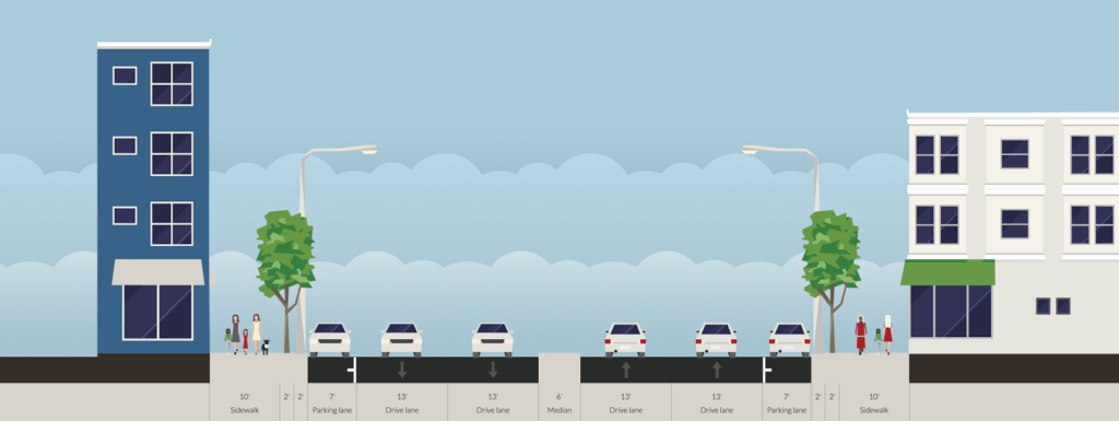 |
| Two wide lanes of traffic each way, parking and a median. Are we in Cambridge, or LA? All diagrams shown made in Streetmix, which is a fantastic tool for this sort of exercise. |
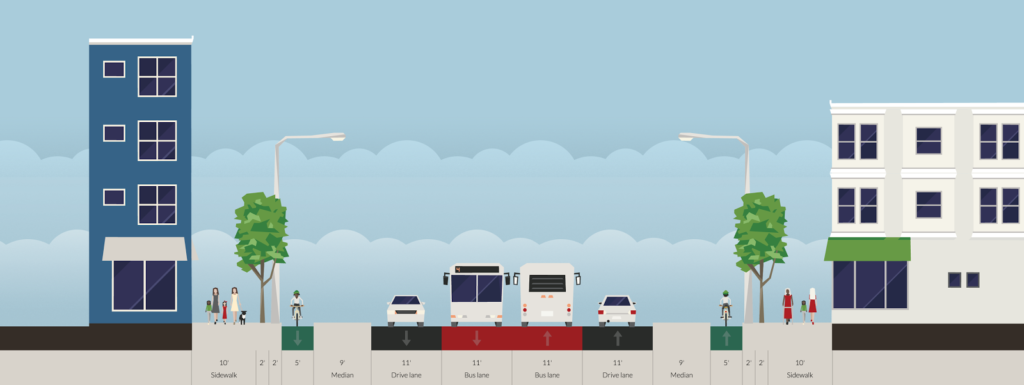
And that needs to change. The street currently serves two functions well: traffic and parking. There’s minimal traffic on Mass Ave because there is ample capacity (the bottlenecks are at either end of Cambridge). There is plenty of parking; nearly the entire stretch of the street has parking on both sides. And since the street is so wide, there is a median to help pedestrians cross, discourage left turns and make the traffic even faster. It is also a concrete waste of six perfectly usable feet.
The street does have 14 feet of pedestrian facilities on either side, but these are hardly enough for the various uses there, which include bus stops, bike racks, sidewalk cafes, building access, power and light poles, etc. And the current lane width is ridiculous. Each side of the street is 33 feet wide: a 7 foot parking lane and two 13 foot travel lanes. Considering that Interstate travel lanes are only 12 feet wide, and 10 foot lanes are used throughout much of Cambridge, this is far, far more width than necessary, meaning that with the median there are 18 wasted feet of space on Mass Ave. Wider lanes cause drivers to speed, which endangers other street users. As for transit, the 77 bus limps along Mass Ave, stuck in traffic and pulling to the curb at every stop, only to wind up stopped at a light behind the cars that passed it.
We need to re-plan Mass Ave, and we need to rethink our priorities. In the 1950s, when the removal of transit safety zones in Mass Ave sped traffic and the end of the streetcars (at the City’s behest, no less), the main priority was vehicular traffic, with no mind paid to cyclists, little to buses, and not much to pedestrians. This is nearly completely backwards. How we should plan is:
- Pedestrians. Every street user other than a pass-through driver is a pedestrian. We need to make sure crossings are manageable, sidewalks are wide enough, and traffic is slow enough to be safe.
- Transit. Right now there are four bus lines along Mass Ave, the 77, 83, 94 and 96, carrying 13,000 passengers daily (as opposed to 20,000 vehicles). In addition, the street serves as the pull-out route for the 71 and 73 buses, serving 10,000 more. At rush hour, there may be a bus every two or three minutes.
- Cyclists. Safe cycling infrastructure is imperative for Mass Ave, as it is the straightest line between Arlington and North Cambridge and Harvard Square and points south and east. It is also the main commercial street for the neighborhood, and safe cycling facilities will allow residents to access businesses without driving. Rather than shunt cyclists to roundabout side streets, we should give them a safe option on Mass Ave.
- Cars. Yes, we need to provide for vehicles. We need a lane in each direction, enough parking to serve businesses (likely on both sides) and turn lanes in a few selected locations. Do we need two lanes in both directions? Certainly not; there are plenty of one-lane roadways which accommodate as much traffic as Mass Ave. And if we build a road that’s better for pedestrians, cyclists and transit users, many of the current drivers will travel by foot, bicycle or bus instead. We also need parking, and there’s enough for parking on each side. It would be eliminated where there are bus stops, but with fewer overall stops there would be only a minor loss of spaces. And with better non-driving amenities, fewer people would drive, anyway.
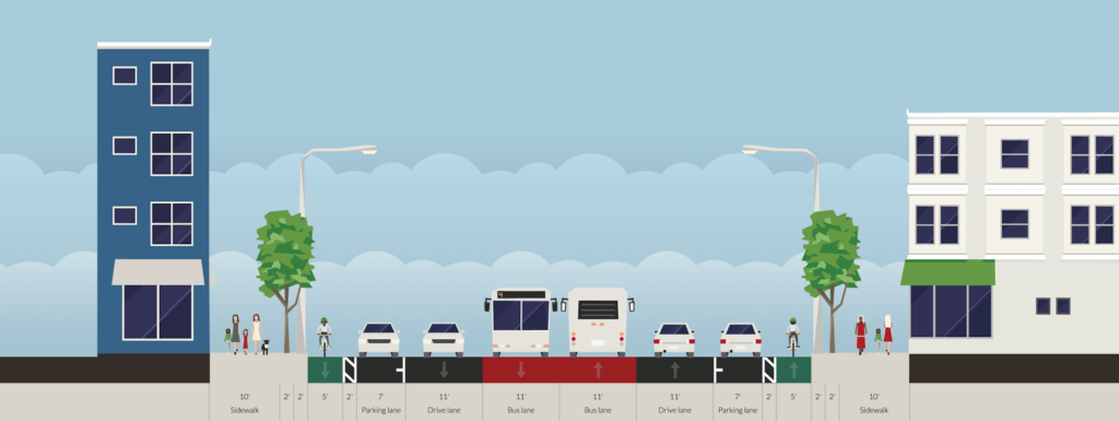
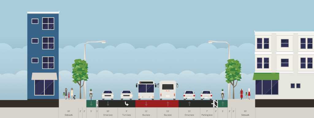
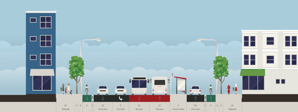
This is a typical section of street. The curbs and sidewalks are unchanged, but everything else is. Cars get one lane, plus parking. There are center bus lanes, which also allows cars to pass people parking, or a double-parked car, although this will require enforcement to keep drivers from using the bus lanes for travel or turns. Each lane is 11 feet wide, and emergency vehicles would also use the bus lanes to bypass traffic. On each side of the street, there is a 5 foot bike lane separated from parked cars by a 2 foot buffer (the bike lanes could either be at street or sidewalk level). This would be the baseline configuration of the street.
When a crossing of the roadway is desired away from a bus stop, the parking lanes would be replaced with curb bumpouts beyond the cycle track, meaning that pedestrians would only have to cross four lanes of traffic—44 feet—instead of the current 72. Crosswalk treatments would be included in the cycletrack to warn cyclists of the pedestrian crossing.
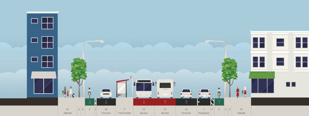
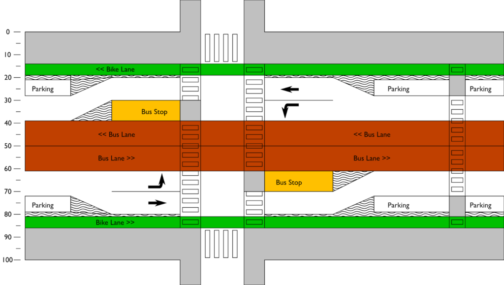
A turn lane could be accommodated by reducing parking in a manner similar to a bus stop. This would often be paired with a bus stop opposite the turn lane, with through traffic proceeding straight and the turn lane becoming the bus stop.
What would it look like from above? Something like this:
In the 1950s, we planned Mass Ave for cars. Cambridge can do better. In 2015, we were honored to have built what was described as the best new bicycling facility in the nation. It’s high time we remake Mass Ave, this time for everyone.

