Expanding reverse commute options in Boston

As with any city in the United States, many jobs in Boston are located away from the central business district, although those areas are not served by transit. Many jobs in Boston—in the Downtown, Back Bay, and Cambridge, are transit accessible, but many more are located in suburban office parks, far from the center of the city and with very limited transit options. There are shuttles from various transit nodes (namely Newton Highlands and Alewife) to locations along 128, mainly in Waltham. The MBTA operates limited bus service to the outer reaches of Waltham, Lexington and Needham along 128, although they are designed mainly for inbound commuting and their outbound scheduled times are likely too long for many commuters. There is limited availability and the speeds are not designed to be even close to being time-competitive with driving. However, there is ample office space which is inexpensive in comparison to downtown, and attracts all sorts of companies, even those with more urban employee bases.

There is transit service to near the Needham-Burlington employment node along 128 via the MBTA’s Riverside Line, but with a dozen suburban stops, it takes 45 minutes to reach the terminus from the core. With added shuttle times, it would create a quite-long commute. Two commuter rail lines pass through the Needham-Newton-Waltham-Lexington region, but neither has a station at 128, and their schedules are certainly not designed for reverse commuting. (It is also less desirable for park-and-ride commuters from Riverside and Woodland, as travel times to Back Bay and Downtown are not particularly speedy.) It is with these commuter lines—especially the Framingham-Worcester line—that there is potential for that to change.
There are two recent developments which make this change more feasible. One is the now-underway expansion of the Yawkey Station (named after the long-time (and racist) Red Sox owner Tom Yawkey) near Kenmore Square in Boston. Originally built to access Fenway Park, the station received limited service in the 1990s on one side platform, but is being rebuilt to accommodate stops from all trains. The station is a short walk from Boston University’s campus and the large Longwood Medical Area, both of which have significant employment and expensive parking. In addition, the parking lots surrounding the station will be redeveloped in to office space. With more frequent service, the station will better serve these communities.
The other new development is the (long-awaited) transfer of the Framingham-Worcester rail line from private ownership and dispatching (CSX) to the MBTA. The private dispatching has been blamed for delays which keep on-time performance on the line low, and the MBTA has been unable to increase service on the line west of Framingham because of limits in capacity. Still, the Framingham line sees ridership of nearly 20,000 (nearly 10,000 each way) a day (see this pdf for full statistics), second only to the Providence-South Attleboro line, which sees a significant portion of its ridership board at it’s own station at Route 128.
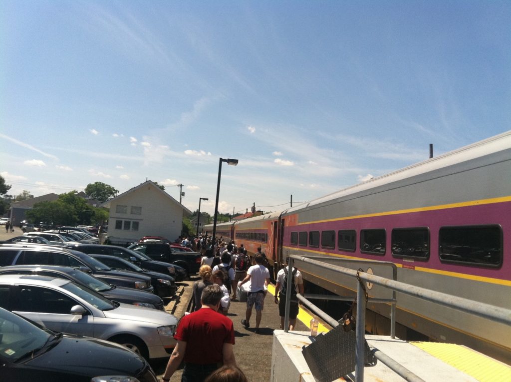
There are three major problems with the existing 128 station. The first is that it is not located near a major job node. There are virtually no jobs within walking distance, and no major job nodes nearby which could be reached in a short shuttle trip. In fact, east of the station, the Blue Hills take up several square miles of conservation land, which do not create many jobs. The station does serve about 2500 MBTA passengers daily and another 1000 Amtrak travelers. The second issue is that, when it was rebuilt in 2000, it was forecast to have more parking revenue that ultimately materialized, creating pitfalls for projects like it which are funded by parking revenues. Even with some MBTA parking facilites, like the Alewife, overflowing, 128 station sees hundreds of empty parking spaces every day. 
These are exacerbated by the third: the 128 Station is located in the center of the least-population-dense area along 128. With the aforementioned Blue Hills on one side and relatively sparsely-populated suburbs on the other, there are few commuters who traverse several exits on 128 for the speedy trip downtown. Those coming up I-95 from Providence would likely use some of the park-and-ride stations further south, which, thanks to the high-speed nature of the line, have shorter-than-auto times to Downtown Boston (from Mansfield to Back Bay, for instance, scheduled train times average nearly 60 mph, along a much straighter line than the often-jammed highways). Commuters to the southeast use the Red Line service, and those to the north are served by the paralleling Needham and Franklin commuter lines. 
A bus/rail transfer station with commuter parking at Route 128 in Weston, near the intersection with the Turnpike, however, may prove much more fruitful to the business and commuting communities, as it would address many of the issues which the current commuting options do not. First, it would be a boon to 128-bound commuters. (A local planning group is in early stages of discussion about this type of project.) The intersection of 128 and the Massachusetts Turnpike—which parallels the rail line—is only 11 miles from downtown Boston. Without freight traffic, rail service from Yawkey Station to this part of the line could be scheduled in 10 or 12 minutes—faster still if the grade-separated line was upgraded from a current speed limit of 60 mph. This would significantly shorten the transit time for many reverse commuters to the 128 corridor. Trains could be run at 20 minute intervals (they already are in the peak direction, so this would not require significant investment new equipment) with timed, coordinated shuttle transfers. In the future, an HOV/bus lane could speed these commuters to workplaces along the highway, and the current Riverside Line could be extended to this station. In addition to these outbound services, connecting bus service could be explored for inbound commuters with timed transfers at this station.
Such a station would not solely benefit non-traditional commuters. It would also be a boon to those Boston-bound (and, thus, not further encourage the less-than-ecologically sound movement of more jobs to the suburbs). With dedicated on- and off-ramps from 128 and the Turnpike, a garage could provide a seamless connection for park-and-ride commuters. Not only is I-90 more and more congested at rush hour (in both directions), but tolls are now $2.50 each way. Add in gas and parking costs, and $5 or $7 for parking to avoid the Turnpike would be a deal. In other words, there is already a $5 economic incentive to avoid the Turnpike, which could be a good push factor towards transit—if it were close to being time-competitive with driving. 
In addition, with more-frequent off-peak service levels, such a station would serve non-commuters as well. Visitors to Boston’s many cultural and entertainment options could be enticed with an easy, comfortable ride, and one which would incur a significant cost savings over tolls, gas and parking. The MBTA already serves many customers going to Fenway Park, this could be expanded significantly.
Now, these options neglect to mention the fate of Newton’s inner stations, which are currently served by some Framingham-Worcester trains. These stations—which once had frequent commuter service—were relegated by the Turnpike to one-platform stations with no reverse commute options. Still, these stations—Auburndale, West Newton and Newtonville, average about 400 boardings per day, more than the further-out Wellesley stations which have more service. This corridor is one of the most densely-populated in Newton (moreso than the area traversed by the Green Line), and more frequent service would certainly result in higher ridership. A local-express service could be added through “The Newtons” with local trains departing the hypothetical 128 station and stopping in Auburndale, West Newton and Newtonville (and, perhaps, additional stops in Newton Corner, Brighton and Allston) towards downtown, allowing transfers from service further west and multi-directional travel in Newton and Boston.

Here, for instance, is a potential schedule for this service and assumes some line upgrades. E = express, L = local stops, NB this is a general idea, and quite condensed, but does show that clockface scheduling (except for a peak-hour express from Worcester) would be feasible. This shows inbound scheduling; outbound would be similar (with a quick transfer at Route 128) with slightly later first and last trains:

6a – 9a, 4p-7p 9a – 4p, 7p-10p
Worcester 4:30a 5:30a :10 :20 :40 :00 11:00p
Framingham 5:10a 5:40a   6:10a :10 :30 :50 :10 :40 11:40p
L L L L E L L L L
128 5:30a 6:00a   6:30a :10 :12 :30 :32 :50 :52 :00 :30 12:00a 12:40a
L L E E L E L E L L L L L
Yawkey 5:50a 6:20a   6:40a :00 :12 :20 :32 :40 :52 :20 :40 12:20a 1:00a
Back Bay 5:52a 6:22a   6:42a :02 :14 :22 :34 :42 :55 :22 :42 12:22a 1:02a
South Sta. 5:55a 6:25a   6:45a :05 :17 :25 :37 :45 :57 :25 :45 12:25a 1:05a
Finally, there are not-insurmountable logistics towards building this type of service. The first is the ability to run two-track service between Boston and Worcester. The main current impediment to this service is through CSX’s Beacon Park Yard, which the freight railroad will mostly vacate as part of the deal with the state. This should allow the MBTA to build a second track through the area. Further west, service to the Newton stations would require platforms on both sides of the tracks, which is currently in planning stages for Auburndale (and likely relatively inexpensive for stations in West Newton and Newtonville).
The second is the ability to build a park-and-ride facility near Route 128. This, too, would present minimal issues—even for a three- or four-track station with local-express service. Why? West of Auburndale Station, the Framingham Worcester retains the four-track right-of-way which was present until the construction of the Turnpike between Back Bay and Framingham. The two tracks take up only half of the available real estate, and with shored-up embankments, there would be plenty of room for four tracks and platforms (currently, the right-of-way is 120 feet wide in this section). The office park to the north of the tracks could be connected to the station, and a parking facility could be built on the footprint of a large parking lot to the east of the offices. Furthermore, the parking facility could be connected, at rather minimal expense, to several of the ramps from 128 and the Turnpike, allowing easy access from the highways to the station. In addition, the station would allow access to the Leo J Martin Golf Course and Weston Ski Track, putting these recreational facilities within easy access of downtown Boston.


View Weston Sta. commuter rail in a larger map

Funding for this facility, and related commuter rail improvements would, of course, be a challenge. Certainly, parking revenues could help fund the parking facility, and maybe even subsidize rail operations. An additional toll surcharge could be placed on Turnpike commuters, but these drivers are already more burdened than others in Boston. Perhaps the nearby localities, which reap significant benefits from the office space in their midst, could be leaned on to help fund this type of project, which would benefit their residents and workers, and even provide some insurance to their suburban office parks against a future where higher gas prices make such car-centric facilities less economically desirable.

There is an obvious need for transit service along the Route 128 corridor. However, without smart investments in infrastructure, it will be hampered by slow service and unattractive to those who would most benefit.

(Or maybe I just want a quick train trip out to the Ski Track.)

Why the 2010 census does not paint a full picture

In a recent post, Andrew Sullivan linked an article by Joel Kotkin arguing that the trends shown by the 2010 census show a continuing flight both from cities to suburbs and from denser cities to less dense ones. This page has never been a fan of Kotkin, who is continually trying to reprove his thesis from 2005 that the suburbs were the way of the future and that the cities of the future were “Orlando, Fla., San Bernardino-Riverside, Calif., Phoenix and Las Vegas.” (Seriously, this 2005 piece gets just about everything wrong.)

I am not going to waste time arguing several of the points Kotkin raises (for instance, he extols falling condo prices without mentioning that suburban house prices in many markets have plummeted just as much) or go in to the politics of subsidized home ownership (Sullivan uses another blogger to point out that high urban housing prices stem from high demand and policies which restrict growth in supply, further subsidizing suburban housing). Instead, I am going to look at recent, post-housing bubble data that shows that Mr. Kotkin’s thesis may be based mostly on the first half of the decade, not recent years. (He goes on to compare the 2009 American Community Survey and the 2010 Census, which are different data sets—so he’s comparing apples to oranges.)

To do so, I am going to use the census data beautifully displayed by Forbes (and commented on by several, including the Kotkin). I’ll concur with one of the other commentaries (all are worth reading, especially interesting is one point out the income difference between in- and out-migration) that there are large swings between 2005 and 2009, but point out that they are not only between certain cities but within them as well.
For each, I’ll show the migration chart from 2005 to 2009, and then the local migration maps from 2005 and 2009. And, yes, it would be great to have data on a more granular level (i.e., by zip code) or more aggregated level (by metropolitan area) but these doen’t exist, as far as I can tell.
1. Suffolk County, Mass. (Boston)

In the second half of the decade, out-migration from Suffolk Country went from well outpacing in-migration to falling behind it, and it fell while in-migration slowly rose. Locally, adjacent counties in eastern Massachusetts were recipients from Suffolk County each year, but further-flung counties, including sprawl-heavy Worcester County and those in Southern New Hampshire, flipped from receiving many migrants to giving them back.

Further afield, in 2005 Boston lost migrants to most every sprawling metropolis, including Dallas, Las Vegas, Atlanta, Charlotte, Jacksonville, Orlando and Miami. It gained population from all these centers in 2009. Middlesex County, including the very dense cities of Cambridge and Somerville (but large exurban areas as well adjacent to New Hampshire) shows similar, if less pronounced, trends.

2. Philadelphia County, Penna.

Philadelphia’s migration trends are not as pronounced as Boston’s—there is no switch from net out-migration to net in-migration—but it mirrors those of its northeastern neighbor. In the region, we can note a pronounced shift away from migration to far-flung suburbs, especially the second ring in Pennsylvania and New Jersey. There are similar shifts to the nearby suburbs in both years (and a similar draw from North Jersey) but the out-migration to the exurbs disappears. On the national front, there were fewer major shifts (like in Boston) but still several trends away from less-dense areas.

3. Washington, D.C.

The demographic trends for Washington show similar patterns, especially on the national scale. It’s out and in migration flipped, like in Boston, although the changes were less pronounced, as it never had the same mid-decade baseline losses as Boston. Locally, there was less movement towards some outer suburbs, although this can be confounded by the presence of Baltimore to the north, which doesn’t really qualify as a D.C. suburb. Still, there was less movement to counties far off in Northern Virginia in 2009 than 2005. Nationally, DC lost residents to Charlotte, Atlanta, Phoenix, Las Vegas and Los Angeles. By 2009, it was gaining residents from all of these.

While I wish I could go on this thread forever, I can’t, because the data (here, at least) is at the wrong scale. New York City is broken in to counties, and it’s so big that each county has different trends since there is so much migration within the city, as well as in to the city from the rest of the country. San Francisco doesn’t show such trends within the metropolitan area because the population is so spread across counties, and except for SF itself, most of the counties have significant urban and rural populations. But, further afield, San Francisco saw dramatic changes: in 2005 it lost significantly to LA, Las Vegas and Phoenix, in 2009 it gained population from these three cities. And in Atlanta and Chicago (Fulton and Cook counties), there weren’t major changes in national out-migration, but dramatic reductions in moves to the outer suburbs.

In any case, go and explore the Forbes map. It’s a lot of fun, both from a geography-nerd level and an exercise in proving Joel Kotkin wrong.

Witches and Networks

A couple items of note from the Boston Globe today (one pay-walled, one not):

1. This summer, we posted on the well-used but ill-marketed weekend train service to beaches on the MBTA’s Newburyport-Rockport line. This past weekend, and this coming weekend, the T is adding several trains on that line. Why? The line goes through (quite literally, in a tunnel) Salem, that of witch trials and general spookiness. Hallowe’en is big business in Salem, with the monthlong “haunted happenings” peaking on the last two weekends of the month. With roads closed and parking limited, the city actively promotes the use of public transportation, and the T obliges. (Oh, and parking gets a lot more expensive. Supply et demand.) With the city backing, the train schedule is more than doubled on weekend afternoons.

Obviously, there’s capacity on the line (which handles nearly no freight—the main choke points are Beverly Junction and the aforementioned one-track tunnel through Salem). Why is there no extra service in the summer? There are probably a couple of reasons. Salem wants as many people as to come as possible—at least before Hallowe’en evening when things can get rowdy. More feet on the ground means more dollars in the coffers. The beach towns are not likely pressing the T for more people to crowd the beaches. They’d be glad to charge drivers $25 to park, but only until the lots are full. Otherwise, there’s not a lot of money to be made on beach admission. Second, the witch tourism is planned far in advance and not very weather dependent (although it likely drops off in case of rain or—this year, apparently—snow). A rainy day does not see many beach-goers. Still, there’s no reason the T shouldn’t at least promote the beach service they have in the summer, even if it’s not to the extent of doubling spooky service.

2. There was a very interesting event on the T yesterday: a startup meetup in the last car of a midday Red Line train. (The Globe article is paywalled and I can’t find a free link. Update: here’s a free link) Apparently, a bunch of local startup firms all met on the Red Line, had short speeches between stops, and then networked. Great idea! As one of the top venture sites in the country (although lagging behind Silicon Valley) many of these types are already on the Red Line every day, so what a good way to get people together. Now, if only we could have rational development policies which did not underprice suburban office parks and pull these companies out to Waltham and Burlington, where innovators spend way too much time behind the wheels of their cars.

Which reminds me … this year, I’ve been tracking my travel. Every day, every mile, every mode. Seriously. I have a spreadsheet, and every month I post a “transport report” for that month. (Here’s January; you can click to subsequent months.) At first, I had no idea what I’d use the data for (other than fun charts. hooray fun charts!). But now I have some ideas:

v 0.1: Manual data entered in to a Google Doc, manual charts made in Excel
v 0.2: Once I figure out how to make PHP and JPGraph work (any help would be appreciated, seriously), have the charts update live from a Google Doc / database when the data is entered
v 0.3: Open this to other transportation geeks who want to provide this type of data, and see if it works—and what happens. When you think about every mile you travel and every mode, you tend to drive less.
v 1.0: Track transport and mode using smart phones (doable, I think, based on discussions from Transportation Camp last spring) and gather data, and develop a social network based on where people are and when. What do you do with these data? All sorts of things. Like:

  • Real-time updates about traffic and transit problems sent to people based on their past behavior (i.e., we know you take the Red Line or drive Route 2 between 8:15 and 8:25, but there’s a disabled train / traffic accident, so you should consider the #1 bus / going to Alewife instead)
  • Helpful hints to help people drive less. A system could weed out short trips which could be made by foot or bicycle. Or help people link trips together. Or even take shorter routes.
  • Let people meet others with similar commuting patterns. If enough people used the system, it might be able to pair drivers in to car pools (“we’ve determined that you and another driver have each driven alone from the same neighborhood to the same office park with 15 minutes of each other 23 of the last 27 days—here is a link to send them an email/fb message/tweet to try to form a carpool.”) or meet people on the train or bus. To make the solitary confinement of a crowded train less—well—solitary. This would be optional, of course, but could be very powerful
  • Provide really interesting data to planners on who is going where, when and by what modes.
Obviously, some work needs to be done. But it’s an idea. If you have any ideas for it, or want to be notified when I get the system off the ground (or even close to that phase) watch this page or email me at ari dot ofsevit at gmail.

On street trees

Take a look at this shot from Google Maps and see if you notice anything:


View Larger Map

If you haven’t found anything, feel free to turn on the labels to show road names. Find Beals Street. (Yup, where JFK was born.) Now turn off the labels. Zoom out a bit if you want. And note that Beals Street has more treecover than any other street in the area. (Once you zoom out, you can also follow the Brighton-Brookline border by where the treecover changes south of Commonwealth Avenue, too.)

Beals Street is lined by American Sycamore trees. This isn’t obvious from above, but as you walk down the street the mottled, almost camouflage bark is striking as some of the trees are several feet in diameter. Their canopy spreads over the street to the extent that sunlight rarely breaks through to the road. Most other streets in the area have less continuous tree cover, and certainly none appear as straight lines of green from an aerial view.

The question is, how long will this last? Beals Street has a monoculture tree of the same age. Even if the trees are not felled by wind all at the same time, they will likely succumb within a few years of each other (there are already a few notable gaps along the street). If there is a blight or other disease, they could die even more quickly. At that time, Beals Street will be opened to sunlight like never before. And the houses, especially those on the northwest side of the street, will no longer be shaded through most of the day. And there seem to be no efforts to plant new trees in the sycamores’ stead.

Street trees have a long history, but the American Elm is probably the most telling example of what happens when a tree quickly dies off. The imported dutch elm disease began killing off elms in the 1930s in Ohio; by 1970 most of the tree’s range was infected. Streets which had previously been lined with the cathedral-like elms had nothing but stumps. Many such streets have still not recovered their tree cover—Kansas City had planted mostly elms and many streets became devoid of trees in ten years.

Some elms survive along street. Luzerne Street in Johnstown, Pennsylvania has been painstakingly preserved for years as infected trees are razed and replanted. (Yes, they have a Facebook page.) Winnipeg, where the disease only spread in the late 1970s, has successfully kept the effects of Dutch elm disease manageable in the last three decades. But it doesn’t come cheap: Winnipeg has significant legislation and capital costs to keep the disease at bay.

Still, the results are remarkable: on Google Maps, streets appear as strips of green between houses. Going forward, we should savor such resources, but when new street trees need to be planted, age diversity and biodiversity should be goals.

Why doesn’t the MBTA better market beach service?

It’s 8 a.m. on a Saturday, the sun is shining bright and the mercury is approaching 80˚. In Boston, these are signs for hundreds of thousands of city dwellers to move north and south and find refuge on the hot sands and cold waters of miles of beaches. While the states most picturesque beaches are probably on Cape Cod, there are many within an hour of downtown Boston. The ones to the north are particularly splendid, and hordes of travelers pack the roads to get there.

There’s a problem. Past Peabody, Route 128 is only two lanes in each direction and can’t cope with the excess traffic. And a bridge repair project has stifled I-93 from its usual four lanes to two, causing a massive back-up and extra traffic on Route 1, the only real alternate route to the northeast. (Fellow beach-goers today described traffic which only let up for a mile in a couple places.) Plus, if you brave the traffic (and survive), many beaches charge $20 or more for parking—often a long walk form the sand. And sometimes full. Tough luck after an hour-long drive.

Some close-in beaches, most notably Revere Beach (a 20 minute transit trip from downtown) are easily accessible without a car, but they are often quite crowded, and water quality is not particularly good near the city. There are, however, several beaches to the north of the city along the Rockport commuter rail line which are within a mile of train stations and can easily be reached from the city.

It’s almost impossible to drive to Manchester-by-the-sea’s Singing Beach, which has restricted parking (town residents only), but it may be the most accessible beach on the north shore as it is just half a mile’s walk from the train station. (There is additional parking for “outsiders” for $25—at the train station.) Several beaches in Gloucester and Rockport are about a mile from stations further out on the line. And Plum Island is a long walk from Newburyport but a manageable bike ride. For the beach, the train is relatively popular; a six-car consist today was about 80% full today from North Station until the train emptied out at Manchester for the walk to the beach. (And on the way home, the platform was crowded several deep and the conductors opened all cars to accommodate the crowd.) Service was punctual, and as fast as driving. With gas near $4 per gallon, it was cheaper, too.

A full train disembarks at Manchester-by-the-sea.

Obviously the train service is working, but the T doesn’t seem to realize that they have a product to market. Weekend service on the commuter lines has waxed and waned over the years, but is now provided almost universally. Headways are genearlly two hours with service in to the evening. Loads carried are light, but full, locomotive-hauled trains are operated. Except for special events (baseball games, major downtown events like the every-few-years arrival of Tall Ships) service is usually limited to one or two cars in a full-train consist. Since the trains are running anyway, any new person on the train is revenue with a marginal cost of nearly zero. So the T should promote the use of these trains whenever they can.

And sometimes they do. In the winter, Wachusett Mountain ski area has partnered with the T to promote the “Ski Train” to Fitchburg, with a shuttle service to the base of the mountain. And the T turned one of their train cars in to a “bike car” which is half seats and half bikes (similar to cars in regular service on Caltrain) which are used, weekends, only, on alternating trains to Rockport and Newburyport (all non-rush hour trains accommodate bicycles, however). They promote this car as a way to reach even more beaches (the south side has a similar car on the Greenbush line), but there’s little information on, say, exactly which stop you should go to get to which beach. Or a full schedule of non-bike car trains which go near the beaches. So if you want to go to the beach on the T, you have to plan it yourself.

Beach-goers line the platform awaiting a train back to the city.

Many people certainly do just that. But the MBTA should put a line item in its publicity budget to promote weekend commuter services to the ocean. With a ridership of 1.3 million daily, there is probably a large contingent that don’t know that it’s possible to spend the day at the beach without a knuckle-dragging slog through traffic or exorbitant parking fee. Ads on subways and buses with brochures or—these days—QR codes could steer people to information, and the agency could develop a website with various transit-accessible options (say, a commuter rail map with the distance from each station to nearby beaches).

Most weekend services surely run at a loss—operating a six-car train with 60 passengers is not particularly cost-effective. But every bottom you put in a seat is revenue for the MBTA—and quite possibly cars off the road. The T should do more to tell people the destinations it serves outside of home and work.

How many buses on Wilshire?

Another bit about Los Angeles: while there, we decided to take the bus on Wilshire towards Santa Monica. In doing so, we boarded one of the most frequent bus routes in the country. How frequent? At certain times of day, three dozen buses run along Wilshire Boulevard per hour, one every 100 seconds. They’re split between the local 20 bus (headways of 6-12 minutes; 30 minutes overnight) and the Metro Rapid 720 bus (headways of 2-9 minutes, generally less than 5). Yes, two minutes. From 6:30 a.m. to 8:30 a.m. westbound, the 720 has an astounding 51 trips, with buses arriving every 2:20 on average (not counting the 20, which adds another 20 trips.

The 720 is operated with 60-foot buses which have a capacity of 100 passengers; or 2500 per hour, with an additional 600 capacity on the 40-foot 20 buses. 3100 passengers per hour—more than a freeway lane of traffic. Yet this parade of buses has operated in regular traffic lanes, with only limited abilities to hold traffic lights. That’s slated to change, as rush-hour bus-only lanes have been approved for most of the corridor. The changes, which will cost $30m, are slated to save riders 10 minutes per trip. While it’s not the ideal solution (that would be a decades-long plan to build a “Subway to the Sea” under the corridor, which would serve many more people and halve transit times), it is a relatively inexpensive fix which will help thousands of riders a day.

How “relatively inexpensive” is it? There are approximately 160 affected trips daily (buses don’t run in each direction at the same frequencies), and we can assume that these trips are 75% full at rush hour (75 passengers per trip). That equals savings for 12,000 passengers per day, times 10 minutes, or 2000 hours saved per weekday, or 500,000 hours saved per year. There is limited literature regarding travel time costs (how much people value the time they spend in transit) but a conservative estimate is $8 per hour; about half of the prevailing average wage. (It’s possible that mobile computing will raise this considerably.) In any case, 500,000 hours at $8 per hour is equal to $4m per year, giving the project an eight year payback in this metric alone.

Of course, LACMTA stands to save as well. Saving ten minutes per trip will save the agency 1600 minutes of bus operation per day, or about 27 hours. It costs about $100 to operate a bus per hour, equating to a savings of $2700 per day, or $675,000 per year (and these are much more quantifiable savings than the time costs).

Will bus lanes give Wilshire Boulevard an acceptable level of transit? No—with the ridership the corridor sees a grade-separated line is probably necessary. But since that is many years off, this is a step in the right direction.

Los Angeles: where’s the transfer?

This spring, I spent some time in Los Angeles—and most of the time I was there I spent without a car. I’d called off a planned hike of the Pacific Crest Trail and stayed with family and friends for most of a week (with an interlude to take the train out to the Grand Canyon) and explore Los Angeles, mostly by bus.

Los Angeles is, of course, synonymous with the freeway and the car. (And, of course, traffic.) While there is a coherent-and-growing network of commuter rail lines, they serve a small proportion of transit use. The rail network—a few light- and heavy-rail urban lines—see more use. However, the majority of Angelinos traveling by transit do so by bus. Of the 1.4 million daily riders, about three quarters—well more than a million—ride the bus, making it the second largest bus system in the country.

There’s been a bit of news about the agency, too—namely, a New York Times article regarding the 305 bus route, which mostly ferries domestic staff from poorer neighborhoods south of downtown LA to wealthy suburbs to the city’s west. The route is slated to be discontinued as the newest light rail line, the Expo Line, will open this fall. When fully completed, the Expo Line will allow for much faster east-west service from Downtown Los Angeles to Santa Monica, a route which is currently heavily traveled and quite slow. And, as with most new transit lines, local bus service will change based on its opening.

In 2004, when I was but a budding student, the Hiawatha Line opened in Minneapolis from downtown to the airport. In Saint Paul, we’d had direct service on the 84 bus (2004 schedule pdf) line every half hour from our college campus to the airport. After the light rail opened, the buses were dramatically rerouted and the trip requires a transfer to the light rail, adding a bit of time but increasing options to get to the airport; the thrice-hourly 74 bus routes near the campus as well. In fact, the 84 was just about the only route whose airport service declined in service. Most buses now have faster and/or more frequent airport service.

And, thanks to free transfers, the fare remained the same. (It’s since risen, but there’s no surcharge to ride the train.)

This is a major problem in Los Angeles. There are no free transfers. If your destination happens to be on the same line as your starting point, the fare is $1.50. If it’s at a right angle and you have to change, it’s $3.00. Given the size of the LA area, it’s quite possible to take a three-legged trip (say, east, north, and east) and pay $4.50. These fares are made up to some degree with the availability of a $6 daily unlimited fare (made up for by a round-trip with transfers). Still, the tacit discrimination against people with trips that don’t fall on a straight line is unwarranted.

And this is the biggest issue with the 305 bus story. If you put the trip from one end of the 305 route to the other on Google Maps, say, from Watts to Cedars Sinai (I picked these simply because they were easily identifiable landmarks near each end of the 305) the map output shows several options:

  • 1:18: Take the Blue Line to the Green Line to 550 express bus. 
  • 1:16: Take the Blue Line to the Red Line to the 14/37 bus.
  • 1:17: Take the 305.

Three very different routes, all with travel times within two minutes. The 305, following Los Angeles’s grid of streets, travels the same distance, but since it is on surface streets the whole way, it travels quite slowly. The rail lines attain much faster speeds which make up for the multiple transfers. (And many other destinations along the 305 benefit from the Metro Rapid system—limited buses which run frequently and only stop every half mile. They’re not that fast, but certainly speedier than buses which stop every block of miles-long routes.) The Times, which states in the lede that “It will be more than an hour before they arrive at work, and soon the same journey may stretch to nearly two hours” supports its narrative with a falsification. It goes on to use the fear of the unknown (in this case, transferring) to posit an actual detriment to service, which it is not.

Then, there’s frequency! Human Transit makes exactly that point: the 305 only runs once every 45 to 60 minutes, while the other services run every five or ten. So if the 305 happens to be about to run (and, yes, LA is on NextBus) it’s faster to travel by other routes. These services—plus the Expo Line—should be able to absorb the 3,000 daily travelers on the 305 without any effect. It seems very reminiscent of the axing of the 26-Valencia bus in San Francisco, an infrequent bus which paralleled Mission buses one street over and which was much-loved by some of its riders but which didn’t actually provide any meaningful transit service. Transit systems across the US are filled with these sorts of historical anachronisms which drain resources without providing any actual service.

The money saved from cutting this line will not adversely affect many travelers—the “community” cited by the NYT article notwithstanding—and will result in greater efficiencies for all …

… if LA better managed their non-existent transfer system.

Poor sharrow/pothole placement

I was biking up to Arlinton to check out the black raspberries along the Minuteman Rail Trail (sadly, there are many fewer than a few years ago when I cleared several pints) and was biking up North Harvard Street in Allston towards Harvard Square. I’ve biked this route frequently in recent months, and it’s a very convenient way to get from Brookline to Cambridge. It’s always faster than the 66 bus (I love the 66, but … walking is often faster than the 66) and usually faster than driving since there are delightful bike lanes to slide by traffic in several locations of Harvard Street. And there’s always traffic on Harvard Street.

Anyhow, I was approaching Western Avenue and there was a truck straddling both lanes, so I cut him a wide berth and aimed over the “sharrow” (the road marking of a bicycle and double-chevron) as I slowed towards the intersection. Since I was braking, my weight shifted forwards, and I kept my eye on the truck to my left. All of the sudden, I was looking at the sky, and a second later, I was lying on the ground. In aiming at the sharrow I had inadvertently aimed directly into the six inch deep pothole it pointed directly at (see picture below), and since my weight was already shifted forwards I managed a full-on endo.

I realized I’d hit my head and would need a new helmet, and got up, shaken, but otherwise mostly unscathed. (My most recent bicycle acrobatics involved a swerve around a car pulling out of a parking space on Chestnut Hill Aveune—and in to the streetcar tracks. I came out of that one completely unscathed since I somehow stuck the landing and wound up running down the street as my bike skidded away.) I was shaking too much to ride my bike, but there was a bike shop a couple of blocks away and I went there to buy a new helmet (my current one was only five or six years old).

I settled down and managed to get back on my bike and return to the scene of the crime. Here’s a picture of the offending pothole:

The high sun angle doesn’t attest to its depth. It’s about six or eight inches deep and the perfect size to catch a bicycle wheel and flip a decelerating rider. Like me.

Just as impressive is the fate of my iPhone. I had it in my pocket—and thank goodness the back was facing out. It took a lot of the force, it seems:

The amazing thing is that it works perfectly! I put some packing tape over the shattered glass—which I’m sure absorbed a lot of energy—and it’s good as new. And a new back costs $12 and is pretty easy to replace, so I’ll get around to that. Until then, I have one badass iPhone.

So, I took a picture with it of my old helmet in the trash and the above pothole picture which I sent off to Boston’s bike czar (I have her email in my gmail) and she suggested I contact the mayor’s 24 hour hotline, which I did. We’ll see if the hole is patched; I’m biking that route at least weekly for the next month or so. I’ll be interested to see if there’s much response—it’s definitely a hazard to cyclists.

I am going to take off my amateur planner hat and put on my bicyclist hat (helmet?) to take away a couple of lessons from this adventure:

1. WEAR A HELMET. I am flabbergasted by the number of cyclists I see biking around the city without helmets. I know all the excuses, generally in the form of “I don’t need a helmet because …”

  • I’m a good cyclist, I don’t need to worry. This is the stupidest one of all—most likely you are not going to be at fault for an accident. I can’t even begin to explain the inanity of this notion. I am a pretty good cyclist—I have thousands of miles of city riding under my belt—and I still have my share of mishaps.
  • I’m not biking at night. This accident occurred around noon; the pothole would have been even more invisible filled with water.
  • I don’t bike in bad weather. It was 85 and sunny.
  • I don’t bike in heavy traffic. There was almost no traffic when I was out midday the week of July 4.
  • I don’t ride fast. I was going about 8 mph when I hit this pothole.
  • I don’t take chances or run red lights/stop signs. I was slowing down to stop at a red light and giving a wide berth to a truck.
  • I don’t bike drunk. I was quite sober when I had my little flight here. As a matter of fact, I’ve never crashed drunk.
Basically, I was biking under ideal conditions, and I had an accident where a helmet meant the difference between walking away (and, a few minutes later, biking away) and going to the hospital. Please, please, please wear a helmet!
2. A lot of people are concerned about using clipless pedals and not being able to clip out when something goes wrong. Well, I’ve had two incidents in the past few months (the aforementioned streetcar track gymnastics and perfect landing being the other) and both times the force of the torque of the accident easily got my feet out of the pedals—and by easily I mean I didn’t have to think about clipping out, it just happened. Basically, if your feet go in a direction violently different from pedaling, you’ll clip out. (At least with my SPD cleats which are probably a bit worn down and have a decent amount of play; I’m sure there are pedal adjustments which would yield different results.)

3. Watch the pavement. Even in the summer. Potholes happen.

Happy biking.

(On a very slightly related note: the fact that, nearly 20 (!) years after it opened, there is no safe route through Arlington Center on the rail trail that doesn’t involve bricks and curb cuts is a travesty. How hard would it be to link the two sides of the bike path?)

Time lapse on the road

A couple years ago, before the long Minnesota winter set in, I went biking around Saint Paul taking long camera exposures to … well, to see what happened.

Other than my hands freezing (it was October, or maybe November), the shots were mostly what I had expected. The lights of the city at night streaked along during the exposure. My subject was still, but the camera was moving. By taking a long shot I was able to take a subject and almost completely abstract it, turning the lights of the city in to squiggly lines along the night sky.

I had a camera out last night in Cambridge and have to change the strap around a bit (i.e. I took a bunch of time lapse pictures of the road), but playing with the lights of the city at night is a lot of fun. And, yes, I really do want to take a bike the next time I head to New York City.

Extra credit: where were these two photographs taken?

200 feet of grass roots

I went for a run yesterday, and as usual observed interesting things at eight miles per hour (as opposed to double that speed on a bus or bike). As I ran along Kent Street in Brookline, I saw someone ahead of me reach towards a vine-covered fence and pick something. I’ve often loved finding wild-growing berries in the urban landscape (which reminds me: black raspberries along the Minuteman Rail Trail are in season!) but this didn’t appear wild—a strip of vegetation climbing a chain link fence between the sidewalk and the parking lot.

It’s not. In fact, it’s a project called the 200 Foot Garden. A couple of local residents saw the shabby patch of land and decided that they’d like to plant it, so back in 2009 they got permission from the property owner to landscape and plant the section of dirt (and, as he points out, save them the cost of landscaping). Once the fence was replaced, he helped to create a peculiar sort of community garden: one where anyone can take the produce. That’s right, anyone. I spy tomato plants, and I’ll be stopping by. (Now, I wonder if these are heirloom varieties. We’ll soon find out.)

The sunny patch seems to grow vegetables well, and while it’s actually only 180 feet long, 360 square feet of open space is a rather large plot in this part of Brookline, which has a population density of more than 25,000 per square mile (that’s double the city of Boston, and about equal to New York City). 25,000 people per square mile is about one person per 1000 square feet, so this unused plot of land, in this neighborhood, was akin to the land used by a third of a person. Or, to put it another way, with a three bedroom apartment going for more than $2000, the rent for this land would probably be around $200 per month.

What’s particularly splendid about this little garden is that it is a completely grass-roots, under-the-radar example of urban design. Mayor Bloomberg did not block off the street (while there are surely many Bloombergs in very-Jewish Brookline, none will ever be mayor—Brookline is, officially, a town, and it doesn’t have a mayor) for pedestrian use. There’s no 200 foot garden conservancy, no gala fundraisers, no executive director. Just an idea, a letter to the owner and some discounted vegetable plants from a local farm. And with surely thousands of similar weird, underused plots of land around, it’s an idea which could grow.